Geomechanics, Streamlined.
© 2026 Geomechanics.io. All rights reserved.
50 articles tagged with Research
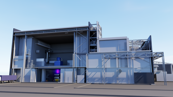
Commonwealth Fusion Systems has become the first international partner in the UK Atomic Energy Authority’s Lithium Breeding Tritium Innovation (Librti) programme at Culham, supporting development of tritium-breeding technologies for future fusion power plants. The collaboration will focus on testing lithium-based breeder materials and component designs under fusion-relevant conditions to optimise tritium production and recovery. For civil and materials engineers, the work points to future design requirements for breeder blankets, cooling circuits and radiation-resistant structural materials in commercial fusion infrastructure.
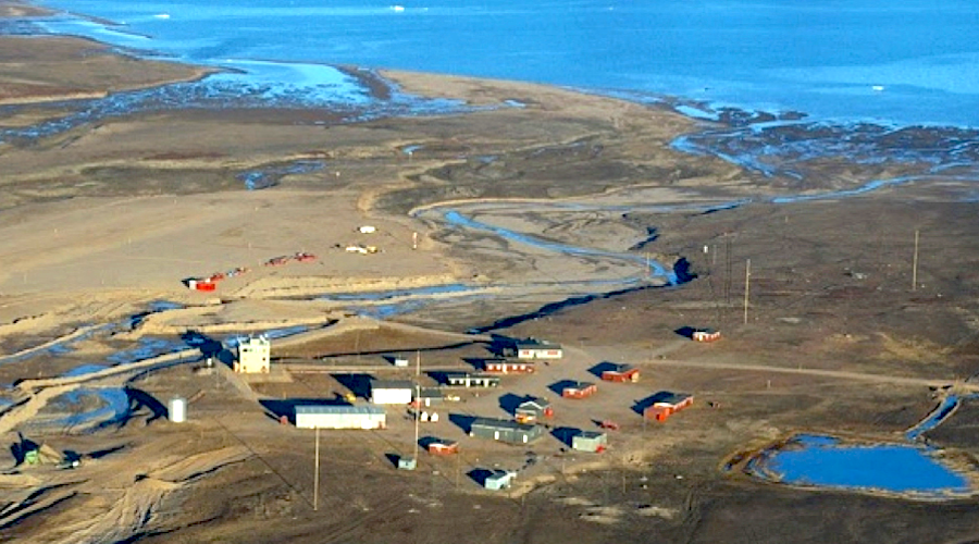
Canada has committed C$7 million through Natural Resources Canada’s Critical Minerals Research, Development and Demonstration programme to Greenland Resources’ open-pit Malmbjerg molybdenum project in east Greenland, the first G7 investment in Greenland mining. The funding supports metallurgical work to test flotation of primary molybdenum using both saline and fresh water and to assess recovery of magnesium and rare earth elements from the orebody and process water, with the programme running to March 2028. Malmbjerg, 20 km from Mestersvig airport, is designed to produce 32.8 million lb/y of molybdenum metal for 10 years within a 20-year mine life, backed by a long-term offtake with Outokumpu.
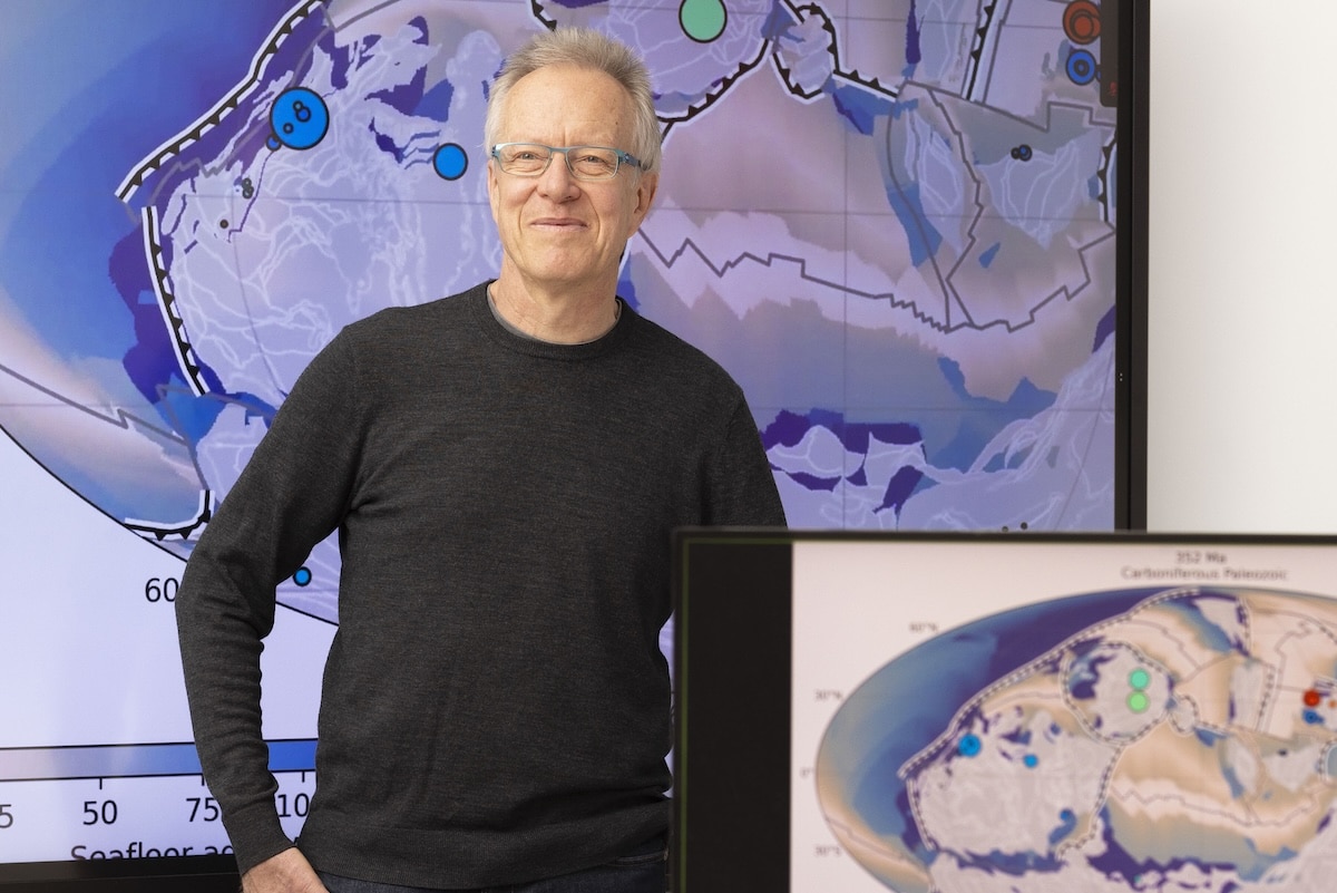
New University of Sydney modelling of 3D plate tectonics and deep Earth flow fields explains why some ancient continental margins host large sedimentary copper systems while others with similar stratigraphy are barren. Led by Professor Dietmar Müller’s EarthByte Group and published in Nature Communications, the work links copper endowment to long-lived mantle upwellings, crustal thinning patterns and basin-scale fluid pathways rather than local geology alone. For explorers, the framework offers a way to rank frontier basins and re-evaluate “failed” provinces using geodynamic criteria.
US DOE’s ARPA‑E ROCKS programme has selected Fieldstone Bio, TerraCore and MIT to build a field‑deployable system that maps critical minerals directly on drill core, delivering quantitative, core‑length metal distributions in hours instead of weeks. The method combines engineered microbial sensors, tuned to emit distinct signals for metals such as gold, copper, molybdenum and arsenic at parts‑per‑billion sensitivity, with compact hyperspectral imaging cameras already used in core logging. Scout Discoveries will supply active Western US drill sites and fresh core to validate performance, with the sensor library to be expanded to rare earths and nickel.
Geotab has partnered with Swinburne University of Technology to establish an AI-enabled transport innovation hub on Swinburne’s Melbourne campus, targeting data-driven management of Australia’s vast road network, around 60 per cent of which is unpaved. The collaboration focuses on telematics, connected vehicle data and predictive analytics to better understand asset performance across both mild and harsh operating environments. For civil and pavement engineers, the work signals growing access to high-resolution fleet and condition data to inform maintenance prioritisation, heavy vehicle routing and whole-of-life pavement design.
Curtin University has shortlisted three mining-focused technologies for its 2026 Curtinnovation Awards: a machine-learning tool for predicting tailings dam failures, a low-energy sensor network for real-time underground strata monitoring, and a modular system for recovering critical minerals from low-grade waste streams. The shortlisted projects, all led by Curtin researchers, target high-risk domains such as tailings storage, deep-level ground control and mine waste reprocessing. For operators, the work signals more data-rich geotechnical surveillance and potential new value from legacy waste facilities.
UK Atomic Energy Authority and Japan’s National Institutes for Quantum Science and Technology have signed a memorandum of cooperation to advance nuclear fusion development, linking UK work at Culham with Japanese programmes on devices such as JT-60SA. The agreement is expected to cover joint R&D on plasma physics, superconducting magnet technology and tritium handling, plus exchanges of engineers and shared use of large experimental facilities. Civil and structural specialists can anticipate future demand for designs accommodating high neutron flux, intense thermal loads and complex shielding in next‑generation fusion testbeds and pilot plants.
New climate-modelling by the British Geological Survey (BGS) projects that up to 11% of UK homes – several million properties – could face increased clay-related subsidence risk by 2070 as hotter, drier summers drive greater soil shrink–swell. The work uses UKCP18 climate scenarios to map susceptibility on shrink–swell clays, flagging particular exposure in southern and eastern England where high-plasticity London Clay and similar formations are widespread. For geotechnical and asset engineers, this points to tighter foundation design, tree and drainage management, and targeted monitoring of existing low-rise housing stock.
China Baowu and Rio Tinto have completed industrial-scale pelletisation and hydrogen-based shaft furnace trials at Baoshan Iron & Steel’s Zhanjiang operations using Rio Tinto’s Pilbara Blend fines. The campaign tested direct reduction-grade pellets in a shaft furnace charged with hydrogen-rich gas, aiming to validate lower-carbon ironmaking routes compatible with existing Baowu infrastructure. Results will inform process design for future DR-grade pellet plants and potential retrofits of blast furnace–basic oxygen furnace lines in China’s coastal steel hubs.
CSIRO has completed a world-first large-scale trial of high-efficiency catalytic ventilation air methane (VAM) abatement at South32’s GM3 Appin underground coal mine in southern New South Wales, using its CataVAM™ catalytic oxidation technology under full production conditions. The system targets the very low methane concentrations typical of mine ventilation exhaust, which are below the flammability limit and difficult to treat with conventional thermal oxidisers. Successful scale-up would allow integration with existing main fans to cut fugitive methane emissions from underground coal operations without major changes to mine layout.
Rio Tinto and China Baowu have completed industrial-scale hydrogen-based direct reduction trials using Pilbara Blend iron ore in a shaft furnace, showing that the mid-grade (~62% Fe) Western Australian ore can achieve metallisation levels suitable for low-carbon DRI. Tests at Baowu’s Zhanjiang base used hydrogen-rich gas in place of coke-based reductants, validating pellet quality, sticking behaviour and gas utilisation under commercial conditions. The work signals that existing Pilbara ore supply chains could be adapted for hydrogen DRI routes, reducing dependence on high-grade (>67% Fe) ores.
Western Australia is positioning itself as a gallium processing hub through a Curtin University–Nimy Resources research programme backed by $550,000 from the Minerals Research Institute of Western Australia and co-funding from Nimy and Curtin’s Resources Technology and Critical Minerals Trailblazer. The work targets extraction of gallium as a by-product from existing orebodies, aiming to develop flowsheets that can be retrofitted to current concentrators rather than relying on greenfield plants. For miners and process engineers, the project signals future value-add options for low-concentration gallium streams within established base metal operations.
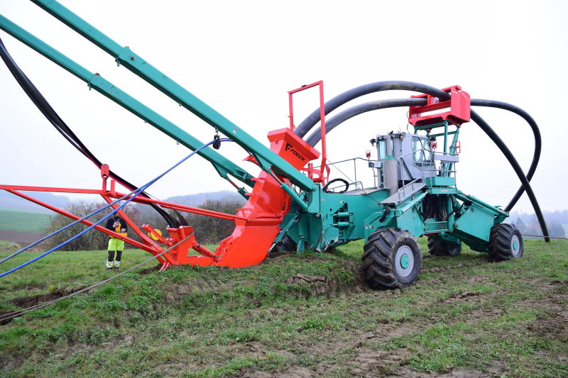
Ramboll’s DESNZ-commissioned study on undergrounding high-voltage transmission lines finds that cable ploughing, horizontal directional drilling and microtunnelling (pipe jacking) can approach the costs of conventional cut-and-cover over 20–50 km routes. Cable ploughing, already used in Wales by Aneurin Thomas Plant with Foeck equipment in sensitive environments, could cut total project costs by 20–40%, with civil works alone reduced by up to 66–72%. The report points to further savings from emerging technologies, including graphene-enhanced conductors and improved converter station design.
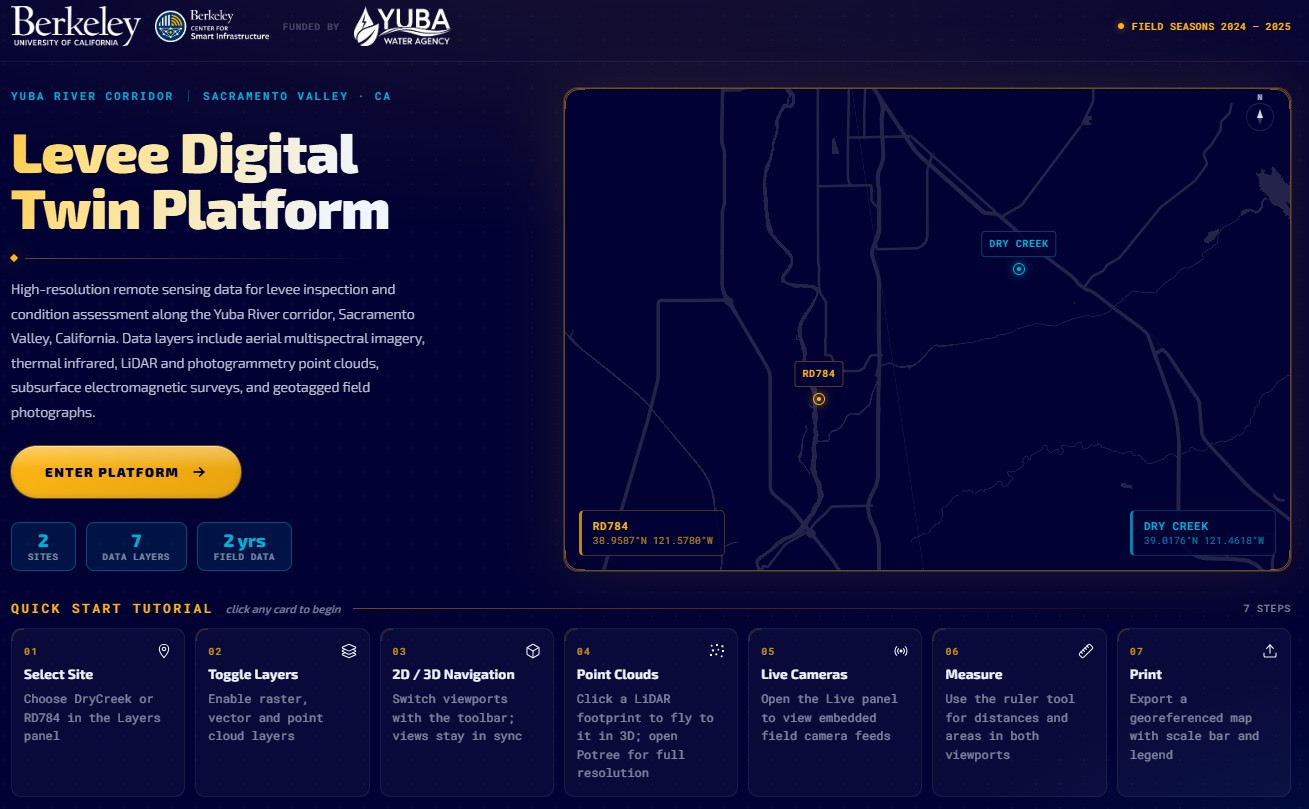
Researchers at UC Berkeley, funded by Yuba Water, have launched a Levee Digital Twin Platform for the Yuba River corridor, integrating continuous sensor data, geotechnical models and inspection records into an interactive system for levee condition assessment. The platform combines real-time pore pressure and deformation monitoring with historical performance data to flag anomalous behaviour along specific reaches and embankment sections. Engineers can use the tool to prioritise field investigations, refine seepage and stability analyses, and plan targeted remediation before high-flow events.
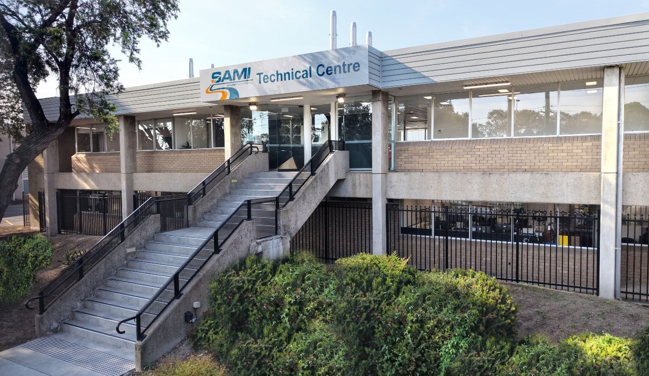
SAMI Bitumen Technologies has opened the SAMI Technical Centre (STC), a purpose-built laboratory for advanced bitumen and asphalt testing, research and performance-based assessment for Australia’s road network. The facility is configured for high-end rheological characterisation, mix design optimisation and durability testing of binders and asphalt, supporting polymer-modified and speciality binders used in heavy-duty pavements. Expanded in-house capability is expected to shorten test turnaround times for road agencies and contractors and support more rigorous performance specifications for high-traffic and high-temperature environments.
Commonwealth Fusion Systems has released five peer‑reviewed papers claiming to validate the plasma confinement and stability physics underpinning its compact, high‑field Arc fusion power plant concept. Arc is based on high‑temperature superconducting magnets to generate stronger magnetic fields in a smaller tokamak, targeting grid‑scale output in a footprint closer to a conventional thermal plant. For civil and infrastructure engineers, this supports planning for dense, urban‑adjacent fusion sites with nuclear‑grade containment structures but reduced land‑take compared with large fission stations.
AECOM has engineered the 2026 Serpentine Pavilion in London with LANZA atelier as a fully demountable hybrid prestressed masonry structure, using a slender internal steel subframe and threaded bars along the wall tops to carry roof loads and control deflection and dynamic response. To enable brick reuse without traditional mortar beds, the team relied on soft joints, wedges and shims to manage variable brick sizes and achieve uniform prestress without local damage. Full-scale physical testing was used to calibrate computational models and validate the composite action of the curved “crinkle-crankle” walls and piers.
Stardust Power Inc. has been selected as the end-use industrial partner in a US Department of Energy-funded programme led by Ohio University’s Institute for Sustainable Energy and the Environment and CONSOL Innovations to develop electrochemical technology for direct lithium extraction from domestic waste streams, including oil and gas wastewater and legacy coal mine drainage. Under FOA DE-FOA-0003105, the team will test coal- and waste coal-based electrodes, with Stardust Power evaluating lithium product against battery-grade specifications and assessing refinery integration. The move supports diversified US lithium feedstocks and strengthens domestic critical minerals processing capacity.
An airborne electromagnetic survey by the Geological Survey of Victoria and Geoscience Australia will be flown from June to November across central Victoria, targeting areas north and west of Melbourne to refine critical mineral prospectivity, including antimony. A specially equipped fixed‑wing aircraft will collect AEM conductivity data to map subsurface structures and groundwater to depths typically of several hundred metres, improving geological models beneath cover. The work is expected to upgrade targeting for deposits similar to the Goschen rare earths project footprint and guide future drilling programmes.
Evonik has formed a strategic partnership with the School of Mining at the University of Guanajuato in Mexico to develop next‑generation sustainable, lower‑toxicity reagents for mineral processing. The collaboration centres on Evonik’s biosurfactant platform, targeting replacement of conventional petrochemical surfactants in flotation and related unit operations to cut ecotoxicity and improve biodegradability. For mine operators, this points to future options for meeting stricter water‑quality and tailings‑discharge limits without major flowsheet changes.
US Department of Energy researchers at Pacific Northwest National Laboratory have built CICERO, a semi-autonomous system that uses AI agents, a liquid-handling robot, a sample-handling device and two analytical instruments to design and run 96 mineral recovery experiments in a single day. Tested on spent permanent magnets and oil and gas wastewater, CICERO rapidly identified flowsheets to recover magnesium from brines and neodymium, praseodymium and samarium from magnet waste. The approach uses existing industrial chemistries and separation methods, offering a route to extract critical elements from waste streams in days rather than months or years.
Greenland Resources has joined Luleå Tekniska Universitet’s BOREAS consortium, alongside 12 other partners, to develop autonomous robotic systems for its Malmbjerg molybdenum project in central-east Greenland. The collaboration targets robotic support for construction, operation and maintenance in remote, high-relief terrain, where steep slopes, ice, and limited access complicate conventional open-pit development. For mine planners and geotechnical teams, the work signals future deployment of field robots for tasks such as bench inspection, slope monitoring and infrastructure upkeep under Arctic conditions.
More than 80% of built environment professionals surveyed rate collaboration as critical to successful project delivery, yet 70% of organisations still use traditional contract frameworks such as lump-sum and design–bid–build. The research points to limited adoption of NEC-style collaborative contracts, early contractor involvement and integrated project teams, despite widespread recognition of their value in managing programme risk and interfaces. For engineers, this gap suggests continued exposure to claims-heavy delivery models, fragmented design–construction feedback, and slower uptake of digital coordination tools like common data environments.
The University of Queensland’s Collaborative Consortium for Coarse Particle Processing Research is entering a second five‑year phase to scale up coarse particle flotation technologies that allow recovery of particles up to several millimetres, reducing grinding energy and water use. Phase I delivered the JKHFmini laboratory rig and plant trials with Eriez HydroFloat and FLSmidth REFLUX Flotation Cell units on copper and gold ores, targeting coarser grind sizes than conventional circuits. The renewed program will expand pilot‑scale testing and integrated circuit modelling, with direct implications for comminution circuit design, tailings management and brownfield plant retrofits.
Four mining technologies from the ARC Training Centre for Integrated Operations for Complex Resources are now ready for field trials, including a digital twin platform for complex orebodies, real-time sensor fusion for ore characterisation, and AI-based decision support for integrated mine-to-mill control. The suite targets data-driven optimisation of drilling, blasting, and processing, with pilots seeking partners across hard-rock operations and brownfield plants. For engineers, the work signals near-term opportunities to plug advanced analytics and automation into existing fleets and control rooms without full greenfield redesigns.
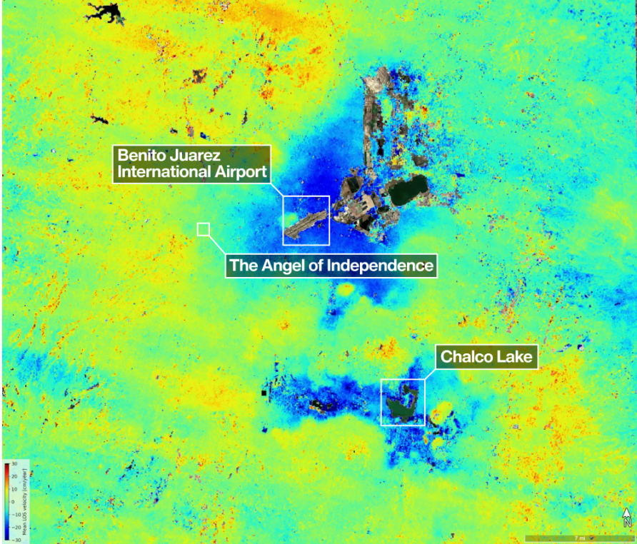
Mexico City’s subsidence has been mapped in new detail by the NASA–ISRO NISAR L-band radar mission, revealing metropolitan zones sinking by more than 50cm per year over clay-rich former lakebed deposits. Interferometric SAR time-series show differential settlement across key infrastructure corridors, with some districts exhibiting cumulative subsidence of several metres over recent decades, far exceeding typical building serviceability limits. The data set offers geotechnical engineers block-scale deformation rates to refine foundation design, tunnel and metro monitoring, and groundwater extraction management.
A UK Government research paper concludes that Nature-based Solutions such as floodplain reconnection, riparian woodland and leaky barriers are most effective when planned and modelled across whole catchments rather than as isolated site schemes. The study stresses integrating NbS with existing hard defences, using hydrological and hydraulic modelling to quantify peak flow attenuation and downstream level reductions under design storm events. For civil and drainage engineers, this points to earlier basin-scale option appraisal, multi-landowner agreements and long-term monitoring of storage volumes, infiltration rates and sediment behaviour.
BHP and Rio Tinto have jointly released new research on large‑scale filtered tailings technology, focusing on improving filtration, stacking and water recovery performance for major iron ore and copper operations. The work examines scaling filter presses and dry‑stack systems from current capacities of tens of thousands of tonnes per day towards ultra‑large installations, addressing challenges such as filter cloth wear, cake consistency, stack stability and conveyor handling. For geotechnical and tailings engineers, the collaboration signals stronger backing for filtered and dry‑stacked designs over conventional upstream or centre‑line tailings storage facilities.
The Federal Government will invest an additional $387.4 million over four years in the Commonwealth Scientific and Industrial Research Organisation (CSIRO) to accelerate mining-related R&D as the sector shifts towards lower-emission, higher-automation operations. Funding is expected to support work on ore-sorting technologies, advanced sensing and data analytics, and low-carbon processing routes, alongside environmental monitoring tools for tailings and water management. For operators and contractors, the move signals stronger backing for technology pilots and scale-up in areas such as remote operations centres and electrified mobile fleets.
Australia’s drive to expand onshore critical minerals processing has advanced with the opening of new research facilities focused on refining battery and magnet metals such as lithium, rare earths and cobalt. The centres are equipped for pilot‑scale hydrometallurgical and pyrometallurgical testwork, including leaching, solvent extraction and high‑temperature roasting, to bridge the gap between bench chemistry and commercial plants. For process and project engineers, the facilities offer local options to de‑risk flowsheet design, validate recoveries on Australian ores and generate data for bankable feasibility studies.
Alligator Energy’s first five-spot well pattern at the Samphire in‑situ recovery uranium field trial has met its leach and recovery targets, confirming the project’s ISR concept in South Australia’s Frome Basin. The trial used alkaline leach chemistry in a confined sandstone aquifer to recover uranium from the Blackbush deposit, with solution breakthrough and head grade response tracking closely to pre‑trial hydrogeological models. Results will feed into updated resource, flow‑rate and reagent consumption assumptions for the planned Samphire restart study.
Optimising cemented paste backfill with admixture technology, Teresa Bellver-Baca and Ignacio Aguilar-Sánchez of Sika report that water-reducing and viscosity-modifying agents can cut yield stress while increasing solids content, improving pumpability over long underground pipelines. Field trials in an underground gold mine showed fresh paste yield stress falling even as solids content rose from typical 67–80%, and uniaxial compressive strength gains at 3, 7 and 28 days for mixes with 12% cement and 0–3% admixture by cement weight. The approach targets lower binder consumption in CPB, which can account for up to three quarters of backfill cost.
Coupling sensor-based ore sorting with commingled tailings and mine rockfill is presented as a way to turn coarse, low-grade crushed waste into a geotechnically useful product rather than a pure disposal cost. X-ray transmissive (XRT) and other multi-sensor sorters can reject up to ~40% of plant feed as coarse waste, which, when mixed with dewatered, non-segregating tailings at 2–6:1 rock-to-tailings ratios, improves shear strength, reduces oxygen ingress, and uses waste-rock voids for tailings storage. Because typical plant feed does not generate enough coarse waste for these ratios, the authors point to sorting marginal or low-grade stockpiles to supply additional rock while scavenging residual high-grade material.
Optimising paste production for underground backfill, SIMEM compares three mixer configurations: a single large twin shaft paste mixer, a 2‑stage system with a twin shaft conditioning mixer plus paste mixer, and optional integration of a high‑shear colloidal mixer for binder pre‑blending. Dense, slab-forming filter press cake typically warrants a conditioning stage to normalise moisture and lump size, while more friable, variable-moisture disk filter cake may suit a single mixer. The key design trade-offs are capital cost, footprint, mechanical wear, and control over rheology, binder dispersion, and strength consistency on long paste pipelines.
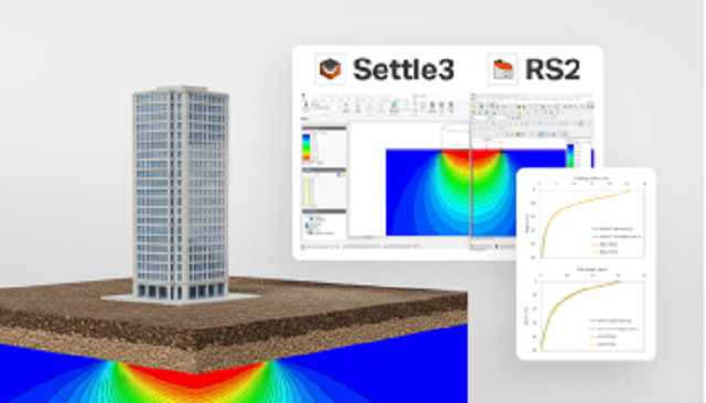
Settlement prediction in layered soils is shown to depend strongly on how vertical stress increments are computed, comparing classical Boussinesq-based methods with numerical analyses in Settle3, RS2, and RS3. The piece contrasts 1D influence-factor approaches against 2D/3D finite element and finite difference models that capture stiffness contrasts, non-linear behaviour, and complex load geometries. For practitioners, it signals when simple elastic solutions become overly conservative and when full numerical stress redistribution is needed to refine serviceability settlement estimates.
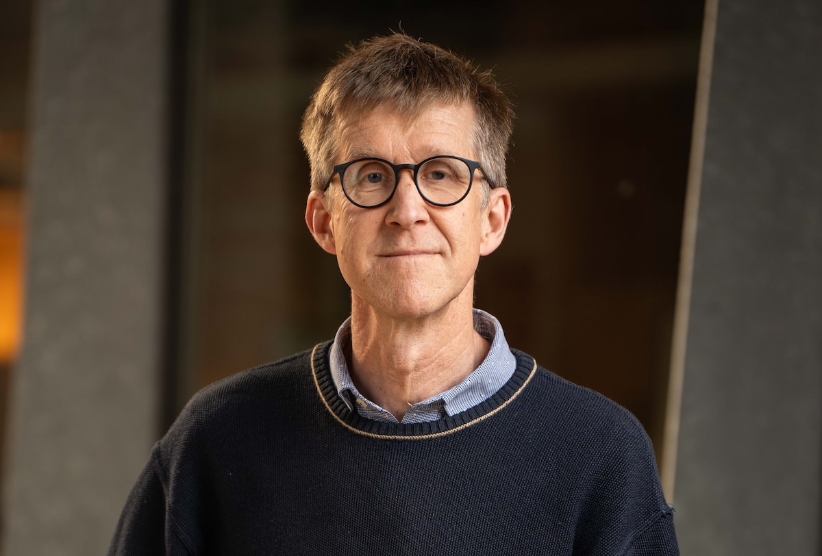
Professor Graham Heinson has received the Australian Academy of Science’s Haddon Forrester King Medal for lifetime contributions to geophysics and mineral exploration. A globally recognised leader in electromagnetic methods, Heinson’s work on deep crustal imaging and magnetotellurics has improved detection of concealed ore systems beneath thick cover. His advances in large-scale geophysical surveying and data inversion directly support lower-risk targeting for greenfields mineral exploration in structurally complex terrains.
Resources Victoria has partnered with CSIRO to map critical minerals potential in the northwest Wimmera–Mallee region using soil geochemistry and machine-learning analysis of regolith and landscape evolution. The programme will integrate shallow soil sampling with existing airborne geophysics and drilling data to detect pathfinder elements for commodities such as rare earths, nickel and cobalt concealed beneath transported cover. Outcomes are expected to refine prospectivity models over thousands of square kilometres of deeply weathered terrain, guiding explorers towards undercover targets and reducing blind drilling.
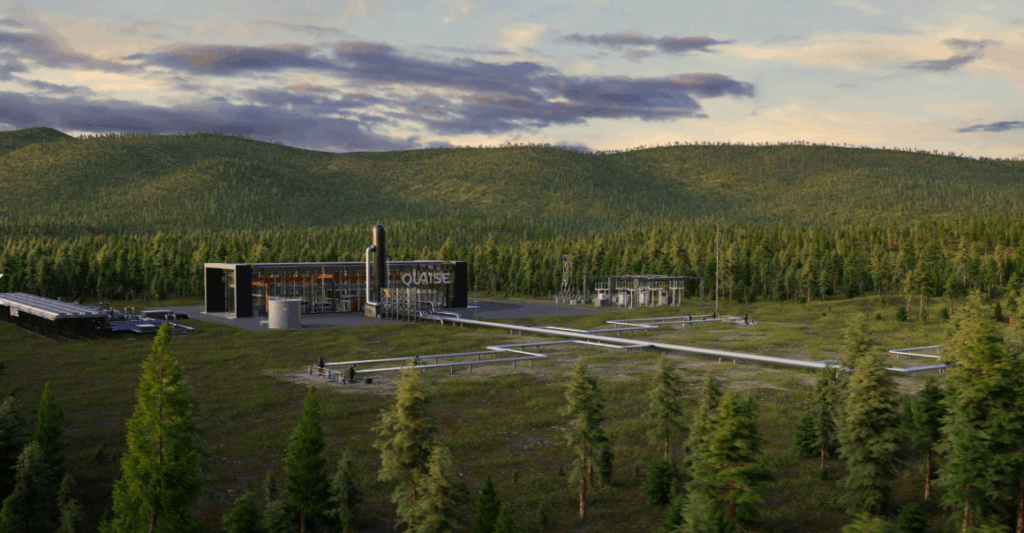
Quaise Energy is advancing Project Obsidian in Oregon, aiming to build the first superhot geothermal plant by drilling into rock above 300°C and delivering a baseload 50 MW from only a handful of wells by 2030. A modelling analysis presented at the 2026 Stanford Geothermal Workshop by senior mechanical engineer Daniel W. Dichter indicates higher subsurface temperatures could ultimately support 250 MW in phase two, with a regional goal of 1 GW. The confirmation well is due online later this year, with lab work at Oregon State University recreating extreme downhole geochemical conditions.
US Critical Materials Corp. and Columbia University have launched a two-year “Mud to Metal” programme to extract defence-critical gallium, scandium, titanium and rare earth elements from red mud waste sourced from multiple alumina refineries, including operations linked to Alcoa. Led by Columbia’s Greeshma Gadikota, the work will trial oxidative leaching, selective separations and co-recovery of titanium dioxide and iron oxide, coupled with techno-economic and lifecycle modelling to test commercial viability. Success could create a domestic byproduct supply chain that complements USCM’s high-grade Sheep Creek rare earth project in Montana.
Chalcopyrite, the dominant copper iron sulphide in most porphyry and VMS deposits, is being re‑examined as a route to cleaner copper production through alternative leaching and electrochemical pathways that avoid traditional high‑temperature smelting. Researchers are focusing on low‑temperature oxidative leach systems, including chloride and bioleach circuits, to accelerate chalcopyrite dissolution and cut SO₂ emissions and slag volumes. For mine operators and metallurgists, successful deployment would shift flowsheets towards heap or in‑situ leaching, change tailings mineralogy, and reduce reliance on large concentrate transport and smelter capacity.
NASA’s Artemis II crew has completed a geology‑focused lunar flyby, using high‑resolution imaging and LiDAR to map candidate Artemis III landing zones across the South Pole–Aitken Basin and other polar regions. Astronauts conducted real‑time visual stratigraphy logging of crater walls up to several kilometres deep and coordinated spectral observations of suspected pyroclastic deposits and boulder fields larger than 5 metres. The resulting datasets on regolith thickness, block size distributions and slope angles are expected to refine bearing capacity models, excavation strategies and ground‑anchor design for future lunar surface infrastructure.
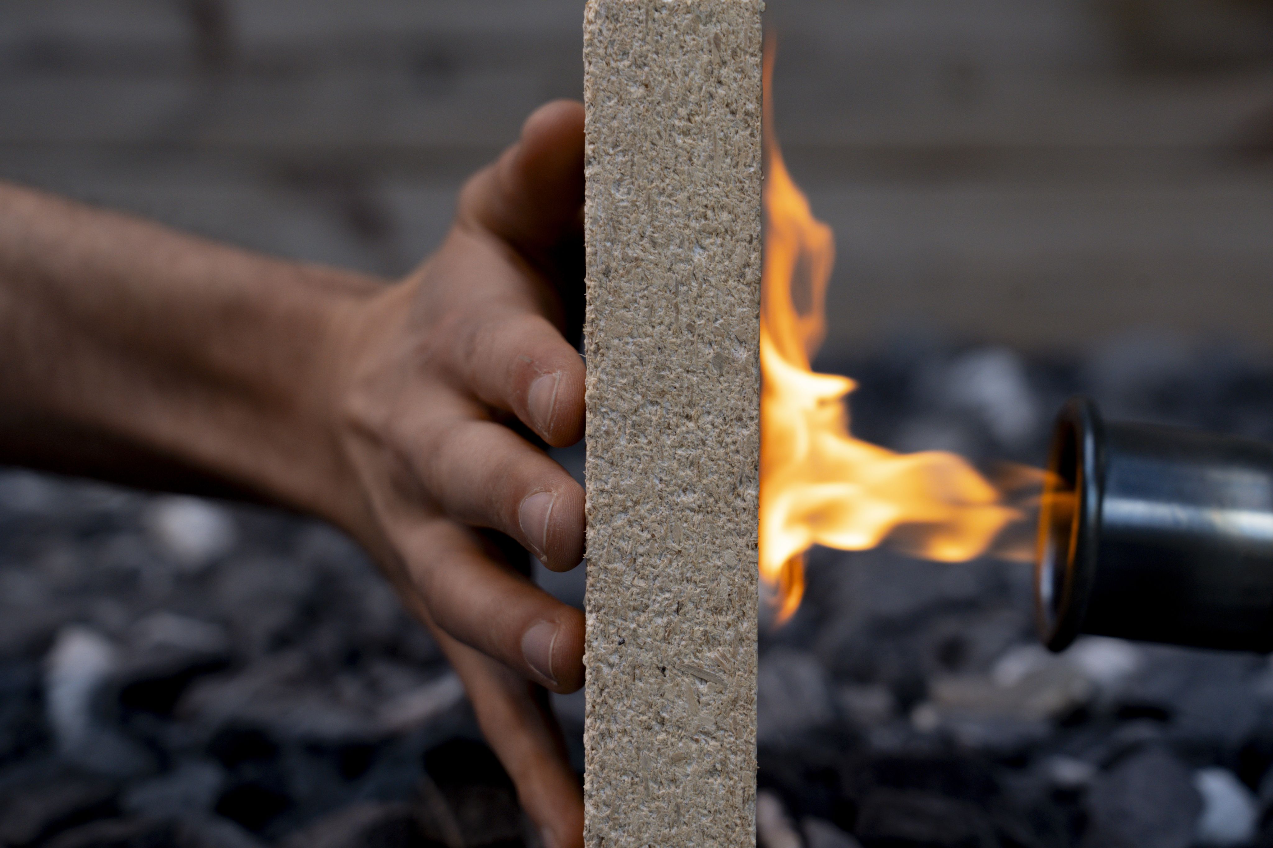
Researchers at ETH Zurich and Empa have developed a recyclable sawdust–struvite composite board that is stronger in compression perpendicular to grain than spruce and shows cone calorimeter ignition times of 45 seconds, around three times longer than untreated timber. The material uses an enzyme from watermelon seeds to control crystallisation of struvite from newberyite, forming large crystals that infill voids between sawdust particles and act as an inorganic flame retardant, potentially matching cement‑bonded particleboard fire classes with only 40% binder by weight. Panels can be mechanically ground, heated to just over 100°C to release ammonia, and fully separated for reuse or as a phosphorus fertiliser, with future cost reductions possible by sourcing struvite from sewage treatment plant deposits.
ABx Group has secured roles in two Federal Government-backed research initiatives to advance rare earths extraction from its ionic adsorption clay deposits in northern Tasmania and bauxite-hosted resources in Queensland. The grants, awarded under national critical minerals and industry growth programmes, will fund testwork on low-acid leach processes, beneficiation flowsheets and pilot-scale recovery of magnet rare earths such as neodymium and praseodymium. Outcomes could materially affect project economics, tailings chemistry and permitting pathways for clay-hosted rare earths developments in Australia.
Immediate load capacity of helical anchors and piles at installation is being challenged by data showing significant “aging” effects, with shaft resistance and overall capacity increasing measurably over days to months in clays and some sands. The discussion contrasts torque-correlated design methods with time-dependent capacity gains, referencing field load tests where post-installation capacity growth alters factor-of-safety assumptions and serviceability performance. For practitioners, the key issue is whether to rely solely on installation torque or to incorporate waiting periods and ageing factors into design for temporary works, tiebacks and lightly loaded foundations.
Australian researchers led by CSIRO have built the world’s first proof‑of‑concept quantum battery, using entangled quantum states to charge multiple cells collectively rather than individually. The lab‑scale device, fabricated in CSIRO’s clean quantum battery engineering lab, is designed to scale to solid‑state architectures compatible with grid‑scale storage and electric vehicles. If commercialised, the technology could sharply increase demand for high‑purity critical minerals such as lithium, nickel, cobalt and rare earth elements, with tighter specifications on impurity control and crystal defect behaviour.
Curtin University and Victory Metals have formed an “industry–academia powerhouse” partnership to accelerate development of Victory’s rare earths project in Western Australia, combining Curtin’s Western Australian School of Mines expertise with the company’s exploration and processing plans. The collaboration will focus on metallurgical testwork, process flowsheet optimisation and resource characterisation to improve recovery of rare earth elements from the project’s ore. For mining engineers and metallurgists, the tie-up signals early integration of research-grade mineral processing and geometallurgy into project design rather than post-feasibility optimisation.
Iron ore prices, mining investment and labour demand are projected by a new Curtin University report to drive a sharp population surge in Western Australia, particularly in the Pilbara and other iron ore hubs. The analysis links sustained prices above long‑run averages with expanded mine capacity, new rail and port upgrades, and intensified competition for skilled trades and geotechnical professionals. For engineers and planners, the report signals mounting pressure on regional housing, transport corridors and supporting civil infrastructure over the medium term.
New analysis by Ordnance Survey maps how climate-driven flood risk intersects with England’s strategic roads and railways, calling for a “clear, forward-looking understanding” of exposure. Using its national topographic database and elevation models, OS identifies low-lying corridors, embankments and cuttings where overtopping, scour and trackbed saturation could disrupt key routes. The work signals a need to integrate updated flood extents into asset management, drainage design and resilience upgrades for highways structures and rail earthworks.
CSIRO is running farm-based trials to test low-frequency wireless signals for use in underground and remote mining connectivity, targeting conditions where conventional Wi-Fi and LTE struggle with rock mass attenuation and long drifts. Researchers are assessing signal penetration through soil and vegetation, antenna configurations, and power requirements to understand how similar systems could maintain links to autonomous trucks and sensors in deep headings and block caves. Early results will inform network design choices for mines seeking robust, low-bandwidth control and monitoring channels alongside existing high-frequency systems.
A new low-emission crushing technology developed at the University of Adelaide aims to cut comminution energy use by targeting ore breakage at natural grain boundaries rather than by conventional compressive crushing. Led by researcher Mark Drechsler, the lab-scale unit is being tested on copper and gold ores to quantify reductions in specific energy consumption and downstream grinding requirements. If pilot-scale trials confirm lower kWh/t and improved liberation, plant designers could downsize SAG/ball mills and reduce both capital cost and CO₂ intensity of mineral processing circuits.