BGS River Tweed groundwater survey: flood model lessons for infrastructure engineers
Reviewed by Tom Sullivan
First reported on New Civil Engineer
30 Second Briefing
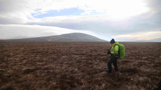
The British Geological Survey has launched a four‑year ground investigation of the River Tweed catchment to characterise groundwater behaviour and its interaction with river levels for improved flood forecasting. Work will include installing new monitoring boreholes, logging groundwater heads and flow paths, and integrating hydrogeological data with existing river‑gauge and rainfall records across the cross‑border catchment. Findings are expected to refine flood models used by local authorities and infrastructure owners, particularly for groundwater‑dominated flood events and prolonged saturation of transport and drainage assets.
Technical Brief
- Safety focus is on earlier warning of groundwater‑driven flooding affecting access, evacuation routes and critical assets.
- Similar integrated hydrogeological datasets are likely to become baseline inputs for flood‑risk assessments on major schemes.
Our Take
The British Geological Survey’s work on the River Tweed catchment sits alongside its new national geotechnical data service, suggesting Tweed groundwater observations are likely to be fed into a wider UK ground model that design teams can query for flood and foundation risk on future projects.
Prepared by collating external sources, AI-assisted tools, and Geomechanics.io’s proprietary mining database, then reviewed for technical accuracy & edited by our geotechnical team.
Related Articles

Related Industries & Products
Construction
Quality control software for construction companies with material testing, batch tracking, and compliance management.
Mining
Geotechnical software solutions for mining operations including CMRR analysis, hydrogeological testing, and data management.
CMRR-io
Streamline coal mine roof stability assessments with our cloud-based CMRR software featuring automated calculations, multi-scenario analysis, and collaborative workflows.
HYDROGEO-io
Comprehensive hydrogeological testing platform for managing, analysing, and reporting on packer tests, lugeon values, and hydraulic conductivity assessments.
GEODB-io
Centralised geotechnical data management solution for storing, accessing, and analysing all your site investigation and material testing data.