RRS Sir David Attenborough glacier robots: sea level data and design notes for engineers
Reviewed by Joe Ashwell
First reported on New Civil Engineer
30 Second Briefing
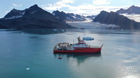
A fleet of autonomous marine robots, including the long‑range Autosub “Boaty McBoatface”, will be launched from the polar research vessel RRS Sir David Attenborough to survey rapidly melting Greenland outlet glaciers and adjacent fjords. The mission will map sub‑ice shelf geometry, measure water column temperature and salinity, and track glacier–ocean interactions that influence Atlantic Meridional Overturning Circulation. Data on seabed morphology, grounding line position and meltwater plumes will feed into improved sea level rise projections and coastal infrastructure design criteria.
Technical Brief
- Autonomous operations reduce time spent by crew in small boats near calving fronts and drifting brash ice.
- Findings are constrained to surveyed outlet glaciers and fjords, with limited direct transfer to other ice‑ocean settings.
Our Take
For operators planning Arctic or sub‑Arctic infrastructure in Greenland, higher‑resolution glacier and ocean data from this type of research can tighten design assumptions on sea‑level rise and iceberg or calving hazards, potentially reducing both over‑design and unforeseen safety risks in future projects.
Prepared by collating external sources, AI-assisted tools, and Geomechanics.io’s proprietary mining database, then reviewed for technical accuracy & edited by our geotechnical team.
Related Articles



Related Industries & Products
Mining
Geotechnical software solutions for mining operations including CMRR analysis, hydrogeological testing, and data management.
Construction
Quality control software for construction companies with material testing, batch tracking, and compliance management.
CMRR-io
Streamline coal mine roof stability assessments with our cloud-based CMRR software featuring automated calculations, multi-scenario analysis, and collaborative workflows.
HYDROGEO-io
Comprehensive hydrogeological testing platform for managing, analysing, and reporting on packer tests, lugeon values, and hydraulic conductivity assessments.
GEODB-io
Centralised geotechnical data management solution for storing, accessing, and analysing all your site investigation and material testing data.