Garmouth Viaduct scour collapse: hydraulic failure lessons for bridge engineers
Reviewed by Tom Sullivan

First reported on New Civil Engineer
30 Second Briefing
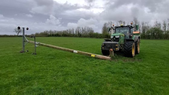
Scour is now confirmed by Moray Council as the likely principal cause of the Garmouth Viaduct collapse over the River Spey on 14 December, after an abrupt change in the river’s flow path is thought to have undermined the masonry or concrete support piers. Engineers are assessing how localised bed erosion and altered hydraulic conditions around the pier foundations triggered the failure. The case will sharpen scrutiny of scour risk assessments, real-time river monitoring and foundation protection measures on older rail and footbridges in dynamic gravel-bed rivers.
Technical Brief
- Failure mechanism being investigated through hydraulic back-analysis of recent flood hydrographs and planform changes.
- Engineers are inspecting exposed pier foundations for loss of embedment, toe undermining and loss of lateral confinement.
- Bed level surveys and bathymetric profiling are being commissioned to quantify local scour depth and extent.
- Structural assessment includes checking remaining spans for differential settlement, unseated bearings and residual stability under reduced support.
- Temporary exclusion zones and access restrictions have been imposed around the collapsed viaduct to control public safety risk.
- Ongoing monitoring options under consideration include real-time river level sensors, scour probes and repeat cross-section surveys at critical piers.
- Case is expected to feed into updated scour design checks and inspection regimes for older masonry and concrete river crossings.
Our Take
Within the 18 Hazards stories in our database, scour-related bridge failures like the Garmouth Viaduct event on the River Spey are relatively rare, suggesting many UK asset owners may still be underestimating dynamic river morphology in their risk models.
For Moray Council, a confirmed scour mechanism at Garmouth Viaduct implies that future capital and inspection programmes on other river crossings will likely need more detailed hydraulic modelling and bed level monitoring, not just conventional structural condition surveys.
Given this sits in the Safety and Projects tag set alongside hundreds of other pieces, the Spey case is likely to be used by designers as a reference when justifying more conservative pier foundations and floodplain management measures on new crossings in similar gravel-bed rivers.
Prepared by collating external sources, AI-assisted tools, and Geomechanics.io’s proprietary mining database, then reviewed for technical accuracy & edited by our geotechnical team.
Related Articles

Related Industries & Products
Mining
Geotechnical software solutions for mining operations including CMRR analysis, hydrogeological testing, and data management.
Construction
Quality control software for construction companies with material testing, batch tracking, and compliance management.
CMRR-io
Streamline coal mine roof stability assessments with our cloud-based CMRR software featuring automated calculations, multi-scenario analysis, and collaborative workflows.
HYDROGEO-io
Comprehensive hydrogeological testing platform for managing, analysing, and reporting on packer tests, lugeon values, and hydraulic conductivity assessments.
GEODB-io
Centralised geotechnical data management solution for storing, accessing, and analysing all your site investigation and material testing data.