Geomechanics.io

  • Free Tools
Sign UpLog In

    Geomechanics.io

    Geomechanics, Streamlined.

    © 2026 Geomechanics.io. All rights reserved.

    Geomechanics.io

    CMRR-ioGEODB-ioHYDROGEO-ioQCDB-ioFree Tools & CalculatorsBlogLatest Industry News

    Industries

    MiningConstructionTunnelling

    Company

    Terms of UsePrivacy PolicyLinkedIn
    Projects
    Product
    Safety

    AIM–Ouster Rev8 LiDAR kits: autonomy and safety takeaways for mine fleets

    June 19, 2026|

    Reviewed by Joe Ashwell

    First reported on International Mining – News

    30 Second Briefing

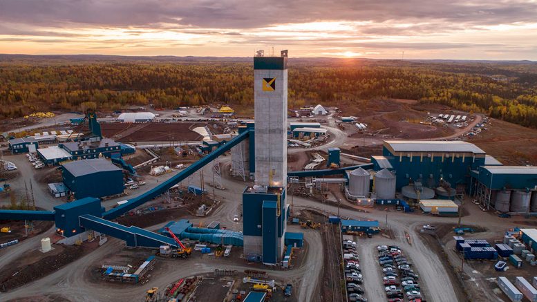
    AIM Intelligent Machines is integrating Ouster’s new Rev8 digital LiDAR into its retrofit autonomy kits for heavy earthmoving equipment, targeting mining and large earthworks fleets. The agreement will see Rev8 sensors used on dozers, excavators and haul trucks to provide 3D perception for obstacle detection, collision avoidance and precise blade/bucket control in dust, low light and high-vibration environments. For mine operators, the move signals more off-the-shelf autonomy options for brownfield fleets without full machine replacement, with LiDAR-centric perception sitting alongside GNSS and onboard AI.

    Technical Brief

    • Strategic agreement designates Ouster as LiDAR supplier for AIM’s autonomous heavy earthmoving platform.
    • Digital LiDAR architecture is intended to maintain ranging performance under high shock and vibration loading.
    • Solid-state sensor design removes moving parts, reducing perception-system failure modes on mining-class mobile plant.
    • High-resolution 3D point clouds enable machine control logic to enforce exclusion zones around personnel and assets.
    • Consistent performance in dust and low-visibility conditions supports safety cases relying on technical protective measures.
    • Retrofit focus allows safety upgrades on existing fleets without altering OEM braking or steering systems.
    • Standardised sensor hardware across dozers, excavators and trucks simplifies spares, calibration procedures and safety validation.
    • Wider adoption of digital LiDAR on brownfield fleets could accelerate formalisation of autonomy safety standards in mining.

    Our Take

    Because this item is also keyword-matched to AI/artificial intelligence, it aligns with a cluster of coverage where perception hardware like Ouster’s sensors is being paired with onboard machine-learning for earthmoving and haulage, signalling that autonomy vendors are moving beyond retrofit tele-remote towards higher levels of automated operation.

    For operators, the combination of AIM’s autonomy kits with Ouster’s Rev8 LiDAR suggests a route to standardise sensing across mixed fleets, which can simplify maintenance and calibration compared with running multiple proprietary sensor stacks on different OEM machines.

    Geotechnical Software for Modern Teams

    Centralise site data, logs, and lab results with GEODB-io, CMRR-io, and HYDROGEO-io.

    No credit card required.

    • Save and export unlimited calculations
    • Advanced data visualisation
    • Generate professional PDF reports
    • Cloud storage for all your projects

    Prepared by collating external sources, AI-assisted tools, and Geomechanics.io’s proprietary mining database, then reviewed for technical accuracy & edited by our geotechnical team.

    Related Articles

    Young-Davidson mine disruptions: seismic and power impacts explained for engineers
    Mining
    about 5 hours ago

    Young-Davidson mine disruptions: seismic and power impacts explained for engineers

    Alamos Gold expects second-quarter output from its Young-Davidson underground mine in northern Ontario to fall to 130,000–135,000 oz, about 12% below prior guidance, after two seismic events damaged infrastructure and cut access to two higher-grade stopes, compounded by a three-day storm-related power outage. Consolidated 2026 production is now projected below full-year guidance with unit costs rising, with revised figures due in July. Production stability is shifting to the Island Gold District, where underground mining rates are planned to increase from 1,500 to 2,000 t/d and the Magino mill ramp-up targets 10,000 t/d by Q3.

    Trinity Metals’ 20% US tungsten supply: project scale and offtake notes for engineers
    Mining
    about 5 hours ago

    Trinity Metals’ 20% US tungsten supply: project scale and offtake notes for engineers

    Trinity Metals has doubled exports from its Nyakabingo tungsten mine in Rwanda to Global Tungsten & Powders, now supplying up to 20% of US primary tungsten concentrate consumption, with more than 320 tonnes of 65–70% WO₃ wolframite shipped since a 2025 offtake deal with Traxys. The 1,600-hectare Nyakabingo concession holds an estimated 30,000 tonnes of recoverable tungsten, is licensed for 25 years from 2015, and is undergoing deep drilling to expand resources. Trinity plans to triple production and is targeting a $100–$200 million international listing, positioning Rwanda as a key conflict-free 3T supplier amid Chinese export restrictions.

    SMRs and mining’s nuclear reality check: key power-planning takeaways for engineers
    Mining
    about 5 hours ago

    SMRs and mining’s nuclear reality check: key power-planning takeaways for engineers

    Small and micro modular reactors (SMRs and microreactors) sit at the bottom of miners’ low‑carbon power options, despite intense promotion of 300 MW‑class SMRs, AI‑optimised reactor operations and bullish uranium price forecasts. Developers are pitching factory‑built, modular units for remote sites and off‑grid mines, but operators still prioritise proven renewables‑plus‑storage, grid power and gas or diesel hybrids. For mine planners and power engineers, nuclear remains a long‑term possibility rather than a near‑term procurement item for new pits, expansions or remote processing hubs.

    Related Industries & Products

    Mining

    Geotechnical software solutions for mining operations including CMRR analysis, hydrogeological testing, and data management.

    CMRR-io

    Streamline coal mine roof stability assessments with our cloud-based CMRR software featuring automated calculations, multi-scenario analysis, and collaborative workflows.

    HYDROGEO-io

    Comprehensive hydrogeological testing platform for managing, analysing, and reporting on packer tests, lugeon values, and hydraulic conductivity assessments.

    GEODB-io

    Centralised geotechnical data management solution for storing, accessing, and analysing all your site investigation and material testing data.

    AllGeotechnicalMiningInfrastructureMaterialsHazardsEnvironmentalSoftwarePolicy