South Eastern Railway flood cameras: design and operations lens for rail engineers
Reviewed by Tom Sullivan
First reported on New Civil Engineer
30 Second Briefing
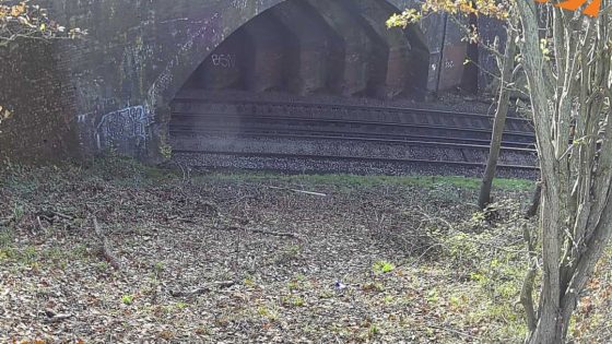
South Eastern Railway has started trialling solar‑powered flood‑warning cameras at five high‑risk locations on its network to cut weather‑related disruption and speed up drainage interventions. The units combine live video with water‑level monitoring and remote communications, allowing control rooms to verify track inundation and blocked culverts in real time without sending inspection teams onto the line. For civil and permanent way engineers, the trial points to wider use of low‑power, off‑grid monitoring at known flooding pinch points, supporting quicker line block decisions and targeted drainage upgrades.
Technical Brief
- Solar power removes dependence on lineside mains feeds, useful where drainage hotspots are remote from stations.
- Camera systems reduce need for trackside inspections during adverse weather, cutting staff exposure to live lines.
- Real‑time visual confirmation supports more defensible decisions on emergency speed restrictions and line blocks.
- Earlier identification of blocked culverts enables targeted drainage maintenance rather than broad, disruptive possessions.
- Continuous monitoring data can be fed into asset management to refine flood‑risk mapping of the route.
- For other rail and linear infrastructure, low‑power camera nodes offer a template for distributed hazard surveillance.
Prepared by collating external sources, AI-assisted tools, and Geomechanics.io’s proprietary mining database, then reviewed for technical accuracy & edited by our geotechnical team.
Related Articles


Related Industries & Products
Construction
Quality control software for construction companies with material testing, batch tracking, and compliance management.
Mining
Geotechnical software solutions for mining operations including CMRR analysis, hydrogeological testing, and data management.
CMRR-io
Streamline coal mine roof stability assessments with our cloud-based CMRR software featuring automated calculations, multi-scenario analysis, and collaborative workflows.
HYDROGEO-io
Comprehensive hydrogeological testing platform for managing, analysing, and reporting on packer tests, lugeon values, and hydraulic conductivity assessments.
GEODB-io
Centralised geotechnical data management solution for storing, accessing, and analysing all your site investigation and material testing data.