Geomechanics.io

  • Free Tools
Sign UpLog In

Geomechanics.io

Geomechanics, Streamlined.

© 2026 Geomechanics.io. All rights reserved.

Geomechanics.io

CMRR-ioGEODB-ioHYDROGEO-ioQCDB-ioFree Tools & CalculatorsBlogLatest Industry News

Industries

MiningConstructionTunnelling

Company

Terms of UsePrivacy PolicyLinkedIn
    AllGeotechnicalMiningInfrastructureMaterialsHazardsEnvironmentalSoftwarePolicy
    Product
    Projects

    Seequent OpenGround lab integration: data quality and workflow notes for ground engineers

    February 10, 2026|

    Reviewed by Joe Ashwell

    Seequent OpenGround lab integration: data quality and workflow notes for ground engineers

    First reported on New Civil Engineer

    30 Second Briefing

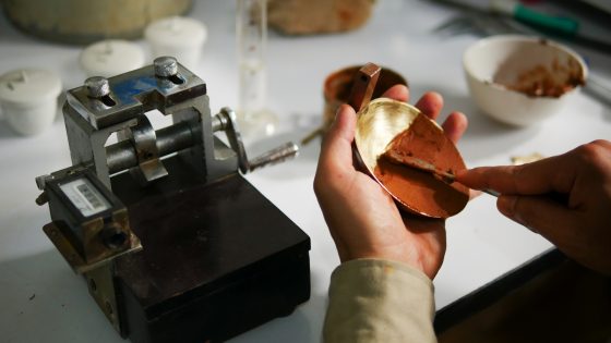
    Seequent has added laboratory testing functionality to its OpenGround cloud geotechnical data platform, allowing soil and rock sample data captured in the field to flow directly into lab reporting workflows. The update links borehole and test pit logs, sample metadata and chain-of-custody information with laboratory test schedules and results in a single environment. For ground investigation teams, this reduces manual data re-entry between site and lab systems and should cut errors in parameters used for foundation, retaining wall and earthworks design.

    Technical Brief

    • Similar cloud‑based GI–lab integrations are likely to become standard on large construction and infrastructure frameworks.

    Our Take

    The recent OpenGround update on integrated lab testing (5 Feb 2026) suggests this new field‑to‑lab link is part of a broader push to keep the entire geotechnical workflow inside a single cloud environment, reducing hand‑offs between site investigation and laboratory reporting.

    Seequent’s own Data Management Report (29 Jan 2026) found geoprofessionals spending over a quarter of their time on data handling, so direct transfer from field collection to lab for OpenGround users is likely aimed at clawing back billable engineering hours rather than just improving data hygiene.

    In our coverage of Seequent’s work at Anglo American’s Barro Alto nickel mine (20 Jan 2026), subsurface risk management hinged on having a live, unified model; piping geotechnical data straight from field to lab via OpenGround is a logical upstream extension of that same ‘single source of truth’ strategy for both mining and civil projects.

    Geotechnical Software for Modern Teams

    Centralise site data, logs, and lab results with GEODB-io, CMRR-io, and HYDROGEO-io.

    No credit card required.

    • Save and export unlimited calculations
    • Advanced data visualisation
    • Generate professional PDF reports
    • Cloud storage for all your projects

    Prepared by collating external sources, AI-assisted tools, and Geomechanics.io’s proprietary mining database, then reviewed for technical accuracy & edited by our geotechnical team.

    Related Articles

    AI in consulting design: fees, teams and QA workflows explained for engineers
    Software
    about 12 hours ago

    AI in consulting design: fees, teams and QA workflows explained for engineers

    AI tools that auto-generate options for 2D drawings, BIM models and outline design calculations in hours instead of weeks are forcing consultants to rethink fee structures built around the billable hour. Senior engineers may shift from producing drawings to curating AI outputs, validating load paths, checking code compliance and managing design risk, while fewer junior staff are needed for repetitive drafting and quantity take-off. Competitive advantage is likely to hinge on proprietary workflows, training data and QA processes, rather than simply having access to generic AI design software.

    Moxa 64-bit Arm edge computers: connectivity and reliability notes for mines
    Software
    2 days ago

    Moxa 64-bit Arm edge computers: connectivity and reliability notes for mines

    Moxa has launched its UC-3400A and UC-4400A 64-bit Arm-based industrial computers with integrated 5G/LTE and Wi-Fi 6, targeting edge deployments in harsh mining environments. The fanless units support wide operating temperatures, DIN-rail or wall mounting, and multiple serial/Ethernet ports for connecting legacy PLCs, sensors and IP cameras across pits, plants and remote haul roads. For mine operators, the combination of cellular and Wi-Fi backhaul enables more resilient telemetry, condition monitoring and fleet data capture where fibre or fixed networks are sparse.

    Civiltech Solutions’ road asset platform: planning and funding insights for engineers
    Software
    5 days ago

    Civiltech Solutions’ road asset platform: planning and funding insights for engineers

    Civiltech Solutions is deploying a cloud-based asset management platform to help Australian councils plan and deliver local road maintenance amid tightening budgets and rising service expectations. The system integrates defect data, pavement condition, work orders and contractor scheduling into a single interface, replacing fragmented spreadsheets and paper-based workflows. For engineers, this enables network-level prioritisation of reseals and rehabilitation, clearer forward works programming, and more defensible funding bids tied to quantified road condition and lifecycle cost scenarios.

    Related Industries & Products

    Construction

    Quality control software for construction companies with material testing, batch tracking, and compliance management.

    Mining

    Geotechnical software solutions for mining operations including CMRR analysis, hydrogeological testing, and data management.

    GEODB-io

    Centralised geotechnical data management solution for storing, accessing, and analysing all your site investigation and material testing data.

    CMRR-io

    Streamline coal mine roof stability assessments with our cloud-based CMRR software featuring automated calculations, multi-scenario analysis, and collaborative workflows.

    HYDROGEO-io

    Comprehensive hydrogeological testing platform for managing, analysing, and reporting on packer tests, lugeon values, and hydraulic conductivity assessments.