Geomechanics.io

  • Free Tools
Sign UpLog In

    Geomechanics.io

    Geomechanics, Streamlined.

    © 2026 Geomechanics.io. All rights reserved.

    Geomechanics.io

    CMRR-ioGEODB-ioHYDROGEO-ioQCDB-ioFree Tools & CalculatorsBlogLatest Industry News

    Industries

    MiningConstructionTunnelling

    Company

    Terms of UsePrivacy PolicyLinkedIn
    Product
    Projects

    Civiltech Solutions’ road asset platform: planning and funding insights for engineers

    February 19, 2026|

    Reviewed by Joe Ashwell

    Civiltech Solutions’ road asset platform: planning and funding insights for engineers

    First reported on Roads & Infrastructure (AU)

    30 Second Briefing

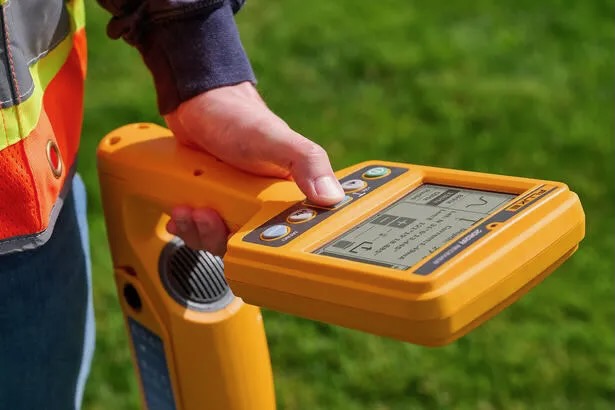
    Civiltech Solutions is deploying a cloud-based asset management platform to help Australian councils plan and deliver local road maintenance amid tightening budgets and rising service expectations. The system integrates defect data, pavement condition, work orders and contractor scheduling into a single interface, replacing fragmented spreadsheets and paper-based workflows. For engineers, this enables network-level prioritisation of reseals and rehabilitation, clearer forward works programming, and more defensible funding bids tied to quantified road condition and lifecycle cost scenarios.

    Technical Brief

    • Platform ingests condition data from visual inspections, automated surveys and historical maintenance records into one schema.
    • Councils can configure defect categories and severity thresholds to match local road hierarchy and intervention levels.
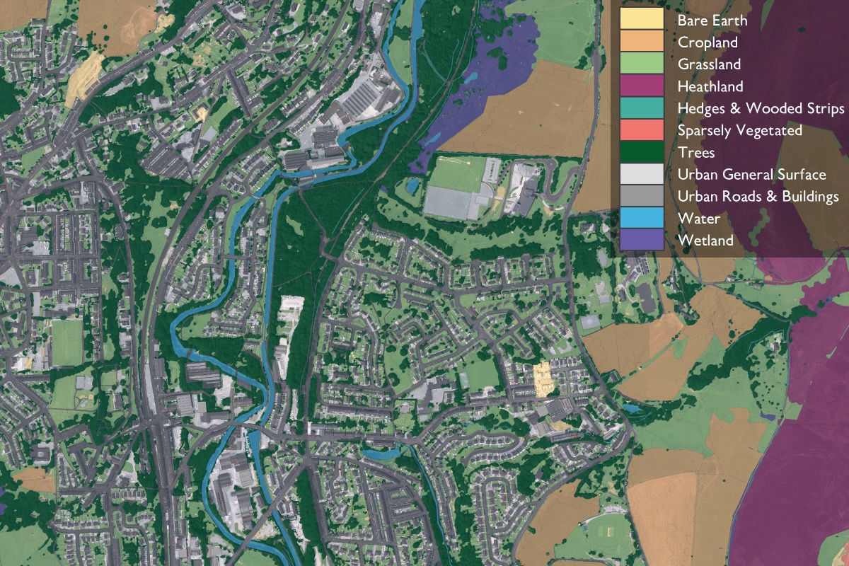
    • GIS-based interface maps pavement segments, enabling spatial querying of failures, reactive works clusters and resurfacing backlogs.
    • Workflows digitise inspection-to-work-order steps, including sign-off, contractor allocation and close-out evidence (photos, notes).
    • Cloud deployment removes local server upkeep, supporting multi-user access for engineering, finance and depot teams.
    • Audit trails log every change to condition ratings and treatment decisions, supporting probity and external performance reviews.
    • Scenario tools allow engineers to test different reseal cycles and treatment mixes against constrained capital envelopes.
    • Similar asset platforms are now being extended to kerbs, footpaths and drainage, enabling corridor-level optimisation.

    Our Take

    Within the 31 Software stories in our database, only a small subset are Australia-focused tools like those from Civiltech Solutions, suggesting local councils and contractors there are becoming a distinct target market for niche civil design and project tools.

    Civiltech Solutions sits in the Product/Projects tag cluster, which in our coverage is dominated by construction workflow and asset management platforms rather than pure design tools, so any emphasis on hands-on project delivery support would fill a relative gap in available solutions.

    For Australia-based practitioners, Roads & Infrastructure Magazine coverage of software vendors like Civiltech Solutions often precedes wider adoption in state and local government procurement panels, signalling that early visibility here can translate into specification advantages on upcoming projects.

    Geotechnical Software for Modern Teams

    Centralise site data, logs, and lab results with GEODB-io, CMRR-io, and HYDROGEO-io.

    No credit card required.

    • Save and export unlimited calculations
    • Advanced data visualisation
    • Generate professional PDF reports
    • Cloud storage for all your projects

    Prepared by collating external sources, AI-assisted tools, and Geomechanics.io’s proprietary mining database, then reviewed for technical accuracy & edited by our geotechnical team.

    Related Articles

    Fluke SmartTrace cable spotter: reducing UK utility strike risk for project teams
    Software
    1 day ago

    Fluke SmartTrace cable spotter: reducing UK utility strike risk for project teams

    Fluke has launched the SmartTrace 2082 Series underground locator, which injects signals to trace metallic cables and pipelines down to 6 m depth while identifying ground faults, sheath faults and coating defects where conductors contact earth. The locator connects via Bluetooth to Fluke’s PointMan app, enabling real-time geolocation, mapping and documentation of buried utilities directly on a smartphone for future works planning. Fluke cites around 60,000 utility strikes per year in UK excavations, positioning SmartTrace as a tool to cut strike risk and improve pre-dig surveys.

    World Day for Safety and Health at Work: digital hazard tools for project engineers
    Software
    2 days ago

    World Day for Safety and Health at Work: digital hazard tools for project engineers

    World Day for Safety and Health at Work sees Mott MacDonald showcase five digital tools from a Strategic Design Partnership hackathon aimed at tightening hazard management on infrastructure projects. Concepts include automated hazard identification from design models, mobile apps for site-based risk reporting, and dashboards aggregating incident and near-miss data in real time. For civil and geotechnical teams, the focus is on earlier visibility of construction and ground risks, faster feedback loops between site and design, and more structured capture of lessons learned.

    OS Enhanced Land Cover for BNG: key mapping takeaways for project teams
    Software
    8 days ago

    OS Enhanced Land Cover for BNG: key mapping takeaways for project teams

    Ordnance Survey has launched OS Enhanced Land Cover (ELC) Beta, a national habitat-mapping dataset that fuses OS National Geographic Database topography, OS aerial imagery, OS Terrain 5 and third-party sources including Natural England’s Living England, the Rural Payments Agency’s Crop Map of England and UKHab classifications to support 10% Biodiversity Net Gain (BNG) assessments. The tool enables desktop and field workflows for ecologists and developers, with Wessex Water using it via Linckia’s ESRI-based Habitat Fabric platform to assess hundreds of sites in a single spatial view. Linckia reports a 40% cut in data processing costs versus previous methods, rising to 90% compared with processing raw imagery, with OS claiming time savings of days to weeks per development across 1.5 million homes in the pipeline.

    Related Industries & Products

    Construction

    Quality control software for construction companies with material testing, batch tracking, and compliance management.

    Mining

    Geotechnical software solutions for mining operations including CMRR analysis, hydrogeological testing, and data management.

    QCDB-io

    Comprehensive quality control database for manufacturing, tunnelling, and civil construction with UCS testing, PSD analysis, and grout mix design management.

    AllGeotechnicalInfrastructureHazardsEnvironmental