National Highways’ 182 road runoff sites: design and risk notes for engineers
Reviewed by Tom Sullivan
First reported on New Civil Engineer
30 Second Briefing
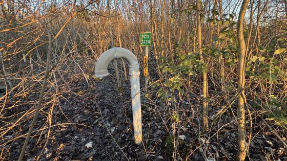
National Highways has identified 182 outfalls and soakaways on the Strategic Road Network that will be remediated for polluted road runoff by 2030, following pressure from river and water quality campaigners. The published list covers priority discharge points where runoff currently enters sensitive watercourses without adequate treatment, enabling targeted design of retrofit SuDS, settlement ponds, filters and upgraded soakaway systems. For civil and geotechnical teams, this signals a pipeline of brownfield drainage works involving constrained verges, high-traffic possessions and complex ground–water interface design.
Technical Brief
- Locations sit on the Strategic Road Network, implying high-speed, high-flow carriageways with limited verge width.
- Outfalls and soakaways will require hydraulic re‑assessment to maintain existing road drainage capacity post‑treatment.
- Retrofit SuDS and treatment assets must be integrated with existing pavement, embankment and cutting geometries.
- Works will trigger CDM and roadworker safety controls under live traffic and night‑time possessions.
- Sensitive watercourses imply tighter water quality objectives and likely Environment Agency permitting constraints.
- Brownfield drainage interventions will need contaminated ground risk assessments and careful spoil handling strategies.
- Programme offers a template for other highway authorities to prioritise runoff risks on legacy assets.
Our Take
Within our 21 Infrastructure stories, the United Kingdom features frequently on drainage and flood-resilience upgrades, so National Highways’ 182-location runoff remediation push is likely to compete directly with other water-management schemes for specialist contractors and materials.
Targeting completion by 2030 effectively aligns National Highways’ programme with UK water-quality and habitat objectives on a similar timescale, which may encourage highway designers to standardise sustainable drainage details on new schemes rather than rely on later retrofit.
For practitioners, a list of 182 outfalls and soakaways signals a shift from ad hoc treatment of polluted road runoff towards network-scale asset management, meaning more emphasis on condition surveys, performance monitoring and lifecycle costing of SuDS-type infrastructure on the strategic road network.
Prepared by collating external sources, AI-assisted tools, and Geomechanics.io’s proprietary mining database, then reviewed for technical accuracy & edited by our geotechnical team.
Related Articles


Related Industries & Products
Construction
Quality control software for construction companies with material testing, batch tracking, and compliance management.
Mining
Geotechnical software solutions for mining operations including CMRR analysis, hydrogeological testing, and data management.
CMRR-io
Streamline coal mine roof stability assessments with our cloud-based CMRR software featuring automated calculations, multi-scenario analysis, and collaborative workflows.
HYDROGEO-io
Comprehensive hydrogeological testing platform for managing, analysing, and reporting on packer tests, lugeon values, and hydraulic conductivity assessments.
GEODB-io
Centralised geotechnical data management solution for storing, accessing, and analysing all your site investigation and material testing data.