Geomechanics.io

  • Free Tools
Sign UpLog In

    Geomechanics.io

    Geomechanics, Streamlined.

    © 2026 Geomechanics.io. All rights reserved.

    Geomechanics.io

    CMRR-ioGEODB-ioHYDROGEO-ioQCDB-ioFree Tools & CalculatorsBlogLatest Industry News

    Industries

    MiningConstructionTunnelling

    Company

    Terms of UsePrivacy PolicyLinkedIn
    Projects
    Safety

    Landslide and liquefaction mapping after major quakes: priorities for geotechnical teams

    July 1, 2026|

    Reviewed by Joe Ashwell

    Landslide and liquefaction mapping after major quakes: priorities for geotechnical teams

    First reported on Geoengineer.org – News

    30 Second Briefing

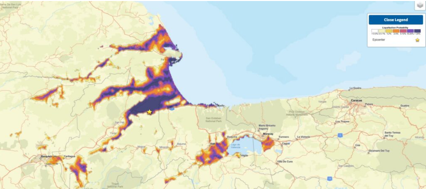
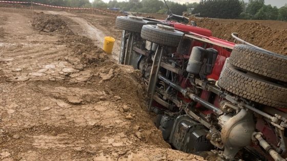
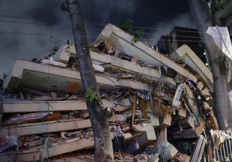
    Recent major earthquakes in Venezuela and the southern Philippines have exposed how delayed mapping of landslides and liquefaction can mask the worst damage for days, especially in remote mountain valleys and low-lying coastal plains. Geoscientists are pushing for rapid post-event zonation using satellite interferometry, UAV photogrammetry and pre-existing susceptibility maps to identify blocked river valleys, buried roads and lateral spreading along reclaimed or alluvial ground. For geotechnical teams, this means integrating near-real-time remote sensing with ground reconnaissance to prioritise slope stabilisation, bridge access and lifeline corridor repairs.

    Technical Brief

    • Emergency teams relied on pre-quake susceptibility maps to prioritise helicopter reconnaissance of likely valley-blocking sites.

    Our Take

    For projects tagged under Safety in the southern Philippines, operators increasingly face tighter local government scrutiny after failures, so robust microzonation and susceptibility mapping can materially influence permitting timelines and acceptable development densities in valleys and coastal plains.

    In Venezuela, where many slopes and urban fringes are informally developed, systematic liquefaction and landslide mapping after major quakes tends to drive retrofitting priorities for transport and lifeline corridors first, which can delay access upgrades for greenfield mining or infrastructure projects in higher-risk zones.

    Geotechnical Software for Modern Teams

    Centralise site data, logs, and lab results with GEODB-io, CMRR-io, and HYDROGEO-io.

    No credit card required.

    • Save and export unlimited calculations
    • Advanced data visualisation
    • Generate professional PDF reports
    • Cloud storage for all your projects

    Prepared by collating external sources, AI-assisted tools, and Geomechanics.io’s proprietary mining database, then reviewed for technical accuracy & edited by our geotechnical team.

    Related Articles

    Melbourne sinkhole investigations: geotechnical lessons for tunnel project teams
    Hazards
    6 months ago

    Melbourne sinkhole investigations: geotechnical lessons for tunnel project teams

    A sinkhole roughly 8–10 m wide and several metres deep has opened on the AJ Burkitt Reserve sporting oval in Heidelberg, directly adjacent to the North East Link tunnel alignment in Melbourne’s northeast. Victorian Infrastructure Delivery Authority has confirmed the “surface hole” is in the vicinity of active tunnelling operations, leading to a work pause while engineers and emergency crews carry out geotechnical investigations and monitoring. No injuries or structural damage have been reported, but the area remains fully cordoned off pending cause determination and stability assessment.

    HS2 contractor fined £400k: haul road and ramp safety lessons for engineers
    Hazards
    4 days ago

    HS2 contractor fined £400k: haul road and ramp safety lessons for engineers

    A joint venture contractor on HS2 has been fined £400,000 after a 20 t tipper truck left the edge of an excavation ramp, leaving the driver with multiple serious injuries. The incident involved a temporary earthworks access ramp where the truck overran the unprotected edge and rolled into the excavation. The case signals renewed scrutiny of haul road and ramp design, edge protection, and traffic management on major UK infrastructure sites, particularly for heavy earthmoving plant.

    Venezuela earthquakes: geotechnical failure lessons and slope risks for engineers
    Hazards
    4 days ago

    Venezuela earthquakes: geotechnical failure lessons and slope risks for engineers

    Two shallow earthquakes of magnitude 7.1 and 6.8 struck near Caracas and La Guaira within hours, collapsing mid‑rise reinforced concrete apartment blocks and older unreinforced masonry in hillside barrios, with hundreds confirmed dead and thousands displaced. Liquefaction, lateral spreading and rockfalls have damaged key transport links, including sections of the Caracas–La Guaira motorway and port access roads, complicating access for rescue equipment and temporary shoring. Geotechnical teams are racing to assess slope stability on steep, weathered tropical soils and to prioritise demolition versus retrofit of heavily cracked shear‑wall structures.

    Related Industries & Products

    Mining

    Geotechnical software solutions for mining operations including CMRR analysis, hydrogeological testing, and data management.

    Construction

    Quality control software for construction companies with material testing, batch tracking, and compliance management.

    CMRR-io

    Streamline coal mine roof stability assessments with our cloud-based CMRR software featuring automated calculations, multi-scenario analysis, and collaborative workflows.

    HYDROGEO-io

    Comprehensive hydrogeological testing platform for managing, analysing, and reporting on packer tests, lugeon values, and hydraulic conductivity assessments.

    GEODB-io

    Centralised geotechnical data management solution for storing, accessing, and analysing all your site investigation and material testing data.

    AllGeotechnicalMiningInfrastructureMaterialsHazardsEnvironmentalSoftwarePolicy