Geomechanics.io

  • Free Tools
Sign UpLog In
Built byBoxcut Studio

Geomechanics.io

Geomechanics, Streamlined.

© 2026 Geomechanics.io. All rights reserved.

Geomechanics.io

CMRR-ioGEODB-ioHYDROGEO-ioQCDB-ioFree Tools & CalculatorsBlogLatest Industry News

Industries

MiningConstructionTunnelling

Company

Terms of UsePrivacy PolicyLinkedIn
    Projects
    Contract Award

    American Rare Earths’ Cowboy State mine: resource upgrade and PFS lens for engineers

    November 20, 2025|

    Reviewed by Joe Ashwell

    American Rare Earths’ Cowboy State mine: resource upgrade and PFS lens for engineers

    First reported on MINING.com

    30 Second Briefing

    American Rare Earths has lifted the Cowboy State mine resource within the Halleck Creek project in Wyoming to about 547.5 million tonnes at a 1,000 ppm TREO cut-off, following 18 new channel samples and expanded geological mapping. Around 63.9 million tonnes have been upgraded from inferred to indicated, and two new Wyoming Department of Environmental Quality permits allow 27 in-fill drill holes to support prefeasibility and subsequent technical studies. The project also benefits from up to $7.1 million in state-backed, non-dilutive funding to advance mine development.

    Technical Brief

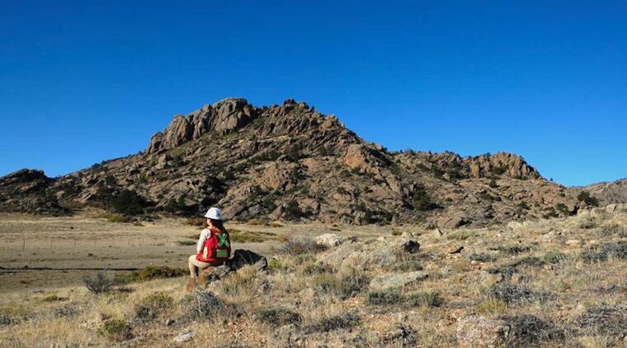
    • Additional geological mapping tied to the channel sampling expanded the defined mineralised footprint, adding ~4.5 Mt to the Cowboy State mine resource without additional drilling.
    • For other rare earth developers, the use of relatively low-cost channel sampling and mapping to both upgrade classification and expand tonnage illustrates the value of detailed surface work before committing to large in-fill drill budgets.

    Our Take

    American Rare Earths is one of only a handful of rare earths and rare earth oxides names in our recent mining coverage, which suggests Cowboy State in Wyoming could become a reference project for US-based critical minerals outside the more commonly reported Canadian and Australian hubs.

    The combination of a 547.5 Mt resource at Cowboy State and state-backed non‑dilutive funding in Wyoming positions ARR differently from many junior rare earths developers in our database, which more often rely on equity raises or strategic offtake to fund early drilling and scoping work.

    With ARR targeting antimony capacity by 2028 alongside rare earth oxides, the company is aligning two US‑listed critical minerals that feature far less frequently than copper or gold in our mining corpus, potentially making Halleck Creek and any South Australia processing facility more attractive to downstream buyers seeking diversified non‑Chinese supply.

    Geotechnical Software for Modern Teams

    Centralise site data, logs, and lab results with GEODB-io, CMRR-io, and HYDROGEO-io.

    No credit card required.

    • Save and export unlimited calculations
    • Advanced data visualisation
    • Generate professional PDF reports
    • Cloud storage for all your projects

    Prepared by collating external sources, AI-assisted tools, and Geomechanics.io’s proprietary mining database, then reviewed for technical accuracy & edited by our geotechnical team.

    Related Articles

    Mining
    about 10 hours ago

    Atlantic Nickel record output at Santa Rita: process and UG transition notes for planners

    Atlantic Nickel’s Santa Rita nickel sulphide mine in Bahia, Brazil, delivered a record 12,464 t of nickel concentrate in August, with metallurgical recovery reaching 86.72%, the highest since operations restarted under Appian Capital ownership. The performance comes as the operation advances its transition from open pit to underground mining, signalling stable plant performance and effective ore blending during a complex changeover. For process and mine planners, the numbers suggest current comminution and flotation circuits are coping well with evolving underground feed characteristics.

    Mining
    about 10 hours ago

    Advanced Navigation US plant: GPS-denied mine positioning insights for engineers

    Advanced Navigation America has opened a US manufacturing facility to scale production of its inertial navigation and robotics systems for GPS-denied underground and surface mines, reducing reliance on vulnerable, legacy GPS-based infrastructure. The plant will build mining-grade INS/IMU units and navigation systems designed to maintain centimetre-level positioning in dust, blast-induced shock and long-haul drifts where satellite signals are unavailable or intermittent. For mine operators, this supports more reliable autonomous haulage, drilling guidance and fleet tracking without installing extensive fixed beacons or repeaters.

    Mining
    about 10 hours ago

    Multotec Zambia expansion: supply chain and uptime takeaways for mine engineers

    Multotec Zambia is marking its 25th anniversary in 2026 by opening a new Central Africa Regional Head Office that will expand local manufacturing, assembly and service support for the Zambian and regional mining sector. The facility is intended to bring Multotec’s process equipment expertise and technology—such as wear linings, screening media and cyclones—closer to copper and cobalt operations that currently rely heavily on imported or South African-supplied components. For mine operators, increased in-country capacity should shorten lead times for critical spares and enable more responsive on-site technical support.

    Related Industries & Products

    Mining

    Geotechnical software solutions for mining operations including CMRR analysis, hydrogeological testing, and data management.

    CMRR-io

    Streamline coal mine roof stability assessments with our cloud-based CMRR software featuring automated calculations, multi-scenario analysis, and collaborative workflows.

    HYDROGEO-io

    Comprehensive hydrogeological testing platform for managing, analysing, and reporting on packer tests, lugeon values, and hydraulic conductivity assessments.

    GEODB-io

    Centralised geotechnical data management solution for storing, accessing, and analysing all your site investigation and material testing data.

    AllGeotechnicalInfrastructureHazardsEnvironmental