Geomechanics.io

  • Free Tools
Sign UpLog In

Geomechanics.io

Geomechanics, Streamlined.

© 2026 Geomechanics.io. All rights reserved.

Geomechanics.io

CMRR-ioGEODB-ioHYDROGEO-ioQCDB-ioFree Tools & CalculatorsBlogLatest Industry News

Industries

MiningConstructionTunnelling

Company

Terms of UsePrivacy PolicyLinkedIn
    Safety
    Projects
    Product

    AI in construction: practical safety and planning gains for site engineers

    January 7, 2026|

    Reviewed by Joe Ashwell

    AI in construction: practical safety and planning gains for site engineers

    First reported on New Civil Engineer

    30 Second Briefing

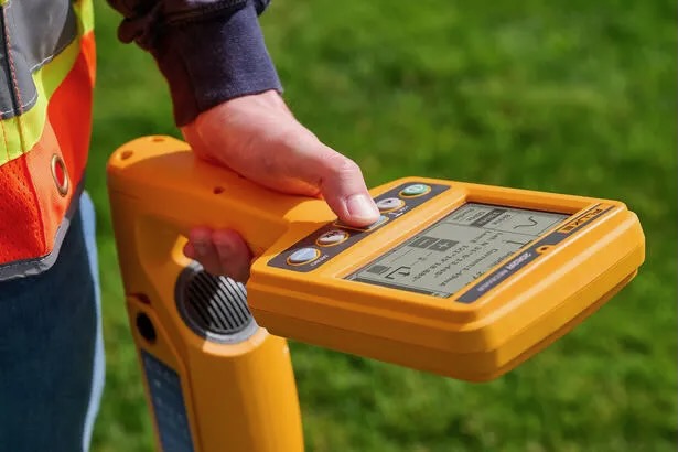
    AI in construction is being positioned as a tool to optimise site processes by feeding supervisors real-time data on plant utilisation, programme clashes and safety-critical behaviours rather than removing operatives from projects. Systems combining computer vision with existing CCTV and 4D BIM models can flag exclusion-zone breaches, near-miss patterns and schedule deviations, giving planners and site engineers earlier warnings than traditional inspections. For geotechnical and civil teams, this means more data-driven decisions on sequencing earthworks, crane locations and temporary works, while still relying on human judgement for risk acceptance and design changes.

    Technical Brief

    • AI tools are framed as augmenting site operatives’ decision-making, not automating or removing roles.
    • Safety benefit is positioned around earlier, clearer information flows to supervisors rather than new physical controls.
    • Human judgement is explicitly retained for risk acceptance, design changes and sign-off of mitigations.
    • Article stresses AI outputs must be explainable so engineers can interrogate and challenge flagged risks.
    • Wider implication: AI is treated as another safety-critical system requiring validation, verification and ongoing performance monitoring.

    Our Take

    Within the 14 Software stories in our database, AI and artificial intelligence are most often linked to safety and project controls, signalling that contractors are testing these tools first in risk-sensitive workflows rather than in core design or labour-replacement roles.

    Among the 1,013 tag-matched pieces on Safety and Projects, software items like this tend to focus on integrating AI into existing CDEs and field-reporting tools, which suggests that near-term value for contractors will come from augmenting current platforms rather than procuring standalone ‘AI products’.

    Coverage of AI in construction software increasingly highlights explainability and audit trails, which is becoming a practical requirement for UK and EU contractors needing to demonstrate how AI-assisted decisions align with CDM and other safety regulations.

    Geotechnical Software for Modern Teams

    Centralise site data, logs, and lab results with GEODB-io, CMRR-io, and HYDROGEO-io.

    No credit card required.

    • Save and export unlimited calculations
    • Advanced data visualisation
    • Generate professional PDF reports
    • Cloud storage for all your projects

    Prepared by collating external sources, AI-assisted tools, and Geomechanics.io’s proprietary mining database, then reviewed for technical accuracy & edited by our geotechnical team.

    Related Articles

    Fluke SmartTrace cable spotter: reducing UK utility strike risk for project teams
    Software
    1 day ago

    Fluke SmartTrace cable spotter: reducing UK utility strike risk for project teams

    Fluke has launched the SmartTrace 2082 Series underground locator, which injects signals to trace metallic cables and pipelines down to 6 m depth while identifying ground faults, sheath faults and coating defects where conductors contact earth. The locator connects via Bluetooth to Fluke’s PointMan app, enabling real-time geolocation, mapping and documentation of buried utilities directly on a smartphone for future works planning. Fluke cites around 60,000 utility strikes per year in UK excavations, positioning SmartTrace as a tool to cut strike risk and improve pre-dig surveys.

    World Day for Safety and Health at Work: digital hazard tools for project engineers
    Software
    2 days ago

    World Day for Safety and Health at Work: digital hazard tools for project engineers

    World Day for Safety and Health at Work sees Mott MacDonald showcase five digital tools from a Strategic Design Partnership hackathon aimed at tightening hazard management on infrastructure projects. Concepts include automated hazard identification from design models, mobile apps for site-based risk reporting, and dashboards aggregating incident and near-miss data in real time. For civil and geotechnical teams, the focus is on earlier visibility of construction and ground risks, faster feedback loops between site and design, and more structured capture of lessons learned.

    OS Enhanced Land Cover for BNG: key mapping takeaways for project teams
    Software
    8 days ago

    OS Enhanced Land Cover for BNG: key mapping takeaways for project teams

    Ordnance Survey has launched OS Enhanced Land Cover (ELC) Beta, a national habitat-mapping dataset that fuses OS National Geographic Database topography, OS aerial imagery, OS Terrain 5 and third-party sources including Natural England’s Living England, the Rural Payments Agency’s Crop Map of England and UKHab classifications to support 10% Biodiversity Net Gain (BNG) assessments. The tool enables desktop and field workflows for ecologists and developers, with Wessex Water using it via Linckia’s ESRI-based Habitat Fabric platform to assess hundreds of sites in a single spatial view. Linckia reports a 40% cut in data processing costs versus previous methods, rising to 90% compared with processing raw imagery, with OS claiming time savings of days to weeks per development across 1.5 million homes in the pipeline.

    Related Industries & Products

    Construction

    Quality control software for construction companies with material testing, batch tracking, and compliance management.

    Mining

    Geotechnical software solutions for mining operations including CMRR analysis, hydrogeological testing, and data management.

    QCDB-io

    Comprehensive quality control database for manufacturing, tunnelling, and civil construction with UCS testing, PSD analysis, and grout mix design management.

    AllGeotechnicalInfrastructureHazardsEnvironmental