Geomechanics.io

  • Free Tools
Sign UpLog In

    Geomechanics.io

    Geomechanics, Streamlined.

    © 2026 Geomechanics.io. All rights reserved.

    Geomechanics.io

    CMRR-ioGEODB-ioHYDROGEO-ioQCDB-ioFree Tools & CalculatorsBlogLatest Industry News

    Industries

    MiningConstructionTunnelling

    Company

    Terms of UsePrivacy PolicyLinkedIn
    Projects
    Contract Award

    Trent Vale new homes plan for Scunthorpe: infrastructure and flood lens for engineers

    July 3, 2026|

    Reviewed by Joe Ashwell

    Trent Vale new homes plan for Scunthorpe: infrastructure and flood lens for engineers

    First reported on The Construction Index

    30 Second Briefing

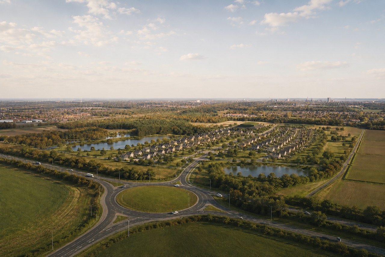
    North Lincolnshire Council has scrapped the long-delayed Lincolnshire Lakes scheme and launched the Trent Vale plan for Scunthorpe, still targeting around 6,000 new homes on land already benefitting from 2019 flood defences and two approved M181 junctions. Trent Vale proposes six distinct villages – Burgess Croft, Burleigh Green, Woldmere, Ashmere, Southgate Hollow and Brumby Green – each tied to local landscape and heritage. For civil and geotechnical teams, the existing flood mitigation and motorway access works materially de-risk primary infrastructure but detailed layouts and phasing remain to be defined with developers.

    Technical Brief

    • Flood prevention infrastructure for the development footprint was physically completed in 2019, pre-dating Trent Vale.
    • Two new M181 junctions already have planning approval, pre-establishing strategic highway access geometry and tie-ins.
    • Legacy Lincolnshire Lakes planning consents largely expired by November 2022, resetting statutory planning baselines.
    • Scunthorpe United’s proposed stadium within the earlier masterplan has been abandoned, freeing up that land parcel.
    • The council publicly reiterates a 6,000-home delivery ambition despite scrapping the original Lakes framework.
    • Six named villages under Trent Vale provide a structure for phased enabling works and utilities corridors.
    • More than 20 years elapsed between the 2004 Lincolnshire Lakes announcement and the current scheme reset.
    • For other large UK housing allocations, this illustrates how long-lived consents can lapse before ground is broken.

    Our Take

    Lincolnshire Lakes/Trent Vale sits in a small subset of our 910 UK Infrastructure stories where housing delivery has been delayed for more than a decade after initial announcement, signalling elevated planning and political risk for developers and lenders looking at North Lincolnshire schemes.

    With six new villages planned around Scunthorpe, North Lincolnshire Council moves from a single-site to a distributed growth model, which typically complicates phasing and utilities strategies but can make it easier to align individual parcels with changing housing-market demand over a 10–20 year build-out.

    Geotechnical Software for Modern Teams

    Centralise site data, logs, and lab results with GEODB-io, CMRR-io, and HYDROGEO-io.

    No credit card required.

    • Save and export unlimited calculations
    • Advanced data visualisation
    • Generate professional PDF reports
    • Cloud storage for all your projects

    Prepared by collating external sources, AI-assisted tools, and Geomechanics.io’s proprietary mining database, then reviewed for technical accuracy & edited by our geotechnical team.

    Related Articles

    Strabag’s Pfaffensteig Tunnel contract: design and delivery notes for rail engineers
    Infrastructure
    about 2 months ago

    Strabag’s Pfaffensteig Tunnel contract: design and delivery notes for rail engineers

    Strabag and Group company Züblin have secured the design-and-build structural works for the ABS Gäubahn Nord/Pfaffensteig Tunnel in south-west Germany, centred on an 11km twin-bore rail tunnel linking Stuttgart Airport station directly to the Gäubahn line towards Switzerland. About 9.8km will be driven by two TBMs, with conventional tunnelling for the A8 motorway undercrossing and airport connection, plus a 240m cut-and-cover section, retaining structures, railway underpasses and a grade-separated crossing. A 3km surface section will be upgraded and partially realigned for 200km/h operation, delivered under an integrated project delivery model with Ed. Züblin, Wayss & Freytag and Strabag AG sharing tunnelling, structural and earthworks packages.

    National Grid TBM under the Thames: tunnelling design and risk notes for engineers
    Infrastructure
    4 months ago

    National Grid TBM under the Thames: tunnelling design and risk notes for engineers

    A 271.5‑tonne Herrenknecht Mixshield TBM, Caroline, has started driving a 2.2km electricity cable tunnel with a 4m internal diameter beneath the River Thames in Essex for National Grid’s Grain to Tilbury project, delivered by the Ferrovial BEMO joint venture. The drive will pass through variable Thames estuary ground conditions between 35m‑deep launch and reception shafts of 15m and 12m diameter, with tunnelling continuing into 2026 and overall scheme completion targeted for 2029. The new tunnel will replace the 1969 Thames Cable Tunnel and carry new high‑voltage circuits between Grain and Tilbury substations.

    Panama Canal Mixshield undercrossing: design and tunnelling lessons for engineers
    Infrastructure
    5 months ago

    Panama Canal Mixshield undercrossing: design and tunnelling lessons for engineers

    A 13.46m diameter Herrenknecht Mixshield TBM has broken through into the future Balboa station on Panama Metro Line 3 after completing the first-ever TBM undercrossing of the Panama Canal at depths exceeding 60m below sea level. The 5,600kW, 26,616kNm machine, fitted with an accessible cutterhead and more than 4,500 sensors linked via the Herrenknecht.Connected platform, has achieved peak advance of 150 segment rings (about 300m) per month through mixed sandstone, tuff, breccias and basalt. Around 1.5km of the 4.5km twin-track tunnel remains to final breakthrough.

    Related Industries & Products

    Construction

    Quality control software for construction companies with material testing, batch tracking, and compliance management.

    Mining

    Geotechnical software solutions for mining operations including CMRR analysis, hydrogeological testing, and data management.

    CMRR-io

    Streamline coal mine roof stability assessments with our cloud-based CMRR software featuring automated calculations, multi-scenario analysis, and collaborative workflows.

    HYDROGEO-io

    Comprehensive hydrogeological testing platform for managing, analysing, and reporting on packer tests, lugeon values, and hydraulic conductivity assessments.

    GEODB-io

    Centralised geotechnical data management solution for storing, accessing, and analysing all your site investigation and material testing data.

    AllGeotechnicalMiningInfrastructureMaterialsHazardsEnvironmentalSoftwarePolicy