Geomechanics.io

  • Free Tools
Sign UpLog In

Geomechanics.io

Geomechanics, Simplified.

© 2025 Geomechanics.io. All rights reserved.

Geomechanics.io

CMRR-ioGEODB-ioHYDROGEO-ioQCDB-ioFree Tools & CalculatorsBlogLatest Industry News

Industries

MiningConstructionTunnelling

Company

Terms of UsePrivacy PolicyLinkedIn
    AllGeotechnicalMiningInfrastructureMaterialsHazardsEnvironmentalSoftwarePolicy
    Safety
    Projects

    Nuar underground asset register: strike-free excavation insights for civils teams

    December 5, 2025|

    Reviewed by Joe Ashwell

    Nuar underground asset register: strike-free excavation insights for civils teams

    First reported on New Civil Engineer

    30 Second Briefing

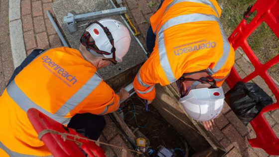
    The National Underground Asset Register (Nuar), a government-backed digital map of buried pipes and cables, is expanding to target contractors with near real-time access to multi-utility asset data before excavation. The platform aggregates location information from water, gas, electricity and telecoms operators into a single online interface, replacing multiple separate searches and paper plans. For ground engineers and civils contractors, Nuar aims to cut service strikes and unplanned outages on streetworks and major schemes by providing faster, more accurate asset location snapshots at the planning and permit stages.

    Technical Brief

    • Safety case is framed around reducing cable and main strikes that currently cause injuries and traffic disruption.

    Our Take

    Within our 165 Infrastructure stories, relatively few focus on digital registries like the National Underground Asset Register, so this pushes the safety tag coverage beyond traditional themes such as site incidents and PPE into data-led risk reduction for contractors.

    For contractors and utilities, a more comprehensive Nuar effectively shifts some duty-of-care expectations: once accurate underground data are widely available, regulators and clients are more likely to treat strike events as failures of planning rather than unavoidable hazards.

    Because this is tagged to both Safety and Projects, Nuar’s evolution is likely to influence how early-stage project planning and CDM documentation are prepared, with asset location data becoming a standard pre-construction deliverable rather than an optional desktop study.

    Geotechnical Software for Modern Teams

    Centralise site data, logs, and lab results with GEODB-io, CMRR-io, and HYDROGEO-io.

    No credit card required.

    • Save and export unlimited calculations
    • Advanced data visualisation
    • Generate professional PDF reports
    • Cloud storage for all your projects

    Prepared by collating external sources, AI-assisted tools, and Geomechanics.io’s proprietary mining database, then reviewed for technical accuracy & edited by our geotechnical team.

    Related Articles

    DSIT’s CNI cybersecurity drive: design and monitoring lessons for engineers
    Infrastructure
    3 days ago

    DSIT’s CNI cybersecurity drive: design and monitoring lessons for engineers

    The Department for Science, Innovation and Technology has expanded its Cyber Runway Critical National Infrastructure programme with innovation accelerator Plexal to bring more cybersecurity SMEs into protecting UK energy, transport, water and digital networks. The scheme targets operational technology and industrial control systems used in assets such as substations, treatment works and tunnels, where legacy SCADA and remote monitoring are increasingly exposed to cyber-physical attacks. For civil and infrastructure engineers, this signals closer integration of cyber risk into asset design, condition monitoring and resilience planning.

    Gatwick PAS 2080 certification: whole-life carbon lessons for project teams
    Infrastructure
    3 days ago

    Gatwick PAS 2080 certification: whole-life carbon lessons for project teams

    London Gatwick has become the first airport globally to achieve PAS 2080:2023 certification for carbon management across its buildings and infrastructure assets. The BSI-verified standard requires quantified whole-life carbon baselines, option appraisal and reduction pathways for capital works, including terminals, piers, pavements and associated civil engineering. For designers and contractors working at Gatwick, future schemes will need to evidence embodied and operational carbon performance alongside cost, influencing material choices, construction methods and asset renewal strategies.

    Northern Ireland DfI AI road stock-take: asset management lessons for engineers
    Infrastructure
    3 days ago

    Northern Ireland DfI AI road stock-take: asset management lessons for engineers

    Northern Ireland’s Department for Infrastructure has commissioned mapping specialist Gaist to deliver a network-wide digital stock-take of its road assets using AI-based condition assessment. High-resolution imaging and machine-learning classification will be used to catalogue carriageway defects, drainage features and street furniture, creating a georeferenced inventory to support maintenance planning amid a mounting roads backlog. For asset managers and pavement engineers, the move signals a shift towards data-driven prioritisation of resurfacing, patching and drainage interventions across the regional network.

    Related Industries & Products

    Construction

    Quality control software for construction companies with material testing, batch tracking, and compliance management.

    Mining

    Geotechnical software solutions for mining operations including CMRR analysis, hydrogeological testing, and data management.

    QCDB-io

    Comprehensive quality control database for manufacturing, tunnelling, and civil construction with UCS testing, PSD analysis, and grout mix design management.