Leica RTC 3D scanners and Livelink: workflow and data lessons for project teams
Reviewed by Joe Ashwell
First reported on The Construction Index
30 Second Briefing
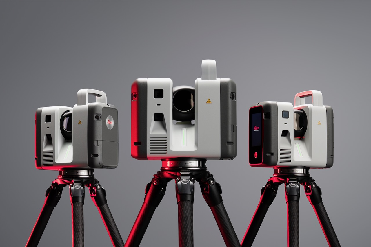
Leica has launched a new RTC series of terrestrial 3D laser scanners that combine the speed and on-site registration of the RTC360 with the robustness and higher accuracy of the ScanStation P‑Series, targeting surveying, construction, industrial plants, public safety and infrastructure workflows. Three performance tiers allow users to step up to more demanding scan jobs without replacing their full hardware stack, supporting incremental upgrades across project portfolios. A new Livelink data service, integrated into the Cyclone Field 360 mobile app, streams multi-scanner datasets directly to Hexagon GeoCloud so field, office and cloud models stay synchronised in near real time.
Technical Brief
- Leica positions the RTC series as merging RTC360 field productivity with ScanStation P‑Series survey-grade robustness.
- Three discrete scanner performance tiers are offered, enabling specification to match survey tolerance and range requirements.
- Livelink is embedded directly in the Cyclone Field 360 mobile app for in-field control and streaming.
- Multi-scanner datasets are aggregated via Livelink before upload, supporting coordinated setups on complex sites.
- Hexagon GeoCloud acts as the central repository, keeping field, office and cloud models synchronised.
- Hexagon’s scanning and mapping division president, Tanja Birner, frames the RTC platform as explicitly “built to scale”.
- Incremental upgrade path is aimed at asset-heavy users wanting to extend scanner capability without fleet replacement.
Our Take
Leica and Hexagon feature only sporadically in our 41 Software stories, so a dedicated piece on the Leica RTC series signals that hardware–software integration (Cyclone Field 360 with Hexagon GeoCloud) is becoming a differentiator rather than an add‑on in survey workflows.
Across our Product-tagged software coverage, most items focus on point solutions rather than full capture-to-cloud chains, so Leica’s three-scanner RTC line tied into Livelink and Cyclone Field 360 suggests a push towards standardised, end‑to‑end reality capture stacks on major projects.
Prepared by collating external sources, AI-assisted tools, and Geomechanics.io’s proprietary mining database, then reviewed for technical accuracy & edited by our geotechnical team.
Related Articles

Related Industries & Products
Construction
Quality control software for construction companies with material testing, batch tracking, and compliance management.
Mining
Geotechnical software solutions for mining operations including CMRR analysis, hydrogeological testing, and data management.
QCDB-io
Comprehensive quality control database for manufacturing, tunnelling, and civil construction with UCS testing, PSD analysis, and grout mix design management.