A35 Dorset £1.8M safety upgrade: design and traffic management notes for engineers
Reviewed by Tom Sullivan
First reported on New Civil Engineer
30 Second Briefing
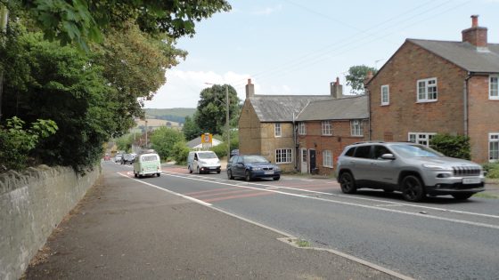
National Highways has started a £1.8M safety upgrade on a 42km single-carriageway section of the A35 in west Dorset, targeting a corridor with a history of serious collisions and speed-related incidents. Measures will focus on speed reduction and driver guidance, typically involving average speed cameras, improved signing and lining, and localised junction treatments on rural curves and undulating gradients. For designers and contractors, the works will require careful traffic management on a strategic trunk route with constrained verges and limited diversion options.
Technical Brief
- Rural cross-section with constrained verges limits options for physical segregation or substantial widening-based countermeasures.
- Undulating topography and horizontal curvature require careful placement of enforcement and guidance measures to avoid sightline issues.
- Likely night-time and off-peak working windows will drive traffic management phasing and temporary safety controls.
- Interfaces with side-road and farm accesses will need bespoke signing and temporary speed management to avoid rear-end shunts.
- Drainage features and soft verges along the corridor will influence safe positioning of new roadside assets and cabinets.
- For similar rural trunk routes, low-cost corridor-wide treatments offer a template where full reconstruction is unaffordable.
Our Take
Within our 558 Infrastructure stories, National Highways features most often in higher-value upgrades, so a £1.8M package on a single 42km corridor in Dorset signals that this stretch of the A35 is being treated as a priority risk location rather than a routine maintenance job.
Among the 1,528 Projects/Safety-tagged pieces, rural A‑roads in the United Kingdom like this west Dorset section typically see incremental, multi-phase interventions; practitioners should expect follow-on schemes or speed management changes if collision data do not improve after this initial works programme.
For local authorities and contractors in Dorset, a safety-focused scheme of this scale on a strategic route often acts as a reference project, shaping design standards and preferred treatments for similar hazard-prone corridors across the region.
Prepared by collating external sources, AI-assisted tools, and Geomechanics.io’s proprietary mining database, then reviewed for technical accuracy & edited by our geotechnical team.


