Vizsla drilling extends Poplar copper system: scale and geometry insights for mine planners
Reviewed by Joe Ashwell
First reported on MINING.com
30 Second Briefing
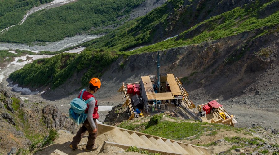
New drilling at Vizsla Copper’s Poplar project in central British Columbia has extended the Thira porphyry system 200 metres north, with hole TH26-151 cutting 675 metres from 32 metres downhole grading 0.26% copper and 0.015% molybdenum, including 435 metres at 0.31% copper and 0.022% molybdenum from 198 metres. Together with hole TH26-148 (483 metres at 0.26% copper, 0.016% molybdenum from 9 metres), mineralisation now spans at least 800 metres east–west and 700 metres north–south and remains open. The 8,000‑metre programme is testing multiple porphyry targets along an 8 km alteration corridor within a 470 sq. km, road-accessible district 38 km from Imperial Metals’ Huckleberry mine.
Technical Brief
- Poplar’s 2021 resource outlines 152 Mt indicated at 0.32% Cu, 0.09 g/t Au, 2.58 g/t Ag.
- Inferred resource adds 139 Mt at 0.29% Cu, 0.07 g/t Au, 4.95 g/t Ag, supporting large-scale tonnage potential.
- Contained metals total about 1.1 Blb Cu, 430 koz Au and 12.6 Moz Ag indicated, plus 903 Mlb Cu inferred.
- Thira sits within an >8 km alteration corridor, with coincident geophysical and geochemical anomalies defining multiple porphyry centres.
- Current 8,000 m drill campaign also targets Copper Pond and Camp Lake, which share similar geophysical signatures to Thira.
- Poplar tenement covers ~470 km² in central British Columbia, 400 km east of the deep-water port at Prince Rupert.
- Existing regional infrastructure includes Imperial Metals’ Huckleberry copper mine located ~38 km from Poplar, reducing greenfield access risk.
- Year-round operability is emphasised, with CEO noting the “infrastructure rich” setting for a near-surface copper system.
Our Take
With Poplar’s indicated and inferred copper resources totalling over 2 billion lb. and a C$102 million market value for Vizsla Copper, the project sits in the tier where a larger copper producer such as First Quantum or Imperial Metals could eventually view it as a bolt-on growth or regional consolidation target in central British Columbia.
The 400 km distance from Poplar to the deep-water port at Prince Rupert, combined with proximity to the past-producing Huckleberry copper mine, suggests any future development could leverage existing regional power, road, and concentrate logistics corridors that have already underpinned other British Columbia copper operations in our database.
British Columbia copper projects like Poplar are coming under closer scrutiny as the province reworks its approach to Indigenous rights and permitting, as flagged in our recent coverage of Premier David Eby’s planned changes to the Declaration on the Rights of Indigenous Peoples Act, which could influence consultation timelines and certainty for new porphyry developments.
Prepared by collating external sources, AI-assisted tools, and Geomechanics.io’s proprietary mining database, then reviewed for technical accuracy & edited by our geotechnical team.
Related Articles


Related Industries & Products
Mining
Geotechnical software solutions for mining operations including CMRR analysis, hydrogeological testing, and data management.
Construction
Quality control software for construction companies with material testing, batch tracking, and compliance management.
CMRR-io
Streamline coal mine roof stability assessments with our cloud-based CMRR software featuring automated calculations, multi-scenario analysis, and collaborative workflows.
HYDROGEO-io
Comprehensive hydrogeological testing platform for managing, analysing, and reporting on packer tests, lugeon values, and hydraulic conductivity assessments.
GEODB-io
Centralised geotechnical data management solution for storing, accessing, and analysing all your site investigation and material testing data.