Geomechanics.io

  • Free Tools
Sign UpLog In

    Geomechanics.io

    Geomechanics, Streamlined.

    © 2026 Geomechanics.io. All rights reserved.

    Geomechanics.io

    CMRR-ioGEODB-ioHYDROGEO-ioQCDB-ioFree Tools & CalculatorsBlogLatest Industry News

    Industries

    MiningConstructionTunnelling

    Company

    Terms of UsePrivacy PolicyLinkedIn
    Failure
    Safety
    Projects

    South East rail disruption: derailments and landslip lessons for geotechnical engineers

    August 18, 2026|

    Reviewed by Joe Ashwell

    South East rail disruption: derailments and landslip lessons for geotechnical engineers

    First reported on New Civil Engineer

    30 Second Briefing

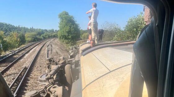
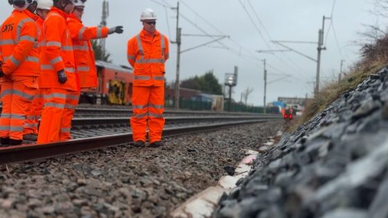
    Two derailments at Lewes in Sussex and Wickford in Essex, plus a landslip on another Sussex route and a separate track defect in Surrey, have simultaneously disrupted key commuter and regional rail corridors in south-east England. The incidents point to localised formation instability and asset degradation across multiple routes rather than a single point failure, with engineers now inspecting embankments, ballast condition and rail geometry. Operators face short-term speed restrictions and diversions while permanent repairs and geotechnical assessments are completed.

    Technical Brief

    • Failure mechanisms under review likely include localised track buckling, ballast voiding and embankment shear along affected lengths.
    • Investigation will centre on detailed geometry recording, ultrasonic rail testing and ballast/formation coring at Lewes and Wickford.
    • Geotechnical assessment of the Sussex landslip will require boreholes, shear strength profiling and groundwater level monitoring.
    • Remote condition monitoring (track circuits, tilt sensors, LiDAR runs) will be critical to detect progressive formation movement post-reopening.
    • Remediation options are expected to include ballast renewal, under-sleeper pads, geogrid reinforcement and local embankment regrading with improved drainage.
    • Temporary speed restrictions must be justified by risk-based assessment of track quality indices and formation stiffness measurements.
    • For similar ageing commuter corridors, clustered incidents argue for corridor-wide asset condition models rather than purely location-specific interventions.

    Our Take

    New Civil Engineer’s recent webinar coverage on BIM, CDEs and asset management platforms highlights a ‘data handover gap’ at project close-out, which is directly relevant to how rail assets in the South East are documented, monitored and handed to operators for safe long-term maintenance.

    The early-career innovation and bridge-retrofit initiatives run by New Civil Engineer and partners such as the Rochester Bridge Trust indicate an emerging pipeline of tools and methods that could be adapted for rail structures in England, potentially improving resilience against track and earthwork failures that lead to derailments.

    Geotechnical Software for Modern Teams

    Centralise site data, logs, and lab results with GEODB-io, CMRR-io, and HYDROGEO-io.

    No credit card required.

    • Save and export unlimited calculations
    • Advanced data visualisation
    • Generate professional PDF reports
    • Cloud storage for all your projects

    Prepared by collating external sources, AI-assisted tools, and Geomechanics.io’s proprietary mining database, then reviewed for technical accuracy & edited by our geotechnical team.

    Related Articles
    Vattenfall picks Natural Power: geotechnical investigation lens for Scottish wind farms
    Geotechnical
    13 days ago

    Vattenfall picks Natural Power: geotechnical investigation lens for Scottish wind farms

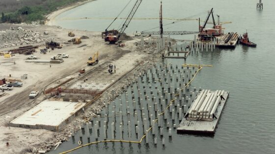
    Vattenfall has appointed Natural Power to deliver comprehensive ground investigations for its planned 100MW Qurack and 90MW Quantans Hill onshore wind farms in Scotland, extending a 15‑year collaboration. Natural Power’s construction and geotechnical teams will deploy specialist site investigation techniques and advanced survey technologies to characterise geotechnical, geological and environmental conditions across both sites. The data will feed directly into turbine foundation design, access road alignment and construction risk reduction, giving Vattenfall higher confidence in earthworks, drainage and infrastructure layouts before detailed design and procurement.

    Transpennine Route Upgrade: legacy ground risks and mitigation for engineers
    Geotechnical
    20 days ago

    Transpennine Route Upgrade: legacy ground risks and mitigation for engineers

    Extensive ground engineering works are under way on the West of Leeds section of the Transpennine Route Upgrade to manage legacy risks from historic industrial activity beneath and adjacent to the railway. Contractors are deploying a mix of ground investigation, grouting, soil stabilisation and structural retaining solutions to deal with old mine workings, made ground and buried obstructions that could compromise track formation and structures. The interventions aim to secure long-term track geometry, reduce differential settlement and maintain line availability during and after capacity and electrification upgrades.

    1960s cold case ground investigation: forensic lessons for geotechnical teams
    Geotechnical
    21 days ago

    1960s cold case ground investigation: forensic lessons for geotechnical teams

    Ground investigation techniques typically used for highways and foundations have been deployed in a 1960s missing person cold case, with RSK geophysicists leading the subsurface search. The team is combining ground-penetrating radar (GPR) with intrusive investigation methods such as boreholes or trial pits to characterise stratigraphy and detect potential burial anomalies. The work shows how standard site investigation tools can be adapted for forensic applications, including in constrained or previously disturbed ground.

    Related Industries & Products

    Mining

    Geotechnical software solutions for mining operations including CMRR analysis, hydrogeological testing, and data management.

    Construction

    Quality control software for construction companies with material testing, batch tracking, and compliance management.

    CMRR-io

    Streamline coal mine roof stability assessments with our cloud-based CMRR software featuring automated calculations, multi-scenario analysis, and collaborative workflows.

    HYDROGEO-io

    Comprehensive hydrogeological testing platform for managing, analysing, and reporting on packer tests, lugeon values, and hydraulic conductivity assessments.

    GEODB-io

    Centralised geotechnical data management solution for storing, accessing, and analysing all your site investigation and material testing data.

    AllGeotechnicalInfrastructureHazardsEnvironmental