Geomechanics.io

  • Free Tools
Sign UpLog In

    Geomechanics.io

    Geomechanics, Streamlined.

    © 2026 Geomechanics.io. All rights reserved.

    Geomechanics.io

    CMRR-ioGEODB-ioHYDROGEO-ioQCDB-ioFree Tools & CalculatorsBlogLatest Industry News

    Industries

    MiningConstructionTunnelling

    Company

    Terms of UsePrivacy PolicyLinkedIn
    Projects
    Safety

    Transpennine Route Upgrade: legacy ground risks and mitigation for engineers

    July 29, 2026|

    Reviewed by Tom Sullivan

    Transpennine Route Upgrade: legacy ground risks and mitigation for engineers

    First reported on New Civil Engineer

    30 Second Briefing

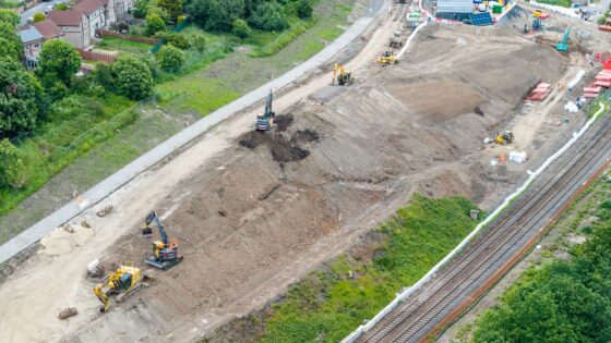
    Extensive ground engineering works are under way on the West of Leeds section of the Transpennine Route Upgrade to manage legacy risks from historic industrial activity beneath and adjacent to the railway. Contractors are deploying a mix of ground investigation, grouting, soil stabilisation and structural retaining solutions to deal with old mine workings, made ground and buried obstructions that could compromise track formation and structures. The interventions aim to secure long-term track geometry, reduce differential settlement and maintain line availability during and after capacity and electrification upgrades.

    Technical Brief

    • Instrumented monitoring (inclinometers, settlement points, track geometry) provides trigger levels for immediate possession or speed restriction.

    Our Take

    New Civil Engineer’s recent focus on BIM, CDEs and asset management ‘data handover gaps’ on major infrastructure schemes indicates that ground-engineering data from the Transpennine Route Upgrade will likely need to be structured for long-term asset management, not just for construction-phase risk control.

    With 2,444 tag-matched pieces on Projects and Safety, this coverage signals that UK clients and contractors working on schemes like the Transpennine Route Upgrade are increasingly expected to demonstrate how geotechnical risk management is integrated into formal safety cases and not handled as an isolated design discipline.

    Geotechnical Software for Modern Teams

    Centralise site data, logs, and lab results with GEODB-io, CMRR-io, and HYDROGEO-io.

    No credit card required.

    • Save and export unlimited calculations
    • Advanced data visualisation
    • Generate professional PDF reports
    • Cloud storage for all your projects

    Prepared by collating external sources, AI-assisted tools, and Geomechanics.io’s proprietary mining database, then reviewed for technical accuracy & edited by our geotechnical team.

    Related Articles
    1960s cold case ground investigation: forensic lessons for geotechnical teams
    Geotechnical
    1 day ago

    1960s cold case ground investigation: forensic lessons for geotechnical teams

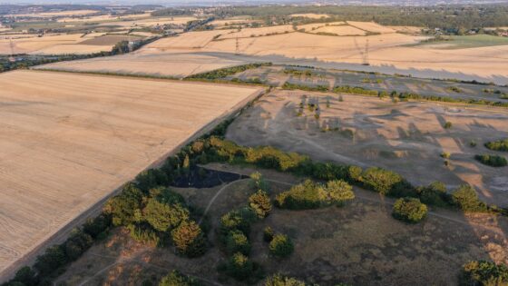
    Ground investigation techniques typically used for highways and foundations have been deployed in a 1960s missing person cold case, with RSK geophysicists leading the subsurface search. The team is combining ground-penetrating radar (GPR) with intrusive investigation methods such as boreholes or trial pits to characterise stratigraphy and detect potential burial anomalies. The work shows how standard site investigation tools can be adapted for forensic applications, including in constrained or previously disturbed ground.

    Coates’ new electric dewatering fleet: design implications for urban geotechnical works
    Geotechnical
    5 days ago

    Coates’ new electric dewatering fleet: design implications for urban geotechnical works

    Coates has expanded its engineered dewatering capability with a new fleet of electric BBA Pumps, including PT200 D265 (8″/200mm), PT150 D185 (6″/150mm) and PT100 D130 (4″/100mm) units for urban construction sites. The electric configuration targets groundwater control on projects from small residential excavations to complex basements, water assets and civil infrastructure in dense urban areas where diesel emissions, noise and access constraints are critical. For geotechnical and civil contractors, the range allows closer-to-face installation and longer runtimes on grid power, simplifying dewatering design and temporary works planning.

    The Observational Method: practical adoption barriers and value for ground engineers
    Geotechnical
    6 days ago

    The Observational Method: practical adoption barriers and value for ground engineers

    The Observational Method in ground engineering is regaining interest as major infrastructure schemes look to manage geotechnical uncertainty in real time rather than rely solely on conservative design factors. Engineers are revisiting staged construction with predefined trigger levels, instrumented slopes and retaining walls, and adaptive support measures, but uptake remains patchy due to contractual risk allocation, programme pressures, and limited monitoring budgets. Wider use could cut unnecessary pile lengths, excavation support thicknesses and contingency allowances, provided clients accept flexible design envelopes and robust monitoring–response plans.

    Related Industries & Products

    Construction

    Quality control software for construction companies with material testing, batch tracking, and compliance management.

    Mining

    Geotechnical software solutions for mining operations including CMRR analysis, hydrogeological testing, and data management.

    QCDB-io

    Comprehensive quality control database for manufacturing, tunnelling, and civil construction with UCS testing, PSD analysis, and grout mix design management.

    AllGeotechnicalMiningInfrastructureMaterialsHazardsEnvironmentalSoftwarePolicy