Northern Peru landslide evacuation: active slope behaviour and lessons for engineers
Reviewed by Joe Ashwell
First reported on Geoengineer.org – News
30 Second Briefing
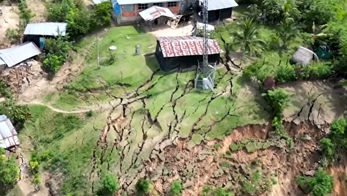
A landslide in northern Peru has forced the evacuation of more than 170 residents after continued ground movement destabilised a hillside settlement, with local authorities warning the slope remains active and at risk of further failure. Civil defence teams report tension cracks and progressive deformation upslope of the initial slip, prompting a red alert and temporary closure of nearby access roads. Geotechnical teams are now monitoring displacement and rainfall, with short-term controls focused on exclusion zones rather than immediate slope stabilisation works.
Technical Brief
- Monitoring priorities include periodic crack gauge readings, photographic logs and visual inspection of upslope drainage paths.
- Short-term remediation under discussion focuses on surface water diversion and temporary toe protection rather than deep-seated works.
- Safety management is centred on enforced exclusion perimeters, controlled escorted access for belongings retrieval, and roadblocks at key junctions.
Our Take
With more than 170 people evacuated and no specific project or mine named, this incident underlines how non-mining hillside communities in northern Peru can still be exposed to failure mechanisms similar to open-pit or waste-dump slope collapses, which has implications for how operators design and communicate regional emergency-response plans.
The Safety tag on this Peru failure aligns with other Hazards pieces where early evacuation has limited casualties, suggesting that local authorities in the region may now be more proactive in triggering evacuations once precursory signs of instability are observed.
Prepared by collating external sources, AI-assisted tools, and Geomechanics.io’s proprietary mining database, then reviewed for technical accuracy & edited by our geotechnical team.
Related Articles


Related Industries & Products
Mining
Geotechnical software solutions for mining operations including CMRR analysis, hydrogeological testing, and data management.
Construction
Quality control software for construction companies with material testing, batch tracking, and compliance management.
CMRR-io
Streamline coal mine roof stability assessments with our cloud-based CMRR software featuring automated calculations, multi-scenario analysis, and collaborative workflows.
HYDROGEO-io
Comprehensive hydrogeological testing platform for managing, analysing, and reporting on packer tests, lugeon values, and hydraulic conductivity assessments.
GEODB-io
Centralised geotechnical data management solution for storing, accessing, and analysing all your site investigation and material testing data.