Geomechanics.io

  • Free Tools
Sign UpLog In

    Geomechanics.io

    Geomechanics, Streamlined.

    © 2026 Geomechanics.io. All rights reserved.

    Geomechanics.io

    CMRR-ioGEODB-ioHYDROGEO-ioQCDB-ioFree Tools & CalculatorsBlogLatest Industry News

    Industries

    MiningConstructionTunnelling

    Company

    Terms of UsePrivacy PolicyLinkedIn
    Safety
    Sustainability
    Projects

    Birmingham flash floods: surface‑first drainage lessons for urban designers

    August 29, 2026|

    Reviewed by Tom Sullivan

    Birmingham flash floods: surface‑first drainage lessons for urban designers

    First reported on New Civil Engineer

    30 Second Briefing

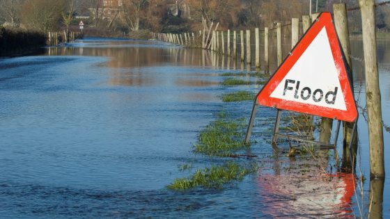
    Flash flooding in Birmingham on 27 August, triggered by intense short‑duration rainfall on parched, largely impermeable urban surfaces, overwhelmed a combined sewer network sized for historic return periods rather than today’s convective storm patterns. Drainage specialists are calling for a “surface‑first” strategy using blue‑green infrastructure such as swales, rain gardens and permeable paving to attenuate runoff before it reaches pipes. For designers, the event reinforces the need to prioritise exceedance routing, overland flow paths and retrofit SuDS over simply upsizing buried sewers.

    Technical Brief

    • Event occurred on 27 August in Birmingham, with intense localised rainfall causing rapid surface ponding.
    • Short storm duration concentrated peak runoff into minutes, giving minimal response time for operational interventions.
    • Parched ground conditions reduced initial infiltration, so almost all rainfall converted directly to surface runoff.
    • Combined foul–surface water sewers received high inflows from roads and roofs simultaneously, compounding surcharge risk.
    • Flooding affected multiple carriageways and underpasses, indicating exceedance flows were not safely routed to low‑risk areas.
    • Urban hardstanding and limited vegetated cover in affected districts increased effective impermeable catchment area to near 100%.
    • For safety planning, incident underlines need to map pedestrian/vehicle flood hazard zones and emergency diversion routes.
    • Similar UK conurbations with legacy combined systems and dense hardstanding face comparable short‑lead‑time flood risk exposure.

    Our Take

    New Civil Engineer’s parallel coverage of BIM and asset-management data handover suggests an opportunity to link surface-first drainage design in the United Kingdom with better digital records of permeable surfaces, SuDS assets and exceedance routes for long-term operation.

    Because this incident is tagged to both Safety and Sustainability, it aligns with a subset of Hazards pieces where flood risk is treated not just as an emergency-response issue but as a driver for project-level design standards and retrofit priorities in existing urban areas.

    Geotechnical Software for Modern Teams

    Centralise site data, logs, and lab results with GEODB-io, CMRR-io, and HYDROGEO-io.

    No credit card required.

    • Save and export unlimited calculations
    • Advanced data visualisation
    • Generate professional PDF reports
    • Cloud storage for all your projects

    Prepared by collating external sources, AI-assisted tools, and Geomechanics.io’s proprietary mining database, then reviewed for technical accuracy & edited by our geotechnical team.

    Related Articles
    LondonEnergy Wembley Waste Transfer Station fire: structural and fire design lessons
    Hazards
    about 7 hours ago

    LondonEnergy Wembley Waste Transfer Station fire: structural and fire design lessons

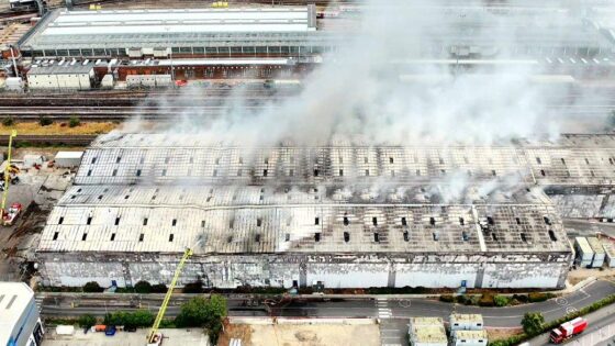
    A major fire at LondonEnergy’s Wembley Waste Transfer Station on Hannah Close, Neasden, has required 20 fire engines and about 125 firefighters to bring the blaze under control. The incident at the enclosed waste-handling facility raises immediate concerns over structural integrity of steel frames, cladding performance under high thermal loads, and potential damage to concrete slabs from prolonged heating and quenching. Engineers will need rapid assessment of fire spread pathways through waste stockpiles and building services to inform repairs, resilience upgrades and future fire-separation design.

    Nuclear Waste Services 5 m wildlife tower: design and risk notes for LLWR engineers
    Hazards
    about 7 hours ago

    Nuclear Waste Services 5 m wildlife tower: design and risk notes for LLWR engineers

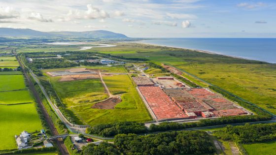
    Plans for a 5m tall wildlife tower at Nuclear Waste Services’ Low Level Waste Repository (LLWR) in Cumbria set out a dedicated habitat structure within an active nuclear waste site, integrating ecological features into a highly regulated industrial landscape. The tower will be sited within the LLWR perimeter, requiring careful foundation design and construction sequencing around existing low-level waste vaults and engineered cap systems. For civil and geotechnical teams, the scheme signals growing expectations to incorporate biodiversity structures into nuclear and hazardous waste infrastructure without compromising containment performance.

    Envirocall solar DCUs: design and deployment notes for asbestos site teams
    Hazards
    2 days ago

    Envirocall solar DCUs: design and deployment notes for asbestos site teams

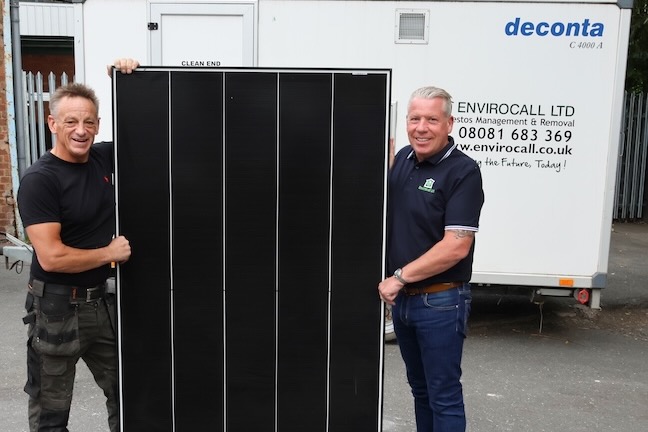
    Envirocall is converting all 19 asbestos decontamination units to off‑grid solar power systems engineered with D G Electrical Services, removing dependence on mains electricity at site. Each three‑stage DCU comprises a dirty zone for stripping contaminated PPE and tools, a hot/cold shower section for fibre removal, and a clean area for redressing, with the new solar arrays and storage sized to run showers, lighting and ventilation autonomously. The move enables DCU deployment on remote or constrained sites where temporary grid connections or diesel generators are costly or impractical.

    Related Industries & Products

    Construction

    Quality control software for construction companies with material testing, batch tracking, and compliance management.

    Mining

    Geotechnical software solutions for mining operations including CMRR analysis, hydrogeological testing, and data management.

    CMRR-io

    Streamline coal mine roof stability assessments with our cloud-based CMRR software featuring automated calculations, multi-scenario analysis, and collaborative workflows.

    HYDROGEO-io

    Comprehensive hydrogeological testing platform for managing, analysing, and reporting on packer tests, lugeon values, and hydraulic conductivity assessments.

    GEODB-io

    Centralised geotechnical data management solution for storing, accessing, and analysing all your site investigation and material testing data.

    AllGeotechnicalInfrastructureHazardsEnvironmental