Sandilands Lincolnshire golf course-to-reserve: earthworks and access lessons for designers
Reviewed by Joe Ashwell
First reported on The Construction Index
30 Second Briefing
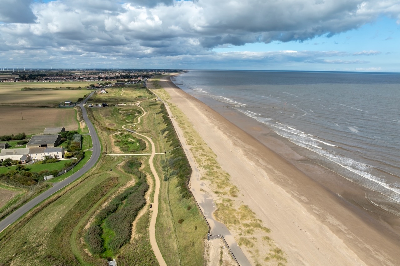
A former 30-hectare golf course at Sandilands on the Lincolnshire coast has been converted by the National Trust into a wetland nature reserve after a six-year programme of planning, consultation and earthworks. Lead consultant Influence Landscape Planning & Design regraded fairways into a mosaic of wetlands, grassland and coastal scrub, with accessible boardwalks, trails and a new visitor hub including café, expanded car parking and changing place facilities. The reserve sits within Lincolnshire Coastal Country Park on the East Coast Flyway, targeting habitat gains for thousands of migratory birds.
Technical Brief
- Newark-based Influence Landscape Planning & Design acted as lead consultant and landscape architect throughout delivery.
- Sandilands reserve footprint is 30 hectares, converted from intensively managed fairways to semi-natural habitats.
- Habitat mosaic explicitly combines wetlands, grassland and coastal scrub to diversify hydrology, structure and ecological niches.
- Site lies within Lincolnshire Coastal Country Park, adding a managed wetland node to the wider coastal corridor.
- Location on the East Coast Flyway targets use by thousands of migratory birds moving between Arctic and southern wintering grounds.
- Visitor infrastructure integrates accessible boardwalks, trails, café, expanded parking, changing place and community space into the regraded landscape.
Our Take
Because Sandilands sits on the UK’s east coast within the Lincolnshire Coastal Country Park and the East Coast Flyway, it effectively adds a managed ‘stepping stone’ habitat along a heavily used migratory corridor, which could influence how other low-lying coastal sites are prioritised for protection or retreat rather than hard defences.
Influence Landscape Planning and Design’s role at Sandilands signals that UK landscape practices based in places like Newark are now being pulled into long-term coastal adaptation work, not just amenity design, which may shift fee structures and skill requirements towards ecology and flood resilience in future Projects/Sustainability work.
Prepared by collating external sources, AI-assisted tools, and Geomechanics.io’s proprietary mining database, then reviewed for technical accuracy & edited by our geotechnical team.
Related Articles
Related Industries & Products
Construction
Quality control software for construction companies with material testing, batch tracking, and compliance management.
CMRR-io
Streamline coal mine roof stability assessments with our cloud-based CMRR software featuring automated calculations, multi-scenario analysis, and collaborative workflows.
HYDROGEO-io
Comprehensive hydrogeological testing platform for managing, analysing, and reporting on packer tests, lugeon values, and hydraulic conductivity assessments.
GEODB-io
Centralised geotechnical data management solution for storing, accessing, and analysing all your site investigation and material testing data.