Geomechanics.io

  • Free Tools
Sign UpLog In
Built byBoxcut Studio

Geomechanics.io

Geomechanics, Streamlined.

© 2026 Geomechanics.io. All rights reserved.

Geomechanics.io

CMRR-ioGEODB-ioHYDROGEO-ioQCDB-ioFree Tools & CalculatorsBlogLatest Industry News

Industries

MiningConstructionTunnelling

Company

Terms of UsePrivacy PolicyLinkedIn
    Projects
    Safety
    Product

    RCT AutoNav at historic nickel mine: safety and autonomy lessons for engineers

    June 26, 2026|

    Reviewed by Tom Sullivan

    RCT AutoNav at historic nickel mine: safety and autonomy lessons for engineers

    First reported on MINING.com

    30 Second Briefing

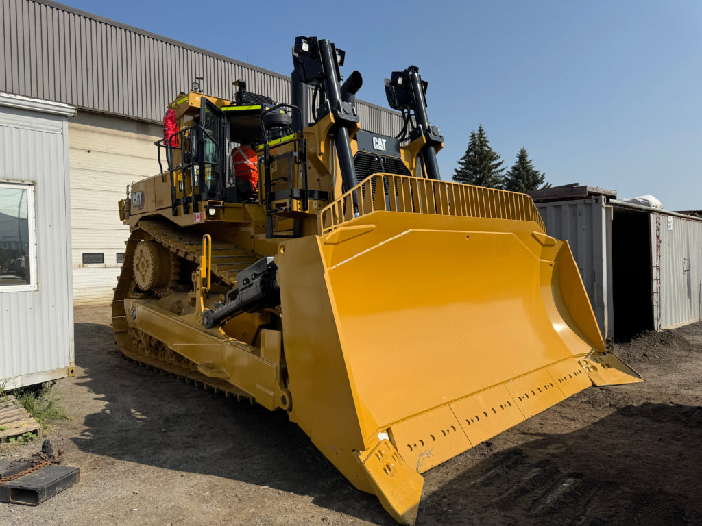
    RCT – Powered by Epiroc – has deployed its agnostic AutoNav Tele system on two CAT D10 dozers and a CAT 992 wheel loader to support the restart of a historic Canadian nickel mine transitioning from underground to open pit operations above legacy voids. Operators now work from an AutoNav Cabin with ergonomic seating and temperature control, critical in -20°C conditions and reducing exposure to potential surface instability. RCT also engineered site communications for extreme weather and a Geofence Zone with crest detection to prevent machines crossing the dam edge, and trained mine staff for on-site autonomy.

    Technical Brief

    • Automation was deployed as a preventative control, not post-incident, aligning with risk-based mine restart planning.
    • Similar brownfield pit-above-voids projects can adapt this model: geofenced exclusion, climate-resilient comms, and remote operation as primary controls.

    Our Take

    RCT – Powered by Epiroc’s work at this Canadian nickel mine follows its rapid AutoNav Lite deployment at a northern Canada gold operation (12 May 2026), signalling that cold-climate, remote-control dozing and haulage is becoming a repeatable offering rather than a one-off solution.

    With the US Commerce Department backing I-Pulse Inc. to the tune of $250 million, both North American governments and OEM-linked tech providers like Epiroc/RCT are clearly funnelling capital and R&D into upstream technologies that can de-risk critical mineral supply such as nickel in Canada.

    Temperatures down to -20°C at the Canadian Nickel mine put RCT’s AutoNav Cabin and geofencing in the same operating envelope as other Arctic and sub-Arctic assets in our database, where automation has often been adopted first for exposure reduction and equipment protection rather than pure labour savings.

    Geotechnical Software for Modern Teams

    Centralise site data, logs, and lab results with GEODB-io, CMRR-io, and HYDROGEO-io.

    No credit card required.

    • Save and export unlimited calculations
    • Advanced data visualisation
    • Generate professional PDF reports
    • Cloud storage for all your projects

    Prepared by collating external sources, AI-assisted tools, and Geomechanics.io’s proprietary mining database, then reviewed for technical accuracy & edited by our geotechnical team.

    Related Articles
    Hertha Metals’ $100M Texas iron plant: supply and process notes for mine planners
    Mining
    about 3 hours ago

    Hertha Metals’ $100M Texas iron plant: supply and process notes for mine planners

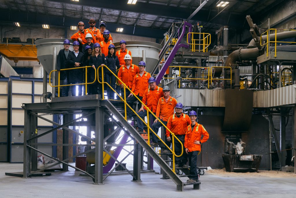
    Hertha Metals has broken ground on its $100 million Hertha Chalyx plant in Conroe, Texas, designed to produce about 10,000 tonnes per year of combined steel-grade and magnet-grade high-purity iron using domestic ore from Minnesota’s Iron Range and Texas natural gas. The facility, adjacent to the Pi100 pilot plant where 99.95% purity was achieved in August, will scale Hertha’s FLEXHERS process, which couples electric arc furnace technology with natural gas or hydrogen. First magnet-grade output is targeted for early 2028, feeding US NdFeB magnet makers that currently rely on China for an estimated 94% of high-purity iron.

    PC Gold’s new North Link zone at Spring Hill: pit and slope implications for planners
    Mining
    about 3 hours ago

    PC Gold’s new North Link zone at Spring Hill: pit and slope implications for planners

    PC Gold has identified a new high-grade North Link zone immediately north of the existing mineral resource estimate at its Spring Hill gold project in the Northern Territory, based on recent reverse-circulation drilling targeting mineralisation extensions. The North Link structure is interpreted to connect with known lodes within the current MRE footprint, potentially extending strike continuity and adding shallow, open-pittable ounces. For mine planners and geotechs, the result signals a need to revisit pit shell optimisation, geotechnical domains and slope design north of the present resource limits.

    Horizon’s Snook gold hits: pit shell growth and UG options for mine planners
    Mining
    about 3 hours ago

    Horizon’s Snook gold hits: pit shell growth and UG options for mine planners

    Horizon Gold has reported its strongest intercept yet at the Snook prospect within the Gum Creek project in Western Australia, with reverse-circulation drilling returning 44m at 5.08g/t gold from 145m, including 11m at 16.30g/t from 174m. The thick, high-grade zone at moderate depth points to a larger open pit shell and supports evaluation of underground mining scenarios beneath any eventual pit floor. For mine planners and geotechs, the result justifies updated pit optimisations, geotechnical domain modelling and closer-spaced drilling to refine continuity and rock mass conditions.

    Related Industries & Products

    Mining

    Geotechnical software solutions for mining operations including CMRR analysis, hydrogeological testing, and data management.

    Tunnelling

    Specialised solutions for tunnelling projects including grout mix design, hydrogeological analysis, and quality control.

    CMRR-io

    Streamline coal mine roof stability assessments with our cloud-based CMRR software featuring automated calculations, multi-scenario analysis, and collaborative workflows.

    HYDROGEO-io

    Comprehensive hydrogeological testing platform for managing, analysing, and reporting on packer tests, lugeon values, and hydraulic conductivity assessments.

    GEODB-io

    Centralised geotechnical data management solution for storing, accessing, and analysing all your site investigation and material testing data.

    AllGeotechnicalInfrastructureHazardsEnvironmental