Geomechanics.io

  • Free Tools
Sign UpLog In

Geomechanics.io

Geomechanics, Streamlined.

© 2026 Geomechanics.io. All rights reserved.

Geomechanics.io

CMRR-ioGEODB-ioHYDROGEO-ioQCDB-ioFree Tools & CalculatorsBlogLatest Industry News

Industries

MiningConstructionTunnelling

Company

Terms of UsePrivacy PolicyLinkedIn
    Product
    Safety

    Metso machine learning for uptime: reliability gains and data risks for plant teams

    March 4, 2026|

    Reviewed by Joe Ashwell

    Metso machine learning for uptime: reliability gains and data risks for plant teams

    First reported on The Construction Index

    30 Second Briefing

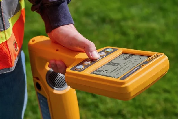
    Finnish aggregate equipment manufacturer Metso has added machine-learning features to its support software to predict maintenance needs and cut crusher and screen downtime by analysing operating data in real time. The system relies on continuous collection of equipment performance and fault data, raising customer concerns over how these datasets are stored, who can access them, and whether they might be shared across fleets or sites. For plant owners, the trade-off is between higher uptime and potential loss of control over sensitive production and condition-monitoring information.

    Technical Brief

    • Algorithms ingest high-frequency telemetry such as motor load, vibration, hydraulic pressure and bearing temperature.
    • Output is a risk-ranked list of components approaching critical condition, with estimated remaining useful life.
    • Maintenance planners receive time-stamped alerts, enabling planned shutdowns instead of unplanned line stoppages.
    • From a safety angle, earlier detection of bearing or structural issues reduces catastrophic failure and flyrock risk.
    • Data governance questions now extend to incident logs and near-miss records captured within the same digital ecosystem.
    • Similar predictive layers are likely to be scrutinised under site safety cases and major hazard facility regulations.

    Our Take

    Metso’s push into machine-learning-based uptime tools aligns with its recent acquisition of MRA Automation, signalling a deliberate build-out of in-house automation and software capability rather than relying solely on OEM hardware differentiation.

    Across the 30 Software stories in our database, Metso appears frequently in connection with ‘whole-of-circuit’ optimisation, so an uptime-focused product is likely to be designed to plug into broader plant-wide control rather than operate as a stand-alone monitoring tool.

    The recent Metso–Loesche VRM dry grinding partnership and the Vertimill® order for DR-grade iron ore both involve high-value, continuous-duty equipment, where predictive uptime software could materially reduce unplanned stoppages and strengthen Metso’s aftermarket lock-in.

    Geotechnical Software for Modern Teams

    Centralise site data, logs, and lab results with GEODB-io, CMRR-io, and HYDROGEO-io.

    No credit card required.

    • Save and export unlimited calculations
    • Advanced data visualisation
    • Generate professional PDF reports
    • Cloud storage for all your projects

    Prepared by collating external sources, AI-assisted tools, and Geomechanics.io’s proprietary mining database, then reviewed for technical accuracy & edited by our geotechnical team.

    Related Articles

    Fluke SmartTrace cable spotter: reducing UK utility strike risk for project teams
    Software
    1 day ago

    Fluke SmartTrace cable spotter: reducing UK utility strike risk for project teams

    Fluke has launched the SmartTrace 2082 Series underground locator, which injects signals to trace metallic cables and pipelines down to 6 m depth while identifying ground faults, sheath faults and coating defects where conductors contact earth. The locator connects via Bluetooth to Fluke’s PointMan app, enabling real-time geolocation, mapping and documentation of buried utilities directly on a smartphone for future works planning. Fluke cites around 60,000 utility strikes per year in UK excavations, positioning SmartTrace as a tool to cut strike risk and improve pre-dig surveys.

    World Day for Safety and Health at Work: digital hazard tools for project engineers
    Software
    2 days ago

    World Day for Safety and Health at Work: digital hazard tools for project engineers

    World Day for Safety and Health at Work sees Mott MacDonald showcase five digital tools from a Strategic Design Partnership hackathon aimed at tightening hazard management on infrastructure projects. Concepts include automated hazard identification from design models, mobile apps for site-based risk reporting, and dashboards aggregating incident and near-miss data in real time. For civil and geotechnical teams, the focus is on earlier visibility of construction and ground risks, faster feedback loops between site and design, and more structured capture of lessons learned.

    OS Enhanced Land Cover for BNG: key mapping takeaways for project teams
    Software
    8 days ago

    OS Enhanced Land Cover for BNG: key mapping takeaways for project teams

    Ordnance Survey has launched OS Enhanced Land Cover (ELC) Beta, a national habitat-mapping dataset that fuses OS National Geographic Database topography, OS aerial imagery, OS Terrain 5 and third-party sources including Natural England’s Living England, the Rural Payments Agency’s Crop Map of England and UKHab classifications to support 10% Biodiversity Net Gain (BNG) assessments. The tool enables desktop and field workflows for ecologists and developers, with Wessex Water using it via Linckia’s ESRI-based Habitat Fabric platform to assess hundreds of sites in a single spatial view. Linckia reports a 40% cut in data processing costs versus previous methods, rising to 90% compared with processing raw imagery, with OS claiming time savings of days to weeks per development across 1.5 million homes in the pipeline.

    Related Industries & Products

    Mining

    Geotechnical software solutions for mining operations including CMRR analysis, hydrogeological testing, and data management.

    CMRR-io

    Streamline coal mine roof stability assessments with our cloud-based CMRR software featuring automated calculations, multi-scenario analysis, and collaborative workflows.

    HYDROGEO-io

    Comprehensive hydrogeological testing platform for managing, analysing, and reporting on packer tests, lugeon values, and hydraulic conductivity assessments.

    GEODB-io

    Centralised geotechnical data management solution for storing, accessing, and analysing all your site investigation and material testing data.

    AllGeotechnicalInfrastructureHazardsEnvironmental