Geomechanics.io

  • Free Tools
Sign UpLog In
Built byBoxcut Studio

Geomechanics.io

Geomechanics, Streamlined.

© 2026 Geomechanics.io. All rights reserved.

Geomechanics.io

CMRR-ioGEODB-ioHYDROGEO-ioQCDB-ioFree Tools & CalculatorsBlogLatest Industry News

Industries

MiningConstructionTunnelling

Company

Terms of UsePrivacy PolicyLinkedIn
    Projects
    Product
    Sustainability

    ICMM global biodiversity dataset: siting and closure insights for mine planners

    November 18, 2026|

    Reviewed by Joe Ashwell

    First reported on International Mining – News

    30 Second Briefing

    ICMM has released a global biodiversity dataset linking 12,000 mining and metals facilities with internationally recognised indicators of ecosystem condition and conservation status, mapped against the Kunming-Montreal Global Biodiversity Framework. The geospatial dataset allows operators to see where individual sites intersect with protected areas, Key Biodiversity Areas and other high-value habitats, providing a consistent screening layer across commodities and regions. For project siting, expansion and closure planning, it offers a standardised basis for no‑go decisions, mitigation hierarchies and portfolio‑level biodiversity risk assessment.

    Technical Brief

    • ICMM combines facility locations with internationally recognised ecosystem condition and conservation status indicators.
    • Analysis is explicitly framed to support delivery of Kunming-Montreal Global Biodiversity Framework goals.
    • Evidence base is intended to inform mineral supply decisions for decarbonisation versus biodiversity conservation trade-offs.

    Our Take

    With 23 Environmental stories in our coverage and several already centred on ICMM, the council is emerging as a key reference point for standardised ESG datasets that operators and lenders can use for portfolio screening rather than just site-by-site studies.

    The new dataset will likely feed into the 2050 scenario work highlighted in the Systemic/ERM report for ICMM, where copper, gold and potash demand pathways intersect with land and biodiversity constraints when stress-testing future project pipelines.

    Geotechnical Software for Modern Teams

    Centralise site data, logs, and lab results with GEODB-io, CMRR-io, and HYDROGEO-io.

    Cancel at any time.

    • Save and export unlimited calculations
    • Advanced data visualisation
    • Generate professional PDF reports
    • Cloud storage for all your projects

    Prepared by collating external sources, AI-assisted tools, and Geomechanics.io’s proprietary mining database, then reviewed for technical accuracy & edited by our geotechnical team.

    Related Articles
    Rio’s US$250m Panguna pledge: remediation priorities for project teams
    Environmental
    1 day ago

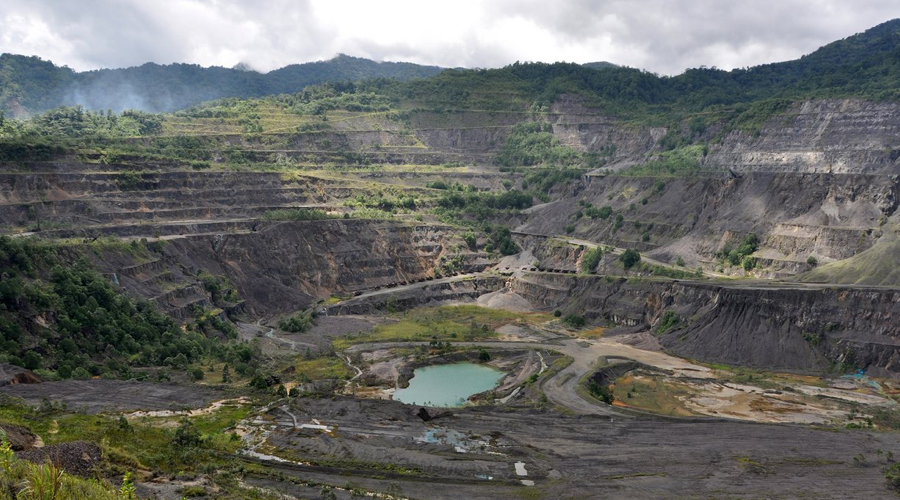
    Rio’s US$250m Panguna pledge: remediation priorities for project teams

    Rio Tinto has pledged US$250 million into a new fund with Bougainville Copper, the Autonomous Bougainville Government and community leaders to address environmental and human-rights impacts from the idled Panguna copper-gold mine in Bougainville, Papua New Guinea. The commitment follows a two-year Tetra Tech Coffey investigation (completed 2024) that identified unstable mine structures, contaminated reaches of the Jaba-Kawerong river system and flood-prone crossings threatening homes, food gardens and drinking water access. Initial funded works include river and delta remediation, bridge construction, hazardous-material removal at Loloho port, and water and sanitation upgrades, with governance and detailed priorities still under consultation.

    PFAS ‘forever chemical’ cuts in England’s rivers: design implications for treatment works
    Environmental
    5 days ago

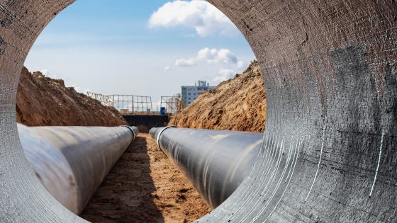
    PFAS ‘forever chemical’ cuts in England’s rivers: design implications for treatment works

    Levels of two per- and polyfluoroalkyl substances (PFAS) in England’s rivers have fallen by about 30% over the past decade, according to new Environment Agency monitoring data. The assessment points to improved control at industrial discharge points and some wastewater treatment works, but also identifies gaps where conventional plants lack advanced PFAS removal processes such as activated carbon or high-pressure membrane treatment. For civil and environmental engineers, the findings signal likely future upgrades to sewage works, tighter discharge consents and more stringent design criteria for treatment infrastructure.

    Thames Water’s 100‑day drought: reservoir and aquifer stress for water engineers
    Environmental
    13 days ago

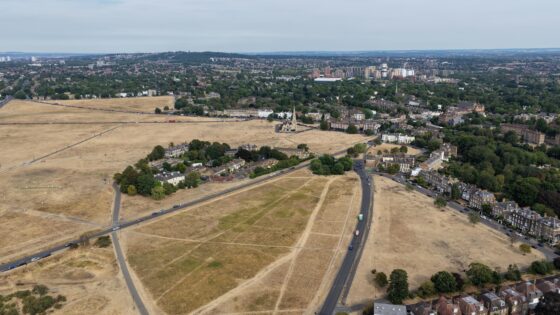
    Thames Water’s 100‑day drought: reservoir and aquifer stress for water engineers

    Thames Water has reached 100 days since declaring a drought across London and the Thames Valley, with key storage such as the Farmoor and Queen Mary reservoirs still below long‑term average levels despite recent rainfall. Groundwater in several Chalk and Thames Gravels aquifers remains depressed, limiting recharge to strategic sources and sustaining pressure on abstraction licences. Civil and water engineers face continued constraints on network planning, leakage control and future resilience schemes, with no immediate scope to relax existing demand‑management measures.

    Related Industries & Products

    Mining

    Geotechnical software solutions for mining operations including CMRR analysis, hydrogeological testing, and data management.

    CMRR-io

    Streamline coal mine roof stability assessments with our cloud-based CMRR software featuring automated calculations, multi-scenario analysis, and collaborative workflows.

    HYDROGEO-io

    Comprehensive hydrogeological testing platform for managing, analysing, and reporting on packer tests, lugeon values, and hydraulic conductivity assessments.

    GEODB-io

    Centralised geotechnical data management solution for storing, accessing, and analysing all your site investigation and material testing data.

    AllGeotechnicalInfrastructureHazardsEnvironmental