Ground conditions in the weather forecast: practical implications for engineers
Reviewed by Tom Sullivan
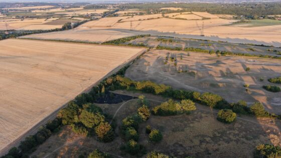
First reported on New Civil Engineer
30 Second Briefing
Calls to add ground condition metrics to public weather forecasts argue that engineers, utilities and transport operators now need near real-time data on soil moisture, pore pressure and desiccation risk, not just rainfall totals and wind speeds. Proponents point to recent UK failures on clay cuttings, embankment slips and buried pipe bursts after prolonged drought–storm cycles, where Met Office rainfall data alone gave little warning of loss of shear strength or shrink–swell movement. Integrating sensor networks, satellite soil-moisture indices and probabilistic geotechnical models into daily forecasts could materially change inspection, access planning and temporary works decisions.
Technical Brief
- Safety management systems would formalise threshold-based actions (speed restrictions, exclusion zones, extra monitoring) using these forecasted ground indices.
- Wider adoption would push geotechnical asset management towards probabilistic, forecast-driven risk models rather than static condition grades.
Our Take
New Civil Engineer’s recent webinar on BIM, CDEs and asset management platforms highlights a ‘data handover gap’, and integrating hourly ground-condition feeds into those digital environments would force owners and contractors to rethink how they store, validate and act on continuously streaming geotechnical data.
Because this piece sits under both Safety and Sustainability tags within a pool of 2,436 tag-matched items, operationalising hourly forecasts could be a route for contractors to evidence proactive risk management and carbon savings (by reducing abortive work and rework) in future award submissions and client reporting that New Civil Engineer frequently showcases.
Prepared by collating external sources, AI-assisted tools, and Geomechanics.io’s proprietary mining database, then reviewed for technical accuracy & edited by our geotechnical team.
Related Articles

Related Industries & Products
Mining
Geotechnical software solutions for mining operations including CMRR analysis, hydrogeological testing, and data management.
Construction
Quality control software for construction companies with material testing, batch tracking, and compliance management.
CMRR-io
Streamline coal mine roof stability assessments with our cloud-based CMRR software featuring automated calculations, multi-scenario analysis, and collaborative workflows.
HYDROGEO-io
Comprehensive hydrogeological testing platform for managing, analysing, and reporting on packer tests, lugeon values, and hydraulic conductivity assessments.
GEODB-io
Centralised geotechnical data management solution for storing, accessing, and analysing all your site investigation and material testing data.