Geomechanics.io

  • Free Tools
Sign UpLog In
Built byBoxcut Studio

Geomechanics.io

Geomechanics, Streamlined.

© 2026 Geomechanics.io. All rights reserved.

Geomechanics.io

CMRR-ioGEODB-ioHYDROGEO-ioQCDB-ioFree Tools & CalculatorsBlogLatest Industry News

Industries

MiningConstructionTunnelling

Company

Terms of UsePrivacy PolicyLinkedIn
    Projects
    Sustainability

    Former Australian coal mine solar and battery: geotechnical lessons for engineers

    November 17, 2026|

    Reviewed by Joe Ashwell

    Former Australian coal mine solar and battery: geotechnical lessons for engineers

    First reported on New Civil Engineer

    30 Second Briefing

    A 176MW solar farm with a 100MWh battery system is being built on a former coal mine site near Muswellbrook in New South Wales, repurposing disturbed land for large-scale renewable generation. Converting the pit and spoil areas to PV arrays and battery pads will require detailed geotechnical validation of backfilled ground, settlement behaviour and drainage, along with management of any residual mine subsidence. For civil contractors, the project offers brownfield grid connection advantages but demands careful earthworks, foundation design and contamination control.

    Technical Brief

    • 176MW PV capacity will dictate large uniform pad areas, challenging on variable backfilled mine spoil.
    • Battery system rated at 100MWh implies high point loads, favouring piled or heavily improved foundations.
    • Former coal workings near Muswellbrook introduce legacy voids and subsidence risk needing detailed mine records and probing.
    • Brownfield setting likely retains haul roads and benches, enabling reuse for access tracks and cable corridors.
    • Historical pit dewatering infrastructure can be repurposed for surface drainage and stormwater attenuation around PV arrays.
    • Residual coal and sulphide-bearing spoil raise acid mine drainage risks, influencing subgrade selection and concrete durability design.
    • Grid connection near an ex‑mine typically benefits from existing high‑voltage corridors but demands clearance checks for panel glint and glare.
    • Similar conversions of open pits to PV/battery hubs are emerging globally, offering a template for post‑closure mine land use.

    Our Take

    For Muswellbrook-scale brownfield conversions, geotechnical teams typically face legacy subsidence and void stability issues; using the site for relatively lightweight solar and battery infrastructure can reduce ground improvement costs compared with industrial or residential redevelopment while still monetising the land.

    Geotechnical Software for Modern Teams

    Centralise site data, logs, and lab results with GEODB-io, CMRR-io, and HYDROGEO-io.

    Cancel at any time.

    • Save and export unlimited calculations
    • Advanced data visualisation
    • Generate professional PDF reports
    • Cloud storage for all your projects

    Prepared by collating external sources, AI-assisted tools, and Geomechanics.io’s proprietary mining database, then reviewed for technical accuracy & edited by our geotechnical team.

    Related Articles
    Low water storage levels: on-farm reservoirs and design notes for engineers
    Geotechnical
    5 days ago

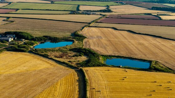
    Low water storage levels: on-farm reservoirs and design notes for engineers

    Below-average water levels in England’s strategic reservoirs are prompting industry bodies to push for easier planning and permitting of on-farm reservoirs to secure irrigation supplies. Proposals focus on small to medium earth-bunded storage ponds drawing winter high flows from local rivers or boreholes, with lined embankments and controlled abstraction to protect low summer flows. For civil and geotechnical engineers, this signals rising demand for costed designs, slope stability assessments and leakage control for numerous dispersed reservoirs on agricultural land.

    Homes that can’t connect to the sewer: geotechnical design notes for engineers
    Geotechnical
    13 days ago

    Homes that can’t connect to the sewer: geotechnical design notes for engineers

    Rethinking wastewater for homes that cannot connect to the public sewer is pushing UK engineers towards on-plot and small-cluster solutions such as packaged treatment plants and advanced septic systems with tertiary filtration. Designers are weighing infiltration fields, reed beds and pumped rising mains against tighter Environment Agency discharge consents and limited garden footprints on dense housing sites. For geotechnical and civil teams, this means more site-specific percolation testing, higher loadings on shallow soakaways, and closer coordination of drainage layouts with foundations and groundwater protection zones.

    Lichfield & Hatherton canal jacked culverts: design and settlement control for engineers
    Geotechnical
    25 days ago

    Lichfield & Hatherton canal jacked culverts: design and settlement control for engineers

    Restoration of the Lichfield and Hatherton canals will require jacked culverts to be installed beneath the A38 and an active railway, reinstating historic waterway alignments severed by past road and rail schemes. Engineers must design low-cover, large-diameter culvert barrels capable of carrying canal navigation loads while maintaining motorway and rail traffic, likely using long-distance pipe jacking from constrained launch shafts. The works will demand careful settlement control, continuous monitoring of track and pavement, and robust groundwater management to protect both existing infrastructure and canal water levels.

    Related Industries & Products

    Construction

    Quality control software for construction companies with material testing, batch tracking, and compliance management.

    Mining

    Geotechnical software solutions for mining operations including CMRR analysis, hydrogeological testing, and data management.

    CMRR-io

    Streamline coal mine roof stability assessments with our cloud-based CMRR software featuring automated calculations, multi-scenario analysis, and collaborative workflows.

    HYDROGEO-io

    Comprehensive hydrogeological testing platform for managing, analysing, and reporting on packer tests, lugeon values, and hydraulic conductivity assessments.

    GEODB-io

    Centralised geotechnical data management solution for storing, accessing, and analysing all your site investigation and material testing data.

    AllGeotechnicalInfrastructureHazardsEnvironmental