GeoDin Ground for Civil 3D: subsurface modelling in practice for designers
Reviewed by Tom Sullivan
First reported on Geoengineer.org – News
30 Second Briefing
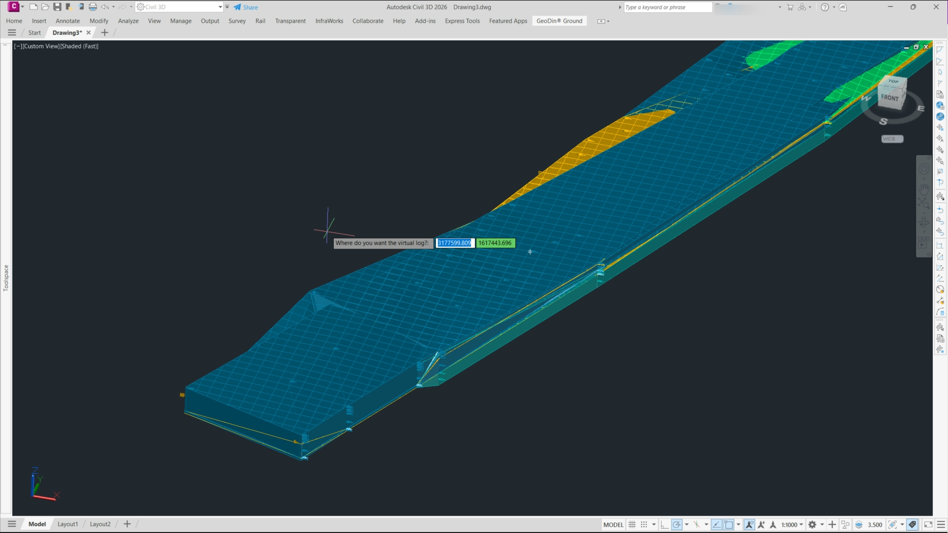
GeoDin Ground, a free Autodesk Civil 3D plug-in, replaces manual borehole imports by directly linking Civil 3D models to GeoDin® geotechnical databases and AGS/Excel borehole logs. The tool generates dynamic 3D subsurface models, including stratigraphy, groundwater levels and geotechnical layers, that update automatically as borehole data change. For designers, this means borehole positions, interpreted soil horizons and material properties are embedded in corridors, alignments and earthworks, reducing data re-entry and improving consistency between geotechnical interpretation and Civil 3D design.
Technical Brief
- GeoDin Ground reads native GeoDin® projects plus AGS and Excel files without intermediate conversion steps.
- Borehole filters allow selection by chainage, offset, depth range or project phase before importing to Civil 3D.
- Users can define custom lithology groupings and engineering units so Civil 3D layers match office standards.
- The plug‑in supports multiple alignments and corridors in one drawing, each linked to the same geodata source.
- Data exchange is two‑way: edited borehole coordinates in Civil 3D can be written back to the GeoDin project.
- Civil 3D surfaces and solids generated from the model can be used directly in volume, cut/fill and clash checks.
Our Take
Autodesk’s role in the RICS-led CLEAR coalition on whole-life carbon reporting suggests that tighter integration of GeoDin subsurface models into Civil 3D could eventually feed directly into embodied carbon and groundworks emissions calculations for infrastructure schemes.
In our database, Autodesk’s recent software coverage has focused on connected construction gains (faster delivery, fewer RFIs), so embedding GeoDin Ground data into design workflows is likely aimed at extending those efficiency gains into geotechnical coordination and reducing late-stage ground-related change orders.
Prepared by collating external sources, AI-assisted tools, and Geomechanics.io’s proprietary mining database, then reviewed for technical accuracy & edited by our geotechnical team.
Related Articles


Related Industries & Products
Construction
Quality control software for construction companies with material testing, batch tracking, and compliance management.
Mining
Geotechnical software solutions for mining operations including CMRR analysis, hydrogeological testing, and data management.
QCDB-io
Comprehensive quality control database for manufacturing, tunnelling, and civil construction with UCS testing, PSD analysis, and grout mix design management.