Geomechanics.io

  • Free Tools
Sign UpLog In
Product
Projects

Trimble SketchUp Pro Civil Contractor: 3D earthworks workflows explained for site engineers

August 17, 2026|

Reviewed by Joe Ashwell

Trimble SketchUp Pro Civil Contractor: 3D earthworks workflows explained for site engineers

First reported on The Construction Index

30 Second Briefing

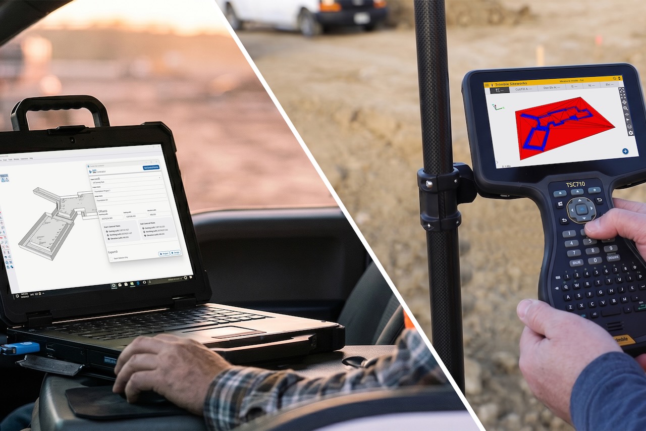
Trimble has released SketchUp Pro Civil Contractor, linking Trimble SketchUp directly with Trimble Siteworks and the Trimble Earthworks grade control platform to create a single 3D earthworks model from design through layout, machine guidance and verification. The tool targets contractors handling grading, excavation and utilities who lack traditional 3D CAD skills, offering a faster way to generate field-ready models for dozers, excavators and survey kits. Streamlined data exchange between design, surveying and earthmoving is intended to cut rework, reduce downtime and improve positional accuracy on site.

Technical Brief

  • SketchUp Pro Civil Contractor is positioned specifically for earthworks, grading and buried utility construction workflows.
  • Trimble’s workflow keeps one “single digital model” through design, layout, construction and verification stages.
  • Field-ready models generated in SketchUp are intended to feed directly into machine guidance without separate CAD translation.
  • Trimble explicitly targets users “without deep 3D modelling skills”, reducing reliance on specialist CAD technicians.
  • The connected workflow is described as applicable from “small grading and excavating jobs” to “large-scale earthwork”.
  • Trimble emphasises reduced downtime between design changes and field deployment through streamlined data exchange.

Our Take

Trimble’s UK-focused earthworks tools sit alongside a cluster of recent coverage where contractors like Kilmac and Wills Bros have standardised on Trimble Siteworks and survey hardware, signalling that full-stack Trimble workflows are becoming common on major British civils schemes.

The agreement for Hitachi Construction Machinery Europe to factory-fit Trimble Earthworks 3D grade control on excavators means UK contractors adopting Trimble SketchUp and Siteworks can increasingly expect plug‑and‑play integration between design, survey and machine control on mixed fleets.

Geotechnical Software for Modern Teams

Centralise site data, logs, and lab results with GEODB-io, CMRR-io, and HYDROGEO-io.

No credit card required.

  • Save and export unlimited calculations
  • Advanced data visualisation
  • Generate professional PDF reports
  • Cloud storage for all your projects

Prepared by collating external sources, AI-assisted tools, and Geomechanics.io’s proprietary mining database, then reviewed for technical accuracy & edited by our geotechnical team.

Related Articles
Software
about 2 hours ago

Deswik’s new Almaty office: mine planning support gains for Central Asia engineers

Deswik has opened a new office in Almaty, Kazakhstan, expanding its in‑country team to support mine planning and scheduling customers across Central Asia. The enlarged local staff, led by Territory Manager Zhanash Sultanova and experienced mining specialists, will deliver on-site implementation, training and troubleshooting for Deswik’s software suite. For regional operators, this should reduce reliance on remote support and shorten turnaround times for complex tasks such as multi-pit scheduling, haulage simulation and detailed drill‑and‑blast design.

Graham–MukAway deal: digital earthworks and ESG data insights for project teams
Software
3 days ago

Graham–MukAway deal: digital earthworks and ESG data insights for project teams

Graham has signed a three‑year deal making MukAway its primary materials management platform across UK and Ireland infrastructure sites, in one of MukAway’s largest contracts to date. The decision centres on handling very high volumes of earthworks on nationally significant infrastructure projects with full digital visibility of material movements and logistics. Graham’s team cites MukAway’s ESG dashboard as a key feature, giving project managers usable, site-level sustainability data in real time to inform haulage choices, disposal routes and reuse strategies.

Emesent Brisbane HQ open night: autonomy and LiDAR workflows for mine engineers
Software
6 days ago

Emesent Brisbane HQ open night: autonomy and LiDAR workflows for mine engineers

Emesent is opening its Brisbane headquarters on 20 August for a free National Science Week evening (5:30–9:00pm), offering students, industry and the public hands-on access to its autonomous mapping technology for “the world’s most inaccessible places”. In partnership with Surveyors Australia, the event will showcase Emesent’s drone-based LiDAR and autonomy stack used for GPS-denied underground mines and other confined environments. For mining engineers and surveyors, it is a rare chance to interrogate hardware–software workflows, data outputs and practical deployment constraints directly with the development team.

Related Industries & Products

Construction

Quality control software for construction companies with material testing, batch tracking, and compliance management.

Mining

Geotechnical software solutions for mining operations including CMRR analysis, hydrogeological testing, and data management.

QCDB-io

Comprehensive quality control database for manufacturing, tunnelling, and civil construction with UCS testing, PSD analysis, and grout mix design management.

Geomechanics.io

Geomechanics, Streamlined.

© 2026 Geomechanics.io. All rights reserved.

Geomechanics.io

CMRR-ioGEODB-ioHYDROGEO-ioQCDB-ioFree Tools & CalculatorsBlogLatest Industry News

Industries

MiningConstructionTunnelling

Company

Terms of UsePrivacy PolicyLinkedIn
    AllGeotechnicalInfrastructureHazardsEnvironmental