Geomechanics.io

  • Free Tools
Sign UpLog In
Built byBoxcut Studio

Geomechanics.io

Geomechanics, Streamlined.

© 2026 Geomechanics.io. All rights reserved.

Geomechanics.io

CMRR-ioGEODB-ioHYDROGEO-ioQCDB-ioFree Tools & CalculatorsBlogLatest Industry News

Industries

MiningConstructionTunnelling

Company

Terms of UsePrivacy PolicyLinkedIn
    Projects
    Sustainability

    BGS remap of UK Continental Shelf: ground model gains for offshore designers

    October 23, 2026|

    Reviewed by Tom Sullivan

    BGS remap of UK Continental Shelf: ground model gains for offshore designers

    First reported on New Civil Engineer

    30 Second Briefing

    BGS will lead a three-year programme to remap seabed geology across the UK Continental Shelf, generating new high-resolution datasets and interpretative reports for offshore energy and infrastructure projects. The work will refine stratigraphy, sediment thickness and seabed geomorphology, improving ground model confidence for fixed and floating wind foundations, subsea cables and pipelines. Developers and designers will gain more consistent geotechnical baseline information for site selection, routeing and preliminary design, potentially reducing investigation redundancy and contingency allowances.

    Technical Brief

    • Three-year BGS-led programme will generate new seabed geology datasets and interpretative reports for the UKCS.

    Our Take

    In our geotechnical coverage, the British Geological Survey features repeatedly as the UK’s de facto subsurface data backbone, from the UK Geoenergy Observatory in Cheshire to national geotechnical data services, so a fresh UK Continental Shelf model is likely to be tightly integrated with onshore datasets used by civil and energy project teams.

    The recent BGS work on CO₂ storage potential in Triassic and Jurassic sandstones beneath the Central North Sea suggests that any remapping of the UKCS will be scrutinised not just by oil and gas operators but also by carbon storage and offshore renewables developers looking for bankable ground models.

    With 21 geotechnical stories and a large number of sustainability‑tagged pieces in our database, the UKCS remap sits alongside BGS flood‑risk and subsidence projects as part of a move towards using national‑scale ground models to de‑risk climate‑exposed infrastructure planning in the United Kingdom.

    Geotechnical Software for Modern Teams

    Centralise site data, logs, and lab results with GEODB-io, CMRR-io, and HYDROGEO-io.

    No credit card required.

    • Save and export unlimited calculations
    • Advanced data visualisation
    • Generate professional PDF reports
    • Cloud storage for all your projects

    Prepared by collating external sources, AI-assisted tools, and Geomechanics.io’s proprietary mining database, then reviewed for technical accuracy & edited by our geotechnical team.

    Related Articles

    ORE Catapult floating wind framework: design and cost notes for offshore engineers
    Geotechnical
    9 days ago

    ORE Catapult floating wind framework: design and cost notes for offshore engineers

    ORE Catapult has issued an updated cost-reduction framework for floating offshore wind, targeting lower levelised cost of energy by standardising substructure design, mooring systems and dynamic cable configurations. The framework focuses on optimising fabrication and assembly in ports, modularising concrete and steel floaters, and rationalising installation strategies for deep-water sites beyond typical fixed-bottom depths. Developers and designers gain a structured route to compare platform concepts, refine geotechnical and anchoring solutions, and de-risk large-scale deployment in harsher metocean conditions.

    Mainmark Godstone sinkhole repairs: resin injection lessons for ground engineers
    Geotechnical
    14 days ago

    Mainmark Godstone sinkhole repairs: resin injection lessons for ground engineers

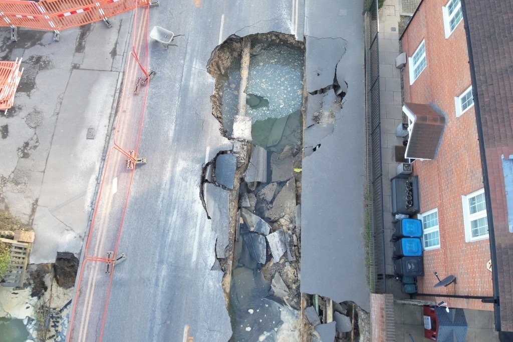
    Mainmark has completed a three‑week ground improvement programme in Godstone, Surrey, following an 18‑month repair effort after a 20m long, 5m wide, 5m deep sinkhole on the High Street exposed historic sand mine workings about 8m below ground. Working within a multidisciplinary team for Surrey County Council, Mainmark installed roughly 600 resin injection points across High Street and Salisbury Road, targeting depths of 1–4m to strengthen weak and disturbed ground. The works aimed to cut off potential void migration pathways above the remediated mine network before full road reconstruction.

    Transport’s climate adaptation: five lessons for UK geotechnical design teams
    Geotechnical
    16 days ago

    Transport’s climate adaptation: five lessons for UK geotechnical design teams

    Record UK heat this summer and Met Office warnings of a strong El Niño driving wetter, stormier conditions this autumn and winter are forcing transport authorities to reassess drainage, slope stability and track formation design. Network Rail, local highways teams and port operators are being pushed towards higher-capacity culverts, upgraded ballast and formation drainage, and more robust earthwork reinforcement to cope with prolonged saturation and intense convective storms. For geotechnical and civil engineers, design storms, return periods and climate allowances in asset management plans now need urgent recalibration.

    Related Industries & Products

    Construction

    Quality control software for construction companies with material testing, batch tracking, and compliance management.

    Mining

    Geotechnical software solutions for mining operations including CMRR analysis, hydrogeological testing, and data management.

    CMRR-io

    Streamline coal mine roof stability assessments with our cloud-based CMRR software featuring automated calculations, multi-scenario analysis, and collaborative workflows.

    HYDROGEO-io

    Comprehensive hydrogeological testing platform for managing, analysing, and reporting on packer tests, lugeon values, and hydraulic conductivity assessments.

    GEODB-io

    Centralised geotechnical data management solution for storing, accessing, and analysing all your site investigation and material testing data.

    AllGeotechnicalInfrastructureHazardsEnvironmental