Geomechanics.io

  • Free Tools
Sign UpLog In

    Geomechanics.io

    Geomechanics, Streamlined.

    © 2026 Geomechanics.io. All rights reserved.

    Geomechanics.io

    CMRR-ioGEODB-ioHYDROGEO-ioQCDB-ioFree Tools & CalculatorsBlogLatest Industry News

    Industries

    MiningConstructionTunnelling

    Company

    Terms of UsePrivacy PolicyLinkedIn
    Projects
    Sustainability

    Advance Green Futures’ Potland Burn BNG: valuation and design notes for project teams

    March 31, 2026|

    Reviewed by Tom Sullivan

    Advance Green Futures’ Potland Burn BNG: valuation and design notes for project teams

    First reported on The Construction Index

    30 Second Briefing

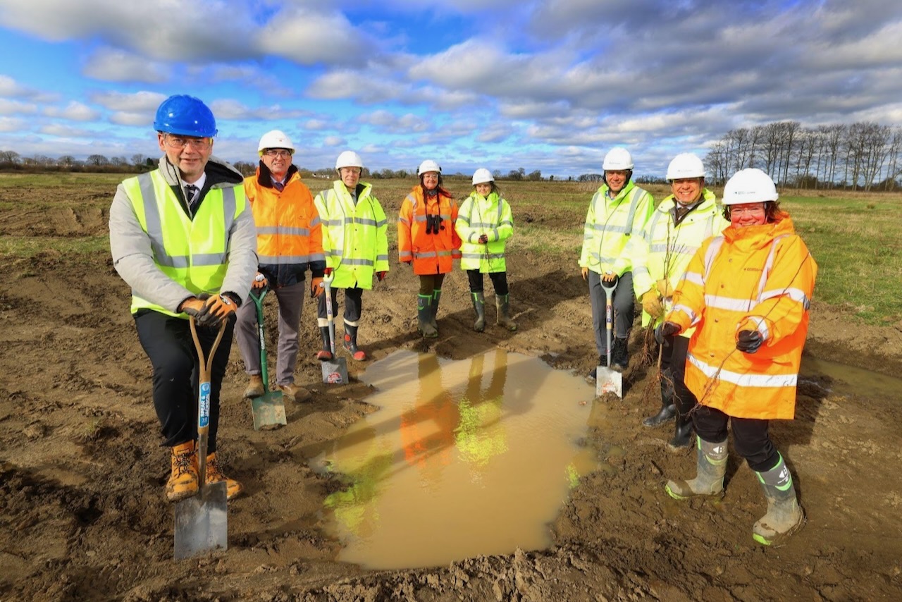
    Advance Green Futures has begun a 268-hectare restoration of the former Potland Burn mining site in Northumberland to create a large habitat mosaic and long-term biodiversity management area. The scheme is being structured to generate a tradable bank of biodiversity net gain (BNG) units for local developers needing to meet mandatory BNG requirements on constrained sites. For civil and housing projects in the area, this offers an off-site BNG route that could materially influence land valuation, masterplanning, and consenting strategies.

    Technical Brief

    • Restoration targets a former mining landscape, implying legacy spoil, voids and altered drainage to be re-engineered.
    • Advance Green Futures is structuring the scheme specifically around tradable biodiversity net gain (BNG) units.
    • Off-site BNG units are intended for developers on constrained plots unable to accommodate on-plot habitat creation.
    • The BNG bank model effectively monetises ecological uplift from derelict mining land into a long-term revenue stream.
    • For land valuation, off-site BNG availability can shift highest-and-best-use assumptions for marginal development land.
    • Similar ex-mining restorations could be packaged as BNG banks, particularly where in-situ remediation is already required.

    Our Take

    Because Potland Burn is in Northumberland rather than a current production hub, any biodiversity net gain or reuse scheme there can act as a lower-risk test bed before similar concepts are applied to active mines in more contested regions.

    Geotechnical Software for Modern Teams

    Centralise site data, logs, and lab results with GEODB-io, CMRR-io, and HYDROGEO-io.

    No credit card required.

    • Save and export unlimited calculations
    • Advanced data visualisation
    • Generate professional PDF reports
    • Cloud storage for all your projects

    Prepared by collating external sources, AI-assisted tools, and Geomechanics.io’s proprietary mining database, then reviewed for technical accuracy & edited by our geotechnical team.

    Related Articles

    UK Government NbS catchment study: hydrological design notes for engineers
    Environmental
    6 days ago

    UK Government NbS catchment study: hydrological design notes for engineers

    A UK Government research paper concludes that Nature-based Solutions such as floodplain reconnection, riparian woodland and leaky barriers are most effective when planned and modelled across whole catchments rather than as isolated site schemes. The study stresses integrating NbS with existing hard defences, using hydrological and hydraulic modelling to quantify peak flow attenuation and downstream level reductions under design storm events. For civil and drainage engineers, this points to earlier basin-scale option appraisal, multi-landowner agreements and long-term monitoring of storage volumes, infiltration rates and sediment behaviour.

    Dalton Quarry biodiversity bank: BNG design and land-take notes for project teams
    Environmental
    10 days ago

    Dalton Quarry biodiversity bank: BNG design and land-take notes for project teams

    A former Ibstock extraction site, Dalton Quarry, is being converted by Green Earth Developments Group into a biodiversity “bank” of engineered habitats to generate tradable biodiversity net gain (BNG) units for UK infrastructure schemes. The project will create a mosaic of habitat types on previously worked quarry land, allowing developers to purchase pre-accredited BNG units rather than delivering all ecological uplift within constrained project footprints. For civil and geotechnical teams, this model could influence land-take, earthworks design and long-term aftercare obligations on major road, rail and housing projects.

    National Highways road run-off plan: design implications for UK civil engineers
    Environmental
    12 days ago

    National Highways road run-off plan: design implications for UK civil engineers

    National Highways has appointed WSP to lead a multi-disciplinary team to deliver its Water Quality Plan targeting pollution from road run-off across the strategic road network. The commission will focus on identifying high-risk outfalls, retrofitting drainage and treatment assets such as interceptors, swales and attenuation ponds, and improving monitoring of contaminants including hydrocarbons and suspended solids. For civil and geotechnical designers, the move signals more retrofit water treatment structures at existing junctions, cuttings and embankments, with tighter controls on discharge consents.

    Related Industries & Products

    Mining

    Geotechnical software solutions for mining operations including CMRR analysis, hydrogeological testing, and data management.

    Construction

    Quality control software for construction companies with material testing, batch tracking, and compliance management.

    CMRR-io

    Streamline coal mine roof stability assessments with our cloud-based CMRR software featuring automated calculations, multi-scenario analysis, and collaborative workflows.

    HYDROGEO-io

    Comprehensive hydrogeological testing platform for managing, analysing, and reporting on packer tests, lugeon values, and hydraulic conductivity assessments.

    GEODB-io

    Centralised geotechnical data management solution for storing, accessing, and analysing all your site investigation and material testing data.

    AllGeotechnicalInfrastructureHazardsEnvironmental