Geomechanics.io

  • Free Tools
Sign UpLog In

    Geomechanics.io

    Geomechanics, Streamlined.

    © 2026 Geomechanics.io. All rights reserved.

    Geomechanics.io

    CMRR-ioGEODB-ioHYDROGEO-ioQCDB-ioFree Tools & CalculatorsBlogLatest Industry News

    Industries

    MiningConstructionTunnelling

    Company

    Terms of UsePrivacy PolicyLinkedIn
    Projects
    Safety
    Sustainability

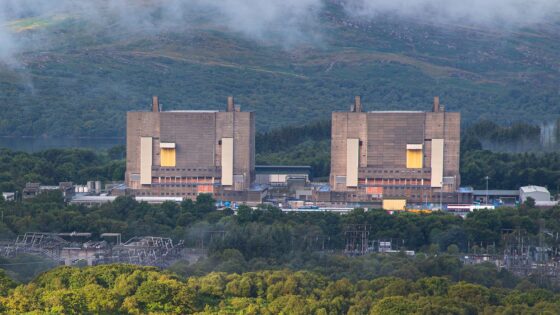
    Trawsfynydd decommissioning milestone: waste-to-dismantling shift for project teams

    May 28, 2026|

    Reviewed by Tom Sullivan

    Trawsfynydd decommissioning milestone: waste-to-dismantling shift for project teams

    First reported on New Civil Engineer

    30 Second Briefing

    Completion of the highest activity radioactive waste management programme at the Trawsfynydd nuclear power station in north Wales marks a key decommissioning milestone after roughly 20 years of work. High‑risk materials from the Magnox-era site have now been retrieved, conditioned and placed into shielded intermediate-level waste stores designed for long-term containment and future transfer to a geological disposal facility. The shift away from active waste handling allows decommissioning teams to focus on structural dismantling, civil works on reactor buildings and progressive reduction of radiological hazards on site.

    Technical Brief

    • Remote handling and containment systems would have been mandatory to avoid direct worker contact with highest-activity items.
    • Waste conditioning and storage design had to align with UK geological disposal facility acceptance criteria from the outset.
    • Completion of high-risk waste work enables revised ALARP assessments for subsequent civil dismantling and demolition sequencing.

    Our Take

    For civil contractors and consultants, a two‑decade decommissioning window at Trawsfynydd effectively creates a long-lived ‘mega-project’ in the Hazards–Projects–Sustainability space, meaning skills and supply chains built around high‑risk waste handling are likely to be retained and redeployed across other complex UK infrastructure schemes.

    Compared with other Safety‑tagged pieces in our coverage, the Trawsfynydd nuclear power station stands out as a brownfield asset where the hazard profile decreases over time rather than increases, which can influence how regulators sequence inspections and how local authorities phase redevelopment or environmental restoration plans in north Wales.

    Geotechnical Software for Modern Teams

    Centralise site data, logs, and lab results with GEODB-io, CMRR-io, and HYDROGEO-io.

    No credit card required.

    • Save and export unlimited calculations
    • Advanced data visualisation
    • Generate professional PDF reports
    • Cloud storage for all your projects

    Prepared by collating external sources, AI-assisted tools, and Geomechanics.io’s proprietary mining database, then reviewed for technical accuracy & edited by our geotechnical team.

    Related Articles
    Melbourne sinkhole investigations: geotechnical lessons for tunnel project teams
    Hazards
    in about 1 month

    Melbourne sinkhole investigations: geotechnical lessons for tunnel project teams

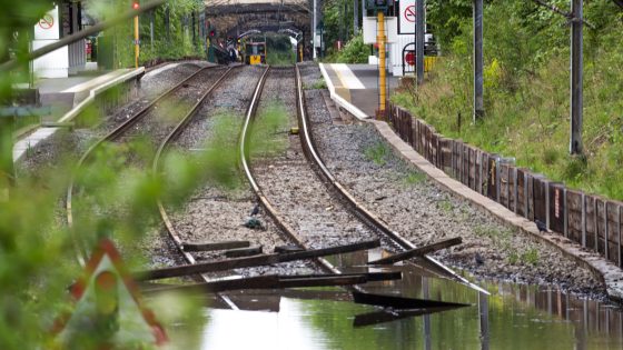
    A sinkhole roughly 8–10 m wide and several metres deep has opened on the AJ Burkitt Reserve sporting oval in Heidelberg, directly adjacent to the North East Link tunnel alignment in Melbourne’s northeast. Victorian Infrastructure Delivery Authority has confirmed the “surface hole” is in the vicinity of active tunnelling operations, leading to a work pause while engineers and emergency crews carry out geotechnical investigations and monitoring. No injuries or structural damage have been reported, but the area remains fully cordoned off pending cause determination and stability assessment.

    CIRIA climate risk guide: geotechnical design and asset resilience notes for engineers
    Hazards
    3 days ago

    CIRIA climate risk guide: geotechnical design and asset resilience notes for engineers

    CIRIA has issued a Good practice guide for managing climate change and extreme weather in land development, the first UK guidance to directly link projected climate impacts with physical changes in geotechnical and geoenvironmental conditions across the full project life cycle. Trigger events cited include the 2022 heatwave, which generated 23,000 subsidence claims and an estimated £219m payout by ABI members, and Storm Babet’s 2023 bridge collapses. The two-part guide combines current climate–geo risk knowledge with a practical framework, diagrams, tools, and case studies to structure consistent assessment of shrink–swell, flooding, groundwater shifts, and landslides.

    Nepal’s Himalayan settlements: flood and landslide risk lens for engineers
    Hazards
    9 days ago

    Nepal’s Himalayan settlements: flood and landslide risk lens for engineers

    Escalating extreme rainfall and glacial melt are driving more frequent floods and landslides in Nepal’s Himalayan districts, with Karnali Province’s steep, highly fractured slopes and narrow river valleys particularly exposed. Recent events include debris flows cutting off road access to remote settlements and riverbank erosion undermining gabion walls and informal river training works along the Karnali and Bheri rivers. Engineers are being pushed towards slope stabilisation with bioengineering, improved drainage, and relocation or elevation of critical infrastructure away from active channels and unstable colluvium.

    Related Industries & Products

    Construction

    Quality control software for construction companies with material testing, batch tracking, and compliance management.

    Mining

    Geotechnical software solutions for mining operations including CMRR analysis, hydrogeological testing, and data management.

    CMRR-io

    Streamline coal mine roof stability assessments with our cloud-based CMRR software featuring automated calculations, multi-scenario analysis, and collaborative workflows.

    HYDROGEO-io

    Comprehensive hydrogeological testing platform for managing, analysing, and reporting on packer tests, lugeon values, and hydraulic conductivity assessments.

    GEODB-io

    Centralised geotechnical data management solution for storing, accessing, and analysing all your site investigation and material testing data.

    AllGeotechnicalInfrastructureHazardsEnvironmental