Geomechanics.io

  • Free Tools
Sign UpLog In

Geomechanics.io

Geomechanics, Streamlined.

© 2026 Geomechanics.io. All rights reserved.

Geomechanics.io

CMRR-ioGEODB-ioHYDROGEO-ioQCDB-ioFree Tools & CalculatorsBlogLatest Industry News

Industries

MiningConstructionTunnelling

Company

Terms of UsePrivacy PolicyLinkedIn
    Projects
    Sustainability

    The Observational Method: practical adoption barriers and value for ground engineers

    July 24, 2026|

    Reviewed by Tom Sullivan

    The Observational Method: practical adoption barriers and value for ground engineers

    First reported on New Civil Engineer

    30 Second Briefing

    The Observational Method in ground engineering is regaining interest as major infrastructure schemes look to manage geotechnical uncertainty in real time rather than rely solely on conservative design factors. Engineers are revisiting staged construction with predefined trigger levels, instrumented slopes and retaining walls, and adaptive support measures, but uptake remains patchy due to contractual risk allocation, programme pressures, and limited monitoring budgets. Wider use could cut unnecessary pile lengths, excavation support thicknesses and contingency allowances, provided clients accept flexible design envelopes and robust monitoring–response plans.

    Technical Brief

    • Risk allocation often leaves contractors carrying downside from unexpected ground behaviour but sharing little in upside savings.
    • Data management is a bottleneck: real‑time interpretation of inclinometers, piezometers and strain gauges is rarely resourced.

    Geotechnical Software for Modern Teams

    Centralise site data, logs, and lab results with GEODB-io, CMRR-io, and HYDROGEO-io.

    No credit card required.

    • Save and export unlimited calculations
    • Advanced data visualisation
    • Generate professional PDF reports
    • Cloud storage for all your projects

    Prepared by collating external sources, AI-assisted tools, and Geomechanics.io’s proprietary mining database, then reviewed for technical accuracy & edited by our geotechnical team.

    Related Articles

    Chalk foundations in the UK: investigation and design lessons for engineers
    Geotechnical
    about 4 hours ago

    Chalk foundations in the UK: investigation and design lessons for engineers

    Industry geotechnical specialists at the John Mitchell lecture warned that UK foundation design on chalk is still misjudging key behaviours such as solution features, variable weathering profiles and the risk of brittle collapse under cyclic loading. Speakers pointed to recent pile and shallow foundation projects where inadequate chalk characterisation, limited core recovery and over-reliance on generic SPT correlations led to unexpected settlements and construction delays. Attendees were urged to adopt more rigorous chalk-specific investigation, including targeted boreholes, high-quality sampling and site-specific load testing, before finalising foundation schemes.

    Network Rail £41M North West earthworks: design and risk notes for geotechnical teams
    Geotechnical
    about 4 hours ago

    Network Rail £41M North West earthworks: design and risk notes for geotechnical teams

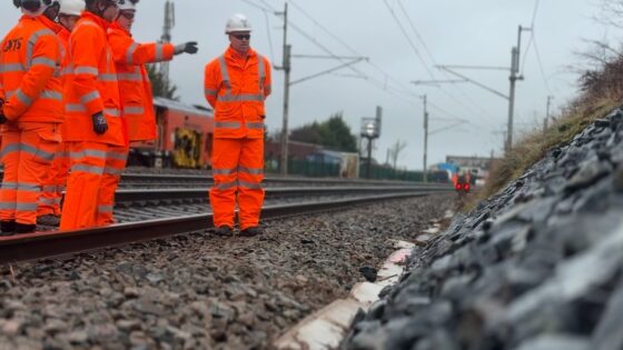
    Network Rail is delivering £41M of earthworks across key North West rail corridors to improve cuttings and embankments against winter rainfall, freeze–thaw and slope instability. Works are expected to include regrading and strengthening of existing earthwork assets, improved drainage systems and renewed trackside access to reduce washouts, slips and emergency speed restrictions. Geotechnical teams will need to manage construction around live traffic, legacy Victorian earth structures and variable ground conditions typical of the region’s glacial tills and weathered rock.

    Ground conditions in the weather forecast: practical implications for engineers
    Geotechnical
    1 day ago

    Ground conditions in the weather forecast: practical implications for engineers

    Calls to add ground condition metrics to public weather forecasts argue that engineers, utilities and transport operators now need near real-time data on soil moisture, pore pressure and desiccation risk, not just rainfall totals and wind speeds. Proponents point to recent UK failures on clay cuttings, embankment slips and buried pipe bursts after prolonged drought–storm cycles, where Met Office rainfall data alone gave little warning of loss of shear strength or shrink–swell movement. Integrating sensor networks, satellite soil-moisture indices and probabilistic geotechnical models into daily forecasts could materially change inspection, access planning and temporary works decisions.

    Related Industries & Products

    Construction

    Quality control software for construction companies with material testing, batch tracking, and compliance management.

    Mining

    Geotechnical software solutions for mining operations including CMRR analysis, hydrogeological testing, and data management.

    GEODB-io

    Centralised geotechnical data management solution for storing, accessing, and analysing all your site investigation and material testing data.

    QCDB-io

    Comprehensive quality control database for manufacturing, tunnelling, and civil construction with UCS testing, PSD analysis, and grout mix design management.

    AllGeotechnicalInfrastructureHazardsEnvironmental