Nepal’s Himalayan settlements: flood and landslide risk lens for engineers
Reviewed by Tom Sullivan
First reported on Geoengineer.org – News
30 Second Briefing
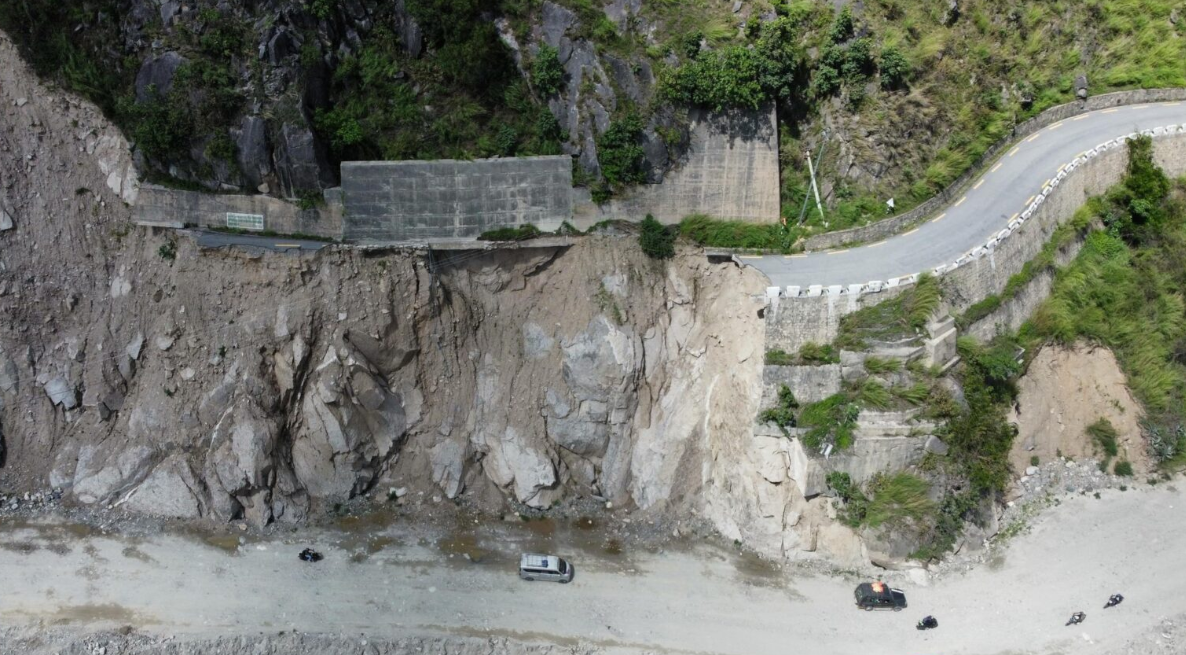
Escalating extreme rainfall and glacial melt are driving more frequent floods and landslides in Nepal’s Himalayan districts, with Karnali Province’s steep, highly fractured slopes and narrow river valleys particularly exposed. Recent events include debris flows cutting off road access to remote settlements and riverbank erosion undermining gabion walls and informal river training works along the Karnali and Bheri rivers. Engineers are being pushed towards slope stabilisation with bioengineering, improved drainage, and relocation or elevation of critical infrastructure away from active channels and unstable colluvium.
Technical Brief
- For similar Himalayan corridors, stricter road design standards and drainage audits are implied as minimum safety practice.
Our Take
For infrastructure and hydropower projects in Karnali Province, the environmental incident profile flagged in this piece implies that design teams will increasingly need to treat compound flood–landslide scenarios as baseline load cases rather than exceptional events, especially for access roads and slope cuts.
Prepared by collating external sources, AI-assisted tools, and Geomechanics.io’s proprietary mining database, then reviewed for technical accuracy & edited by our geotechnical team.
Related Articles
Related Industries & Products
Mining
Geotechnical software solutions for mining operations including CMRR analysis, hydrogeological testing, and data management.
Construction
Quality control software for construction companies with material testing, batch tracking, and compliance management.
CMRR-io
Streamline coal mine roof stability assessments with our cloud-based CMRR software featuring automated calculations, multi-scenario analysis, and collaborative workflows.
HYDROGEO-io
Comprehensive hydrogeological testing platform for managing, analysing, and reporting on packer tests, lugeon values, and hydraulic conductivity assessments.
GEODB-io
Centralised geotechnical data management solution for storing, accessing, and analysing all your site investigation and material testing data.