Geomechanics.io

  • Free Tools
Sign UpLog In
Built byBoxcut Studio

Geomechanics.io

Geomechanics, Streamlined.

© 2026 Geomechanics.io. All rights reserved.

Geomechanics.io

CMRR-ioGEODB-ioHYDROGEO-ioQCDB-ioFree Tools & CalculatorsBlogLatest Industry News

Industries

MiningConstructionTunnelling

Company

Terms of UsePrivacy PolicyLinkedIn
    Product
    Projects

    Hitachi excavators with Trimble Earthworks: workflow implications for site engineers

    March 19, 2026|

    Reviewed by Joe Ashwell

    Hitachi excavators with Trimble Earthworks: workflow implications for site engineers

    First reported on The Construction Index

    30 Second Briefing

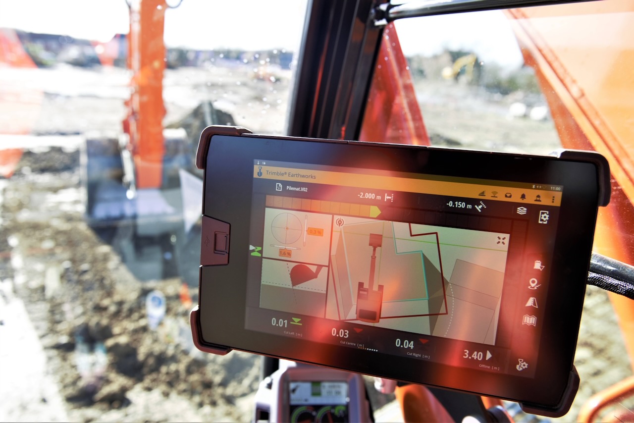
    Hitachi Construction Machinery Europe has signed an agreement to factory-fit Trimble Earthworks 3D grade control on its excavators sold across Europe, creating a single-source purchase, training and support route for machine control. Qualifying Hitachi dealers will also supply Trimble WorksManager, enabling remote transfer of construction-ready 3D models, fleet-wide device management and offsite troubleshooting between office and site. The deal signals deeper integration of digital grade control into standard excavator offerings, reducing aftermarket retrofit complexity for contractors adopting precision earthworks workflows.

    Technical Brief

    • Scott Crozier (Trimble, civil construction VP) emphasises direct access to full Earthworks functionality on Hitachi machines.
    • The same WorksManager environment is used to manage connected devices and machines and push configuration updates.

    Our Take

    Because this is tagged under both Product and Projects and located in the United Kingdom/Europe, it is likely to influence specification norms on major infrastructure and quarrying jobs, where contractors increasingly treat 3D machine control as a precondition for tendering rather than an optional add-on.

    Geotechnical Software for Modern Teams

    Centralise site data, logs, and lab results with GEODB-io, CMRR-io, and HYDROGEO-io.

    No credit card required.

    • Save and export unlimited calculations
    • Advanced data visualisation
    • Generate professional PDF reports
    • Cloud storage for all your projects

    Prepared by collating external sources, AI-assisted tools, and Geomechanics.io’s proprietary mining database, then reviewed for technical accuracy & edited by our geotechnical team.

    Related Articles

    Software
    1 day ago

    Carlson 2027 CAD suite: interoperability and drafting gains for mine planners

    Carlson Software has released its 2027 CAD suite for Survey, Civil, Hydrology, GIS, Mining and Point Cloud, built on IntelliCAD 14.1 and fully compatible with AutoCAD 2027. The update adds native CAD tables, expanded point cloud handling and mining-specific drafting tools aimed at faster layout of pits, stopes and haul roads. For mine planners and geotechnical teams, the key gains are smoother data exchange with existing DWG workflows and reduced rework between survey, design and hydrology models.

    Travis Perkins Connect Scope 3 calculator: data and FCA-readiness notes for project teams
    Software
    2 days ago

    Travis Perkins Connect Scope 3 calculator: data and FCA-readiness notes for project teams

    Travis Perkins has launched Connect, a Scope 3 carbon calculator that assigns CO2e values to more than 120,000 products by mapping material weights in tonnes and kilograms and using manufacturer EPDs or recognised industry datasets. The tool, designed by a CCF-led team under Phil Monkman, automatically converts delivery and invoice data into auditable, report-ready embodied carbon figures, replacing manual entry of up to 3,000 data points per month for some subcontractors. Roll-out across Travis Perkins, CCF, Keyline, BSS and Managed Services targets upcoming FCA disclosure rules from 2027–28, reducing reliance on estimates that can be up to 60% inaccurate.

    Software
    3 days ago

    Acquire EnviroSys–GIM Suite integration: workflow and QA gains for mine teams

    Acquire Technology Solutions has linked its Envirosys 9.5 environmental compliance platform with its GIM Suite geological data management system, creating a single workflow for drill hole, monitoring and location records. Environmental teams can now pull borehole IDs, collar coordinates and monitoring point locations directly from GIM Suite into Envirosys, reducing manual duplication and reconciliation. For mine operators, this should cut reporting errors in groundwater, dust and discharge datasets that rely on accurate spatial and geological references.

    Related Industries & Products

    Construction

    Quality control software for construction companies with material testing, batch tracking, and compliance management.

    Mining

    Geotechnical software solutions for mining operations including CMRR analysis, hydrogeological testing, and data management.

    QCDB-io

    Comprehensive quality control database for manufacturing, tunnelling, and civil construction with UCS testing, PSD analysis, and grout mix design management.

    AllGeotechnicalInfrastructureHazardsEnvironmental