EWR and Kier drone ecology surveys: programme impacts for civil engineers
Reviewed by Joe Ashwell
First reported on New Civil Engineer
30 Second Briefing
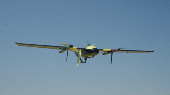
East West Rail has begun using thermal-imaging drones in pre-construction ecological surveys to speed up vegetation clearance while locating protected species before archaeological trenching. Working with contractor Kier, the programme replaces or reduces manual ground searches, allowing faster sign-off of clearance areas and more targeted exclusion zones around detected animals or nests. For civil and geotechnical teams, this can shorten enabling-works programmes and reduce last-minute design or access changes driven by ecological constraints.
Technical Brief
- Thermal-imaging payloads are mounted on multirotor UAVs, allowing low-altitude sweeps over dense vegetation.
- Night or dawn flight windows are used to maximise thermal contrast between fauna and background ground temperatures.
- Ecologists remain on site to ground‑truth thermal signatures, reducing false positives before clearance crews mobilise.
- Archaeological trenching sequences are re-ordered using drone data, prioritising areas confirmed clear of protected species.
- Reduced need for manual transect walks cuts exposure hours for staff in rough terrain and near plant.
Our Take
East West Rail’s use of drones for site clearance sits alongside its route‑wide consultation and £300M programme assurance procurement, signalling that the Oxford–Cambridge scheme is being used as a testbed for both digital delivery and environmental risk management at scale.
Among Infrastructure pieces tagged for Safety and Sustainability in our database, relatively few involve early‑stage construction logistics like vegetation clearance, so EWR and Keir’s approach is likely to be watched by other UK rail promoters looking to de‑risk ecology and public interface before main works.
The repeated appearance of East West Rail in recent coverage for consultation practice and design updates suggests the promoter is sensitive to scrutiny; visibly wildlife‑friendly methods such as drone‑assisted surveys may help with stakeholder confidence ahead of the final Development Consent Order push for the Oxford–Cambridge line.
Prepared by collating external sources, AI-assisted tools, and Geomechanics.io’s proprietary mining database, then reviewed for technical accuracy & edited by our geotechnical team.
Related Articles


Related Industries & Products
Construction
Quality control software for construction companies with material testing, batch tracking, and compliance management.
Mining
Geotechnical software solutions for mining operations including CMRR analysis, hydrogeological testing, and data management.
QCDB-io
Comprehensive quality control database for manufacturing, tunnelling, and civil construction with UCS testing, PSD analysis, and grout mix design management.