Geomechanics.io

  • Free Tools
Sign UpLog In
Built byBoxcut Studio

Geomechanics.io

Geomechanics, Streamlined.

© 2026 Geomechanics.io. All rights reserved.

Geomechanics.io

CMRR-ioGEODB-ioHYDROGEO-ioQCDB-ioFree Tools & CalculatorsBlogLatest Industry News

Industries

MiningConstructionTunnelling

Company

Terms of UsePrivacy PolicyLinkedIn
    Standard/Guideline
    Sustainability
    Projects

    EU digital action plan for water: key implications for civil and water engineers

    May 28, 2026|

    Reviewed by Tom Sullivan

    EU digital action plan for water: key implications for civil and water engineers

    First reported on New Civil Engineer

    30 Second Briefing

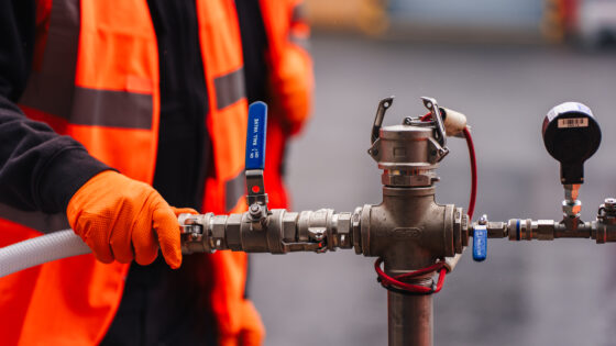
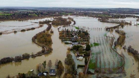
    The European Commission has opened a call for evidence to shape an EU-wide Action Plan on digitalisation in the water sector, responding to projections that water demand could exceed available supply by around 40%. The initiative is expected to prioritise smart metering, real-time network monitoring and digital twins for treatment plants and distribution systems to cut leakage and optimise asset operation. Civil and water engineers should anticipate future requirements for interoperable data standards, sensor-ready infrastructure and integration of hydraulic models with EU-level digital platforms.

    Technical Brief

    • Call for evidence is the formal first step in drafting the EU-level water digitalisation Action Plan.
    • Evidence submission window sets the timetable for when future technical requirements could begin to crystallise.

    Our Take

    The European Commission’s EU-wide Action Plan on digitalisation in the water sector sits within a large body of 164 policy stories in our database, but is one of relatively few that explicitly frame digital tools as a response to quantified resource gaps such as demand outstripping supply by 40%.

    Because New Civil Engineer is already convening industry around digital handover and data environments in its recent webinar coverage, this Action Plan is likely to filter quickly into UK infrastructure practice via standards for common data environments and asset information models for water networks.

    A projected 40% demand–supply imbalance gives regulators in the United Kingdom and the EU strong justification to hard-wire digital performance monitoring and leakage reduction targets into project approvals, which could materially change how water schemes are scoped and funded at the feasibility stage.

    Geotechnical Software for Modern Teams

    Centralise site data, logs, and lab results with GEODB-io, CMRR-io, and HYDROGEO-io.

    No credit card required.

    • Save and export unlimited calculations
    • Advanced data visualisation
    • Generate professional PDF reports
    • Cloud storage for all your projects

    Prepared by collating external sources, AI-assisted tools, and Geomechanics.io’s proprietary mining database, then reviewed for technical accuracy & edited by our geotechnical team.

    Related Articles

    DfT secrecy on Cosco UK port presence: risk takeaways for port engineers
    Policy
    1 day ago

    DfT secrecy on Cosco UK port presence: risk takeaways for port engineers

    The Department for Transport has refused a freedom of information request to disclose what port facilities Chinese state-owned Cosco Shipping operates in the UK, after US officials alleged the firm has enabled Beijing to monitor US military communications. The decision limits public visibility of Cosco’s role in UK container terminals, logistics hubs and potential access to critical maritime data infrastructure such as fibre links and port management systems. Port planners, marine engineers and security consultants may face tighter scrutiny on future concessions, terminal upgrades and digital systems involving Chinese operators.

    Mining data transparency: what EITI revenues mean for project economics
    Policy
    1 day ago

    Mining data transparency: what EITI revenues mean for project economics

    Mining transparency rules under the Extractive Industries Transparency Initiative now cover 56 countries and about 3,900 entities, with governments disclosing $3.6 trillion in extractive revenue and using project-level models to renegotiate deals such as the DRC’s Sicomines copper-cobalt agreement, which lifted planned infrastructure investment to $7 billion from $3 billion. EITI-backed fiscal analysis has halted or reshaped major transactions, including Ghana’s proposed Agyapa Royalties sale and Porgera gold mine ownership in Papua New Guinea, and is informing Simandou iron ore revenue planning in Guinea. Ownership and trade data are also driving licence refusals, enforcement against illicit flows and due-diligence checks in Armenia, Ghana and Colombia, particularly for critical minerals.

    £10.5bn UK flood defences: pipeline and design implications for engineers
    Policy
    1 day ago

    £10.5bn UK flood defences: pipeline and design implications for engineers

    The UK government is creating a Flood and Drought Resilience Taskforce alongside a £10.5bn funding commitment for flood defences between 2024 and 2036. The programme will target long‑term protection against extreme rainfall and prolonged dry spells, signalling sustained investment in river embankments, coastal defences, storage reservoirs and urban surface‑water schemes. Civil and geotechnical teams can expect a steady pipeline of appraisal, design and upgrade work, with closer integration of hydrological modelling, asset condition data and climate‑change allowances in line with current Environment Agency practice.

    Related Industries & Products

    Construction

    Quality control software for construction companies with material testing, batch tracking, and compliance management.

    CMRR-io

    Streamline coal mine roof stability assessments with our cloud-based CMRR software featuring automated calculations, multi-scenario analysis, and collaborative workflows.

    HYDROGEO-io

    Comprehensive hydrogeological testing platform for managing, analysing, and reporting on packer tests, lugeon values, and hydraulic conductivity assessments.

    GEODB-io

    Centralised geotechnical data management solution for storing, accessing, and analysing all your site investigation and material testing data.

    AllGeotechnicalInfrastructureHazardsEnvironmental