England’s ‘default yes’ near stations: design and delivery notes for engineers
Reviewed by Tom Sullivan
First reported on New Civil Engineer
30 Second Briefing
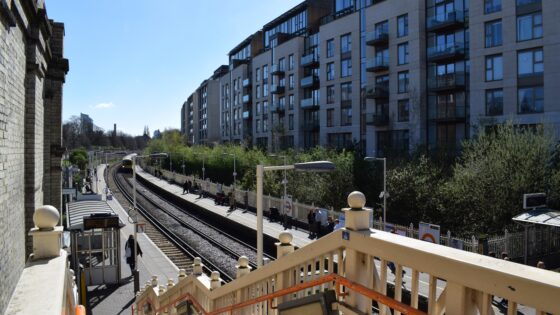
Planning policy changes in England now give a “default yes” to higher-density housing within walking distance of well-connected train, tram and Underground stations, aiming to accelerate approvals on brownfield and infill sites. Local plans will be required to prioritise station catchments with frequent services and existing utilities, reducing scope for refusal where schemes meet design codes and access standards. For civil and geotechnical teams, this signals sustained demand for mid-rise foundations, utility diversions and rail-adjacent construction methods with tight possession and vibration constraints.
Technical Brief
- Policy change is embedded in national planning rules, not guidance, so directly constrains appeal decisions.
- “Well-connected” stations are explicitly defined as those with frequent train, tram or Underground services.
- Catchments are limited to walking distance of stations, focusing work on tight urban footprints and infill plots.
- Brownfield land around stations becomes the primary target, implying extensive contamination, obstructions and demolition interfaces.
- Existing utilities near stations are assumed available, increasing diversion, protection and capacity‑upgrade scopes.
- Rail‑adjacent schemes must satisfy access and design codes before benefitting from the “default yes” presumption.
- Local plans are now required to prioritise these station areas, front‑loading transport‑oriented geotechnical and civil workload.
- For other urban rail corridors, this codifies transit‑oriented development practice rather than leaving it to local discretion.
Our Take
For practitioners, this kind of pro-development policy around train stations in England will sharpen the value of accurate transport accessibility modelling and TOD (transit-oriented development) layouts, as schemes that can clearly evidence strong rail connectivity should move more quickly through planning risk assessments.
New Civil Engineer’s broader coverage of digital handover and BIM on UK infrastructure schemes suggests that housing projects near rail nodes may increasingly be expected to integrate transport data and asset information from the outset, to satisfy both planning authorities and long-term asset managers.
Prepared by collating external sources, AI-assisted tools, and Geomechanics.io’s proprietary mining database, then reviewed for technical accuracy & edited by our geotechnical team.
Related Articles



Related Industries & Products
Construction
Quality control software for construction companies with material testing, batch tracking, and compliance management.
Mining
Geotechnical software solutions for mining operations including CMRR analysis, hydrogeological testing, and data management.
QCDB-io
Comprehensive quality control database for manufacturing, tunnelling, and civil construction with UCS testing, PSD analysis, and grout mix design management.