Geomechanics.io

  • Free Tools
Sign UpLog In
Built byBoxcut Studio

Geomechanics.io

Geomechanics, Streamlined.

© 2026 Geomechanics.io. All rights reserved.

Geomechanics.io

CMRR-ioGEODB-ioHYDROGEO-ioQCDB-ioFree Tools & CalculatorsBlogLatest Industry News

Industries

MiningConstructionTunnelling

Company

Terms of UsePrivacy PolicyLinkedIn
    Projects
    Sustainability

    Cambridgeshire wind farm with turbines twice Big Ben: EIA and design notes for engineers

    November 21, 2026|

    Reviewed by Joe Ashwell

    Cambridgeshire wind farm with turbines twice Big Ben: EIA and design notes for engineers

    First reported on New Civil Engineer

    30 Second Briefing

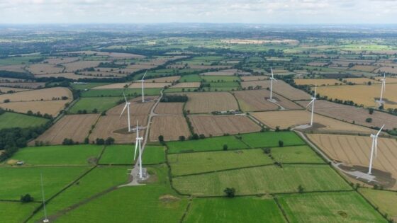
    A proposed wind farm in Cambridgeshire featuring turbines reportedly twice the height of Big Ben (so in the ~180–200m class) has triggered questions in Parliament over visual, noise and shadow-flicker impacts on nearby communities. MPs are pressing for clarity on cumulative landscape effects, aviation safeguarding and proximity to existing settlements, given the exceptional tip heights compared with typical UK onshore machines. For designers and planners, the scheme signals closer political scrutiny of very tall onshore turbines, EIA scope and local acceptability thresholds.

    Technical Brief

    • Such hub heights typically require large-diameter piled or gravity foundations, driving substantial geotechnical investigation scope.
    • Extreme blade sweep envelopes increase rotor clearance requirements over public rights of way and local roads.
    • Noise and shadow-flicker assessments must use height-appropriate propagation models, not legacy assumptions from smaller machines.
    • Construction logistics for large blades and tall towers constrain crane pad design, bearing pressures and access road geometry.
    • For other UK onshore sites, any move to significantly taller turbines will materially tighten EIA baselines and cumulative impact analyses.

    Our Take

    Cambridgeshire onshore wind schemes are likely to intersect with the flood and water-management themes highlighted in New Civil Engineer’s recent Floods & Water Awards coverage, so design teams will be pushed to evidence cumulative hydrological and drainage impacts as well as visual ones.

    Within our 120 Policy stories, UK onshore renewables frequently trigger planning disputes around landscape and heritage; schemes in low-relief regions like Cambridgeshire tend to face tougher scrutiny on turbine height and spacing because there are fewer natural landforms to screen structures.

    New Civil Engineer’s focus on BIM and asset-management ‘data handover gaps’ suggests that any large wind farm promoted in the UK now risks planning conditions that require robust digital asset records, which can add upfront design and information-management workload for project teams.

    Geotechnical Software for Modern Teams

    Centralise site data, logs, and lab results with GEODB-io, CMRR-io, and HYDROGEO-io.

    Cancel at any time.

    • Save and export unlimited calculations
    • Advanced data visualisation
    • Generate professional PDF reports
    • Cloud storage for all your projects

    Prepared by collating external sources, AI-assisted tools, and Geomechanics.io’s proprietary mining database, then reviewed for technical accuracy & edited by our geotechnical team.

    Related Articles

    US seabed auction off American Samoa: legal and project risk notes for engineers
    Policy
    1 day ago

    US seabed auction off American Samoa: legal and project risk notes for engineers

    The first US deep-sea mineral lease auction is proceeding for two tracts totalling 31.5 million acres of Pacific seabed off American Samoa, with bidding set to start at $3 million per tract in Thousand Oaks, California, despite a federal court voiding the National Marine Fisheries Service’s Endangered Species Act sign-off. District Judge Jill Otake ruled the agency unlawfully assessed only sale and survey impacts, not subsequent exploration and mining of nodules and iron-manganese crusts, casting legal doubt over this and a proposed sale near the Northern Mariana Islands and Guam. The Marine Minerals Administration says leases will initially allow only mapping and other preliminary work, with separate approvals required for advanced exploration, testing and commercial extraction.

    ICE call for greater public say on UK infrastructure: governance lens for engineers
    Policy
    1 day ago

    ICE call for greater public say on UK infrastructure: governance lens for engineers

    ICE and the Future Governance Forum are calling on prime minister Andy Burnham to give communities and local leaders a stronger statutory role in shaping UK infrastructure schemes, from early option selection through to consent. Proposals centre on formalising local input into Nationally Significant Infrastructure Projects and major transport and energy corridors, rather than relying on late-stage consultations. For engineers, this signals likely changes to project governance, stakeholder engagement requirements and programme risk on large schemes if adopted.

    US rare earths regulations: supply-chain risk lens for defence engineers
    Policy
    2 days ago

    US rare earths regulations: supply-chain risk lens for defence engineers

    US rare earths regulations will bar the Pentagon from buying magnets, tantalum and tungsten products mined, refined or separated in China, North Korea, Iran or Russia from 1 January 2027, closing the current loophole that allows Chinese-origin feedstock if final melting occurs elsewhere. Neodymium-iron-boron and samarium-cobalt magnets, plus gallium and germanium from December 2027, fall under tightened DFARS rules requiring full supply-chain mapping, alternative source qualification and sharply limited waivers. With US capacity still fragmented across mining, separation, metallisation and magnet production, defence contractors face near-term supply risk despite new projects with ElementUSA, Colorado School of Mines and Phoenix Tailings.

    Related Industries & Products

    Construction

    Quality control software for construction companies with material testing, batch tracking, and compliance management.

    Mining

    Geotechnical software solutions for mining operations including CMRR analysis, hydrogeological testing, and data management.

    QCDB-io

    Comprehensive quality control database for manufacturing, tunnelling, and civil construction with UCS testing, PSD analysis, and grout mix design management.

    AllGeotechnicalInfrastructureHazardsEnvironmental