Geomechanics.io

  • Free Tools
Sign UpLog In

Geomechanics.io

Geomechanics, Streamlined.

© 2026 Geomechanics.io. All rights reserved.

Geomechanics.io

CMRR-ioGEODB-ioHYDROGEO-ioQCDB-ioFree Tools & CalculatorsBlogLatest Industry News

Industries

MiningConstructionTunnelling

Company

Terms of UsePrivacy PolicyLinkedIn
    AllGeotechnicalMiningInfrastructureMaterialsHazardsEnvironmentalSoftwarePolicy
    Projects
    Failure
    Safety

    Binaliw landfill slope failure, Philippines: stability lessons for waste engineers

    January 10, 2026|

    Reviewed by Joe Ashwell

    Binaliw landfill slope failure, Philippines: stability lessons for waste engineers

    First reported on Geoengineer.org – News

    30 Second Briefing

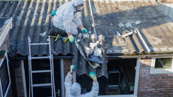
    A massive slope failure at the privately operated Binaliw landfill in Cebu City has triggered continuous rescue operations, with dozens of waste-pickers and site workers reported missing beneath tens of metres of municipal solid waste. The collapse occurred during active tipping and compaction, raising immediate questions over waste slope geometry, leachate control and adherence to stability criteria for high fills in a high-rainfall, seismically active region. Local authorities are now reviewing permits and operational controls for large waste embankments across Metro Cebu.

    Technical Brief

    • Rescue teams report unstable residual waste faces and secondary sloughing during excavation, highlighting the need for real-time geotechnical monitoring and strict exclusion zones during recovery works.
    • For similar high fills in tropical, seismically active settings, operators are likely to face tighter controls on maximum slope angles, staged construction, independent stability reviews and emergency response planning for waste-pickers and informal workers.

    Our Take

    Within the 29 Hazards stories in our coverage, landfill and waste-slope failures like the Binaliw site in Cebu City are far less common than tailings or open-pit wall incidents, so this event will likely be scrutinised as a benchmark case for municipal waste geotechnics in humid tropical settings.

    For operators in the Philippines, this kind of large-scale failure at Binaliw reinforces that urban landfills can present slope-stability risks comparable to small open pits, which may push local authorities towards stricter geotechnical design, drainage control, and monitoring requirements even for ostensibly ‘non-mining’ waste facilities.

    Several other safety-tagged items in our database now reference AI or artificial intelligence for real-time monitoring, suggesting that similar sensor- and data-driven approaches could be evaluated for high faces and active tipping zones at sites like Binaliw to detect deformation before catastrophic movement.

    Geotechnical Software for Modern Teams

    Centralise site data, logs, and lab results with GEODB-io, CMRR-io, and HYDROGEO-io.

    No credit card required.

    • Save and export unlimited calculations
    • Advanced data visualisation
    • Generate professional PDF reports
    • Cloud storage for all your projects

    Prepared by collating external sources, AI-assisted tools, and Geomechanics.io’s proprietary mining database, then reviewed for technical accuracy & edited by our geotechnical team.

    Related Articles

    Melbourne sinkhole investigations: geotechnical lessons for tunnel project teams
    Hazards
    in 3 months

    Melbourne sinkhole investigations: geotechnical lessons for tunnel project teams

    A sinkhole roughly 8–10 m wide and several metres deep has opened on the AJ Burkitt Reserve sporting oval in Heidelberg, directly adjacent to the North East Link tunnel alignment in Melbourne’s northeast. Victorian Infrastructure Delivery Authority has confirmed the “surface hole” is in the vicinity of active tunnelling operations, leading to a work pause while engineers and emergency crews carry out geotechnical investigations and monitoring. No injuries or structural damage have been reported, but the area remains fully cordoned off pending cause determination and stability assessment.

    Devon A379 coastal erosion failure: funding and design lessons for engineers
    Hazards
    about 15 hours ago

    Devon A379 coastal erosion failure: funding and design lessons for engineers

    Coastal erosion has destroyed a section of the A379 Slapton line in Devon, severing a key coastal route, but central government has offered only sympathy and no funding or technical commitment to reinstate it. The community, which depends on the road as the primary link between Kingsbridge and Dartmouth, now faces long diversion routes on minor inland roads not designed for current traffic volumes or heavy vehicles. For geotechnical and coastal engineers, the situation signals continued uncertainty over who funds long-term adaptation of low-lying coastal highways exposed to accelerating shoreline retreat.

    River dredging for UK rural flooding: design and risk lens for engineers
    Hazards
    1 day ago

    River dredging for UK rural flooding: design and risk lens for engineers

    MPs have pressed the environment minister on whether large-scale river dredging will be adopted to reduce rural flooding during extreme rainfall, amid pressure from farming communities hit by repeated winter overflows. The debate centres on whether increasing channel capacity by removing bed sediment and vegetation in rivers such as the Severn and Wye offers better value than upstream storage, washlands and natural flood management. Engineers will need to weigh short-term conveyance gains against impacts on bank stability, habitat loss, maintenance cycles and downstream flood peaks.

    Related Industries & Products

    Mining

    Geotechnical software solutions for mining operations including CMRR analysis, hydrogeological testing, and data management.

    Construction

    Quality control software for construction companies with material testing, batch tracking, and compliance management.

    CMRR-io

    Streamline coal mine roof stability assessments with our cloud-based CMRR software featuring automated calculations, multi-scenario analysis, and collaborative workflows.

    HYDROGEO-io

    Comprehensive hydrogeological testing platform for managing, analysing, and reporting on packer tests, lugeon values, and hydraulic conductivity assessments.

    GEODB-io

    Centralised geotechnical data management solution for storing, accessing, and analysing all your site investigation and material testing data.