Geomechanics.io

  • Free Tools
Sign UpLog In

    Geomechanics.io

    Geomechanics, Streamlined.

    © 2026 Geomechanics.io. All rights reserved.

    Geomechanics.io

    CMRR-ioGEODB-ioHYDROGEO-ioQCDB-ioFree Tools & CalculatorsBlogLatest Industry News

    Industries

    MiningConstructionTunnelling

    Company

    Terms of UsePrivacy PolicyLinkedIn
    Projects

    BGS UK ground investigation data service: design and risk notes for engineers

    May 22, 2026|

    Reviewed by Tom Sullivan

    BGS UK ground investigation data service: design and risk notes for engineers

    First reported on New Civil Engineer

    30 Second Briefing

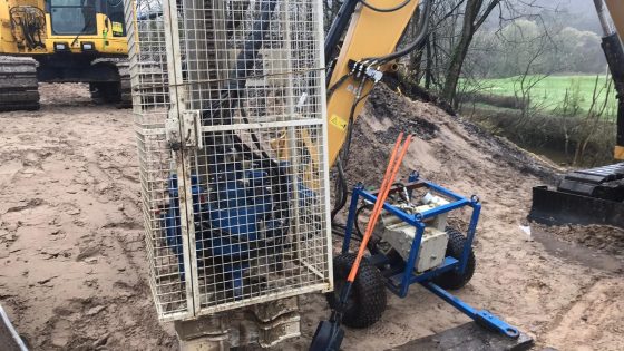
    The British Geological Survey is advancing a national geotechnical data service to collate UK ground investigation records into a single, standardised digital platform for project teams. By aggregating borehole logs, in situ test results and laboratory data from multiple legacy sources, the system aims to give designers earlier visibility of variable strata, groundwater conditions and historical contamination. For geotechnical and civil engineers, this could reduce duplicate site investigations, refine ground models at concept stage and improve risk pricing for foundations, earthworks and underground structures.

    Technical Brief

    • For similar national initiatives, the main technical challenge is reconciling inconsistent historical coding and stratigraphic nomenclature.

    Our Take

    The British Geological Survey’s push to collate UK ground investigation data aligns with its North Sea CO₂ storage mapping work, signalling a move towards re‑using legacy subsurface datasets across both onshore infrastructure and offshore energy transition projects.

    Within our 23 Geotechnical stories, BGS is one of the few UK-based institutions repeatedly appearing as a data custodian rather than a project proponent, which suggests consultants and asset owners may increasingly depend on BGS-curated datasets as a quasi-standard reference for ground models.

    Geotechnical Software for Modern Teams

    Centralise site data, logs, and lab results with GEODB-io, CMRR-io, and HYDROGEO-io.

    No credit card required.

    • Save and export unlimited calculations
    • Advanced data visualisation
    • Generate professional PDF reports
    • Cloud storage for all your projects

    Prepared by collating external sources, AI-assisted tools, and Geomechanics.io’s proprietary mining database, then reviewed for technical accuracy & edited by our geotechnical team.

    Related Articles

    Inter Helix Spacing in Helical Piles: design implications and torque guidance
    Geotechnical
    4 days ago

    Inter Helix Spacing in Helical Piles: design implications and torque guidance

    Inter‑helix spacing for helical piles and anchors is traced from early empirical rules of thumb (typically 3× helix diameter) to current design approaches based on cylindrical shear and individual bearing models. The review compares performance implications of close spacing (overlapping stress bulbs, higher installation torque, potential group behaviour) versus wider spacing (reduced interaction, deeper embedment, more steel), and links them to torque‑to‑capacity correlations. For practitioners, it clarifies when legacy spacing rules remain adequate and when soil type, load regime, and installation constraints justify project‑specific optimisation.

    TAS stadium works: Macquarie Point contract and ground risks for engineers
    Geotechnical
    12 days ago

    TAS stadium works: Macquarie Point contract and ground risks for engineers

    Tasmania’s Government has let a contract to dismantle and compact the early‑20th‑century Goods Shed at Macquarie Point to clear the site for a $1.13 billion multi‑purpose stadium in Hobart. The former rail and port freight hub will be packed down to formation level, providing a prepared platform for the stadium’s deep foundations, services corridors and future transport interfaces. Geotechnical teams will need to manage demolition spoil, variable fill and potential contamination typical of historic industrial waterfronts before main works can proceed.

    Keller North America engineer programme: design–build skills lens for geotechnical teams
    Geotechnical
    13 days ago

    Keller North America engineer programme: design–build skills lens for geotechnical teams

    Keller North America has expanded its field engineer / project engineer development programme after a successful pilot, formalising a structured path from site-based roles into project management and technical leadership. The scheme combines intensive on-the-job training on ground improvement and deep foundation projects with rotations through estimating, design, and operations, exposing graduates to tools such as geotechnical instrumentation, grout mix design, and pile load testing. For contractors and clients, the move signals a pipeline of early-career engineers with stronger design–build integration skills and site-ready competence.

    Related Industries & Products

    Construction

    Quality control software for construction companies with material testing, batch tracking, and compliance management.

    Mining

    Geotechnical software solutions for mining operations including CMRR analysis, hydrogeological testing, and data management.

    HYDROGEO-io

    Comprehensive hydrogeological testing platform for managing, analysing, and reporting on packer tests, lugeon values, and hydraulic conductivity assessments.

    GEODB-io

    Centralised geotechnical data management solution for storing, accessing, and analysing all your site investigation and material testing data.

    AllGeotechnicalInfrastructureHazardsEnvironmental