Geomechanics.io

  • Free Tools
Sign UpLog In
Built byBoxcut Studio

Geomechanics.io

Geomechanics, Streamlined.

© 2026 Geomechanics.io. All rights reserved.

Geomechanics.io

CMRR-ioGEODB-ioHYDROGEO-ioQCDB-ioFree Tools & CalculatorsBlogLatest Industry News

Industries

MiningConstructionTunnelling

Company

Terms of UsePrivacy PolicyLinkedIn
    Product
    Safety
    Projects

    ALLMI Proximity to Slopes tool: stability planning notes for crane engineers

    December 19, 2025|

    Reviewed by Joe Ashwell

    ALLMI Proximity to Slopes tool: stability planning notes for crane engineers

    First reported on The Construction Index

    30 Second Briefing

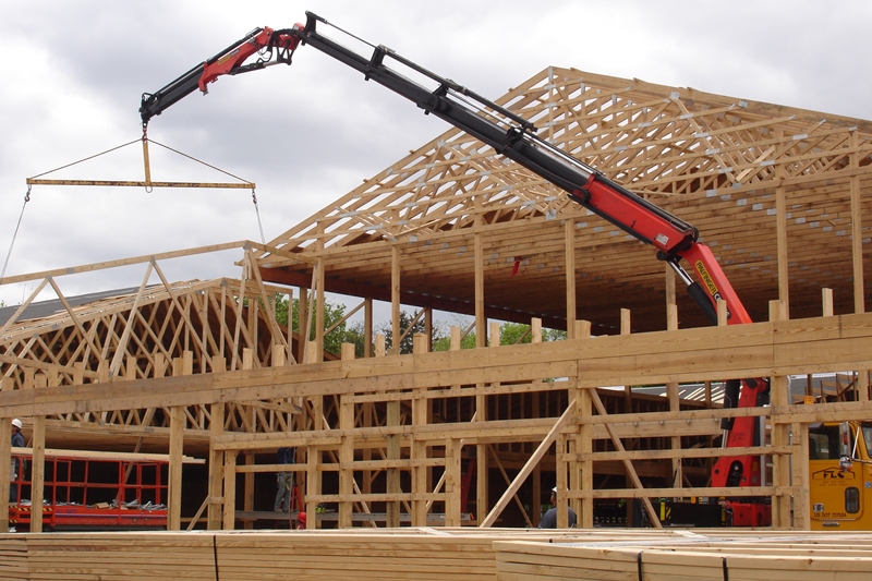
    Proximity to Slopes, a new calculator in the Association of Lorry Loader Manufacturers & Importers (ALLMI) app, now quantifies safe stabiliser leg positions for loader cranes working beside embankments. Users input mat width, horizontal distance from the crane base to the crest, and slope height; the tool then defines a “danger area” where stabilisers must not be placed to avoid loss of stability. For temporary works and lift planners, this offers a quick, standardised check when siting cranes on or near cuttings, bunds and roadside batters.

    Technical Brief

    • Tool output is explicitly framed as guidance for stabiliser leg siting, not full geotechnical design.
    • Input parameters are limited to mat width, horizontal offset to crest and slope height, simplifying field use.
    • Calculator logic assumes use of spreader mats, explicitly incorporating mat width into the danger-zone geometry.
    • By standardising a simple geometric check, the tool supports more consistent compliance with generic lifting-plan requirements.
    • For complex stratigraphy, high slopes or waterlogged batters, separate geotechnical assessment remains essential despite app guidance.

    Our Take

    Within the 11 Software stories in our database, very few are UK-focused and safety-tagged, so ALLMI’s loader crane proximity tool stands out as one of the more formalised, industry-body-led digital safety initiatives rather than a single-vendor product push.

    Because ALLMI is a trade association rather than an equipment OEM, this kind of software emerging from the United Kingdom is likely to influence multiple loader crane brands and contractors on projects, making it easier for principal contractors to specify a common approach to slope-related exclusion zones.

    Among the 797 tag-matched Product/Safety/Projects pieces, most safety tools relate to mobile plant or underground mining; a loader crane-specific proximity solution suggests that UK regulators and clients are now scrutinising lifting operations on construction projects with similar intensity to earthmoving activities.

    Geotechnical Software for Modern Teams

    Centralise site data, logs, and lab results with GEODB-io, CMRR-io, and HYDROGEO-io.

    Cancel at any time.

    • Save and export unlimited calculations
    • Advanced data visualisation
    • Generate professional PDF reports
    • Cloud storage for all your projects

    Prepared by collating external sources, AI-assisted tools, and Geomechanics.io’s proprietary mining database, then reviewed for technical accuracy & edited by our geotechnical team.

    Related Articles

    GEOVIA Surpac 2027: key workflow and modelling upgrades for mine planners
    Software
    1 day ago

    GEOVIA Surpac 2027: key workflow and modelling upgrades for mine planners

    GEOVIA has released Surpac 2027, updating its 3D mine planning and geological modelling platform with advances in implicit modelling, data editing, intelligent UI, interactive charting and reporting, and improved stability and performance. The release targets faster resource wireframing and block model updates, tighter integration of geological data workflows, and more responsive visualisation for complex open-pit and underground designs. For mine planners and resource geologists, the changes aim to cut manual rework in model updates and design iterations, particularly where frequent grade control and reconciliation are required.

    Sizewell C–Crysp tie-up: digital risk controls and CDM takeaways for project teams
    Software
    1 day ago

    Sizewell C–Crysp tie-up: digital risk controls and CDM takeaways for project teams

    Sizewell C has appointed Yorkshire-based Crysp to provide its cloud-based compliance and risk management platform for health and safety oversight on the nuclear power station project. The software will centralise statutory inspections, contractor compliance data and asset safety records across the multi-billion-pound site, supporting CDM duties and nuclear site licence conditions. For contractors and consultants, the move signals tighter digital control of RAMS, permits and inspection regimes on one of the UK’s largest complex concrete, earthworks and marine infrastructure programmes.

    Volvo–Trimble 3D machine control: integration insights for earthworks engineers
    Software
    1 day ago

    Volvo–Trimble 3D machine control: integration insights for earthworks engineers

    Volvo Construction Equipment and Trimble are integrating the Trimble Earthworks 3D grade control platform directly into the Volvo Co-Pilot in-cab display on F-series excavators, eliminating the need for a separate Earthworks screen. The factory-fit system, targeted for production from early 2027, will give operators a single interface for 3D design surfaces, cut/fill visualisation and bucket position guidance. For contractors, tighter integration should simplify installation, reduce aftermarket hardware, and support more consistent grading accuracy on complex earthworks.

    Related Industries & Products

    Mining

    Geotechnical software solutions for mining operations including CMRR analysis, hydrogeological testing, and data management.

    Construction

    Quality control software for construction companies with material testing, batch tracking, and compliance management.

    CMRR-io

    Streamline coal mine roof stability assessments with our cloud-based CMRR software featuring automated calculations, multi-scenario analysis, and collaborative workflows.

    HYDROGEO-io

    Comprehensive hydrogeological testing platform for managing, analysing, and reporting on packer tests, lugeon values, and hydraulic conductivity assessments.

    GEODB-io

    Centralised geotechnical data management solution for storing, accessing, and analysing all your site investigation and material testing data.

    AllGeotechnicalInfrastructureHazardsEnvironmental