UK subsurface mapping vs Germany: key lessons for UK street works engineers
Reviewed by Tom Sullivan
First reported on New Civil Engineer
30 Second Briefing
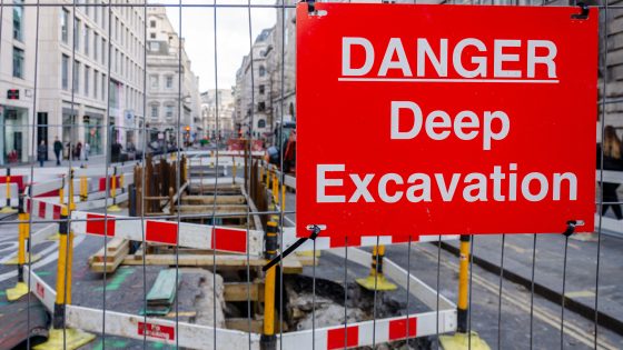
Repeated strikes on live electricity cables during street works in Britain are being blamed on poor subsurface mapping and fragmented utility records, with contractors often relying on outdated paper plans and limited ground-penetrating radar surveys. German cities are cited as a benchmark, using centralised digital cadastres of buried assets, mandatory as-built 3D records and shared GIS platforms to locate power, gas, water and fibre within centimetres. For UK civil and utilities engineers, the argument is for statutory data standards, interoperable mapping and routine pre-excavation scanning to cut strikes, delays and near-miss incidents.
Technical Brief
- Live cable strikes in Britain are occurring on the order of every few weeks nationwide.
Our Take
Across the 864 Infrastructure stories in our database, relatively few explicitly compare the United Kingdom’s asset data practices with continental European benchmarks like Germany, so this piece signals growing practitioner interest in cross-border lessons rather than purely domestic standards debates.
New Civil Engineer’s recent webinar coverage on BIM, common data environments and the ‘data handover gap’ suggests that any UK move to emulate German-style subsurface records will likely hinge on closing that handover gap so buried utilities and structures are captured as operational asset data, not just design intent.
Because New Civil Engineer is also convening early-career innovation challenges with Heathrow Airport and bridge sector bodies, the call for better knowledge of what lies under UK streets is likely to filter quickly into competition briefs and training agendas, pushing younger engineers to treat underground mapping and data standards as a core design constraint on future projects.
Prepared by collating external sources, AI-assisted tools, and Geomechanics.io’s proprietary mining database, then reviewed for technical accuracy & edited by our geotechnical team.
Related Articles


Related Industries & Products
Mining
Geotechnical software solutions for mining operations including CMRR analysis, hydrogeological testing, and data management.
Construction
Quality control software for construction companies with material testing, batch tracking, and compliance management.
CMRR-io
Streamline coal mine roof stability assessments with our cloud-based CMRR software featuring automated calculations, multi-scenario analysis, and collaborative workflows.
HYDROGEO-io
Comprehensive hydrogeological testing platform for managing, analysing, and reporting on packer tests, lugeon values, and hydraulic conductivity assessments.
GEODB-io
Centralised geotechnical data management solution for storing, accessing, and analysing all your site investigation and material testing data.