Storm-hit UK electricity and rail: UAV inspection lessons for asset engineers
Reviewed by Tom Sullivan
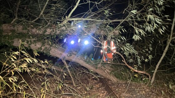
First reported on New Civil Engineer
30 Second Briefing
Storms Austen and Boelo, the first named storms of the 2026-27 winter, severely disrupted UK electricity and rail networks over the weekend, forcing network operators to deploy engineers, helicopters and drones for rapid inspection of overhead lines and track assets. Aerial teams focused on locating downed conductors, damaged pylons and fallen trees on key rail corridors, enabling targeted isolation and sectional repairs rather than full-line shutdowns. The response underlines the growing operational role of UAV-based condition assessment in extreme weather events, particularly for long linear assets in remote or inaccessible terrain.
Technical Brief
- Incident command structures followed established rail and electricity emergency plans, integrating asset, safety and control teams.
- Safety case reviews are likely to tighten design wind load and tree-fall allowances for linear assets.
Our Take
The 2026–27 winter season timing aligns with other recent NCE coverage on digital asset management and BIM ‘data handover gaps’, suggesting operators are under pressure not just to repair storm damage but to integrate richer condition data from helicopters and drones into long-term resilience planning.
New Civil Engineer’s parallel focus on bridge retrofit challenges and early-careers innovation competitions indicates that lessons from this winter’s network disruption are likely to feed quickly into bridge and linear-asset retrofit concepts, rather than waiting for full replacement schemes.
Prepared by collating external sources, AI-assisted tools, and Geomechanics.io’s proprietary mining database, then reviewed for technical accuracy & edited by our geotechnical team.
Related Articles


Related Industries & Products
Construction
Quality control software for construction companies with material testing, batch tracking, and compliance management.
CMRR-io
Streamline coal mine roof stability assessments with our cloud-based CMRR software featuring automated calculations, multi-scenario analysis, and collaborative workflows.
HYDROGEO-io
Comprehensive hydrogeological testing platform for managing, analysing, and reporting on packer tests, lugeon values, and hydraulic conductivity assessments.
GEODB-io
Centralised geotechnical data management solution for storing, accessing, and analysing all your site investigation and material testing data.