Geomechanics.io

  • Free Tools
Sign UpLog In

Geomechanics.io

Geomechanics, Streamlined.

© 2026 Geomechanics.io. All rights reserved.

Geomechanics.io

CMRR-ioGEODB-ioHYDROGEO-ioQCDB-ioFree Tools & CalculatorsBlogLatest Industry News

Industries

MiningConstructionTunnelling

Company

Terms of UsePrivacy PolicyLinkedIn
    Projects
    Product

    Sandvik My Sandvik Geo: drill data to blast design – key points for mine engineers

    March 2, 2026|

    Reviewed by Joe Ashwell

    Sandvik My Sandvik Geo: drill data to blast design – key points for mine engineers

    First reported on International Mining – News

    30 Second Briefing

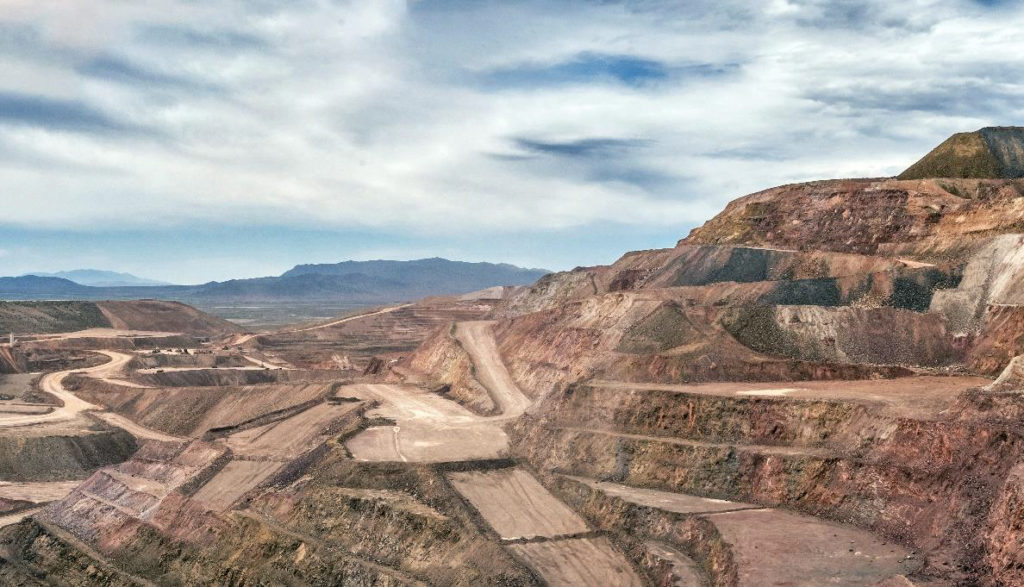
    Sandvik Mining has launched My Sandvik Geo at CONEXPO-CON/AGG 2026, a cloud-based service that converts surface top-hammer drill data into near real-time geological and geotechnical models of subsurface conditions. The platform ingests parameters such as penetration rate, torque and vibration from connected drill rigs to infer rock hardness, fracture zones and lithological boundaries along each blast hole. Operators can use these insights to adjust blast designs hole-by-hole, refine burden and spacing, and reduce both overbreak and underbreak in production benches.

    Technical Brief

    • For similar digital drill‑to‑blast workflows, integration with mine planning packages is likely the next step.

    Our Take

    Across recent coverage, Sandvik features in multiple equipment and digitalisation pieces – from the Leopard DI610i drill launch to the large D25KX fleet order in Zambia – signalling that My Sandvik Geo is likely another layer in an integrated, data-rich fleet ecosystem rather than a standalone app.

    The acquisition of ThoroughTec Simulation suggests Sandvik is building a broader digital training and decision-support stack, so My Sandvik Geo could eventually feed geological and production data into simulation-based planning and operator training workflows.

    With Sandvik Mining also embedded in project-level studies such as Atlas Salt’s Great Atlantic feasibility work, a real-time geological insight tool like My Sandvik Geo is likely to be positioned not just for operations monitoring but for tightening the loop between design assumptions and actual ground conditions on new projects.

    Geotechnical Software for Modern Teams

    Centralise site data, logs, and lab results with GEODB-io, CMRR-io, and HYDROGEO-io.

    No credit card required.

    • Save and export unlimited calculations
    • Advanced data visualisation
    • Generate professional PDF reports
    • Cloud storage for all your projects

    Prepared by collating external sources, AI-assisted tools, and Geomechanics.io’s proprietary mining database, then reviewed for technical accuracy & edited by our geotechnical team.

    Related Articles

    US uranium contract cuts to Canada: lessons on boom–bust risk for mine planners
    Mining
    about 14 hours ago

    US uranium contract cuts to Canada: lessons on boom–bust risk for mine planners

    US cancellation of uranium supply contract renewals in late 1959 abruptly threatened Canada’s position as the world’s top uranium producer, just months after Elliot Lake opened a C$3-million, 116‑bed hospital built on the boom. With US military contracts due to expire in 1962–63 and domestic American uranium output rising, higher‑cost Canadian mines shut while stronger operators consolidated assets. Mining towns like Elliot Lake faced a rapid bust that lasted until civilian nuclear demand later in the 1960s stabilised the sector.

    Focus Graphite’s Lac Tetepisca resource: capex and pit geometry notes for engineers
    Mining
    3 days ago

    Focus Graphite’s Lac Tetepisca resource: capex and pit geometry notes for engineers

    Focus Graphite’s Lac Tetepisca project in central Quebec now hosts 14.7 million tonnes of contained graphite at 10.2% Cg, an 86% increase over its 2022 resource, ranking fifth globally and second in North America by contained tonnes. The updated estimate, based on 26,095 metres of drilling in 150 holes, includes 12.3 million tonnes contained graphite in measured and indicated resources (120.1 million tonnes at 10.27% Cg) plus 2.3 million tonnes inferred (24.1 million tonnes at 9.88% Cg). Grades above 10% Cg, open-pit geometry with favourable strip ratios, low-cost Quebec hydropower and planned >99.9% purity processing underpin analyst views that Focus trades at an 81% discount to peers.

    Freeport’s delayed Grasberg restart to 2028: production and risk notes for mine engineers
    Mining
    3 days ago

    Freeport’s delayed Grasberg restart to 2028: production and risk notes for mine engineers

    Freeport Indonesia has pushed back Grasberg’s full production restart to early 2028, after a September mudflow in the Grasberg Block Cave killed seven workers, halted underground mining and triggered force majeure on shipments. The complex, which previously supplied about 3% of global copper (1.7 billion lb/year) and 1.4 million oz/year of gold, is currently operating at roughly 40–50% capacity, with copper output for 2026 now guided at 700 million lb versus a prior 1‑billion‑lb target. Ramp-up targets have been reset to 65% capacity in H2 2026 and 80% by mid‑2027, as additional logistics and ore-handling infrastructure work proceeds.

    Related Industries & Products

    Mining

    Geotechnical software solutions for mining operations including CMRR analysis, hydrogeological testing, and data management.

    Construction

    Quality control software for construction companies with material testing, batch tracking, and compliance management.

    CMRR-io

    Streamline coal mine roof stability assessments with our cloud-based CMRR software featuring automated calculations, multi-scenario analysis, and collaborative workflows.

    HYDROGEO-io

    Comprehensive hydrogeological testing platform for managing, analysing, and reporting on packer tests, lugeon values, and hydraulic conductivity assessments.

    GEODB-io

    Centralised geotechnical data management solution for storing, accessing, and analysing all your site investigation and material testing data.

    AllGeotechnicalInfrastructureHazardsEnvironmental