RSK at Fort Halstead: brownfield redevelopment and GI lessons for engineers
Reviewed by Joe Ashwell
First reported on The Construction Index
30 Second Briefing
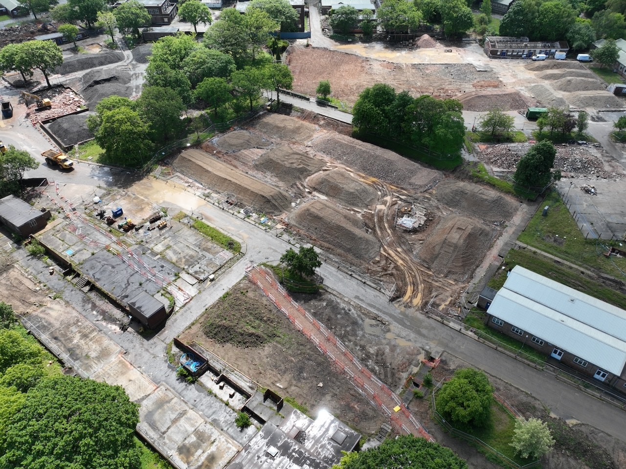
RSK is mobilising a 14‑business, 16‑discipline team for Barratt David Wilson Homes Kent’s 635‑home brownfield redevelopment at the 70‑hectare former Fort Halstead defence research site, with 18 hectares earmarked for development including a primary school and commercial units. Soilfix is delivering demolition and enabling works under an approved materials management plan targeting reuse of about 48,000 m³ of soil in enabling and a further ~80,000 m³ during construction, while retaining a scheduled ancient monument and some 1,600 trees of ancient semi‑natural woodland. Pre‑demolition ground investigation completed in December 2024 combined non‑intrusive geophysics with intrusive works at over 300 locations (c.25 m borehole spacing), supported by GIS to refine foundation and remediation design and cut over‑excavation and waste.
Technical Brief
- Pre‑demolition ground investigation finished December 2024, ahead of large‑scale demolition and enabling works.
- Over 300 intrusive investigation locations achieved roughly 25 m borehole spacing in proposed development zones.
- Non‑intrusive geophysical surveys were combined with drilling to target potential buried hazards from historic defence uses.
- GIS platforms were used to visualise multi‑discipline datasets, tightening foundation and remediation design assumptions.
- Data‑driven design aims to reduce over‑excavation, cutting surplus waste soils and associated haulage emissions.
- Soilfix’s demolition and enabling works proceed in parallel with ongoing investigations to refine final remediation design.
- Heritage constraints include retention and conversion of the scheduled Fort Halstead structure into an interpretation centre.
- Operational complexity arises from remaining defence‑related partners, residents and office occupiers continuing to use parts of the site.
Our Take
RSK’s role at Fort Halstead builds on its presence in other UK Infrastructure coverage, such as the Cheshire silica sand quarry floating solar project with Nova, signalling that the group is increasingly positioned at the interface of brownfield land, energy and environmental services.
A 70 ha former defence site with only 18 ha earmarked for development implies a high ratio of retained land and woodland, which will likely push RSK Geosciences and partners towards more intensive investigation grids and complex cut‑and‑fill or foundation zoning to reconcile housing density with tree and habitat protection.
With over 300 investigation locations at roughly 25 m spacing in proposed development zones, the ground model here is likely to be robust enough to support differential foundation strategies (e.g. selective piling, ground improvement) that can reduce both embodied carbon and remediation volumes compared with more conservative, uniform solutions often seen in UK brownfield housing schemes in our database.
Prepared by collating external sources, AI-assisted tools, and Geomechanics.io’s proprietary mining database, then reviewed for technical accuracy & edited by our geotechnical team.
Related Articles


Related Industries & Products
Construction
Quality control software for construction companies with material testing, batch tracking, and compliance management.
Mining
Geotechnical software solutions for mining operations including CMRR analysis, hydrogeological testing, and data management.
QCDB-io
Comprehensive quality control database for manufacturing, tunnelling, and civil construction with UCS testing, PSD analysis, and grout mix design management.