Liebherr extends MyLiebherr digital services: fleet data insights for engineers
Reviewed by Tom Sullivan
First reported on The Construction Index
30 Second Briefing
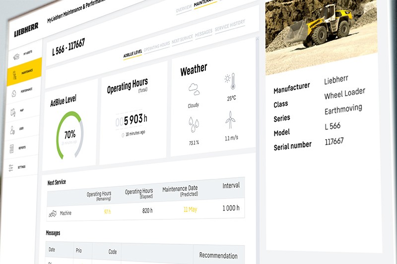
Liebherr is rolling out its expanded MyLiebherr Performance and MyLiebherr Maintenance digital services for earthmoving and material handling fleets in Australia, the UK, Ireland, Canada and the USA, with six months’ free access. The maintenance module gives workshop managers a fleet-wide status overview with traffic light condition coding, cause-specific alerts (e.g. upcoming services, low fluid levels), machine-level service histories and geo-tracked locations to plan bundled interventions. The performance module tracks utilisation, idle hours, fuel consumption versus a global average, and weighing data, enabling group comparisons by machine type or operation to tighten scheduling and cut operating costs.
Technical Brief
- MyLiebherr Maintenance uses a machine-and-attachment status list with colour-coded traffic light condition indicators.
- Notifications are filterable by cause category, e.g. scheduled maintenance events versus low operating fluid levels.
- Machine detail view aggregates active alerts by priority and date, plus full historical service records.
- System generates action recommendations aligned to each alert type, guiding fault resolution and maintenance steps.
- Confirmed service appointments record location and date from the Liebherr service partner for planning bundled interventions.
- Maintenance planning logic mirrors the on-machine display, synchronising workshop scheduling with in-cab service prompts.
- MyLiebherr Performance includes a utilisation overview, showing relative working intensity for each connected machine.
- Geo-Track map replays past machine locations and routes to analyse haul paths and hazard-prone points.
Our Take
Liebherr already features in several recent project pieces in the UK, including the first 195 HC-LH luffing jib crane for City Lifting and work around the London Eye, so extending MyLiebherr digital services into the UK and Ireland gives an immediate installed base where performance and maintenance tools can be trialled at scale.
Our Software category coverage shows 38 software stories, but relatively few are tied to heavy equipment OEMs like Liebherr, suggesting these MyLiebherr Performance and Maintenance tools are part of a smaller but growing push by machinery suppliers to own more of the data and support layer on construction and mining fleets.
With Liebherr’s recent supply of large electric excavators to Assarel-Medet’s copper operations, rolling out MyLiebherr digital services into markets such as Canada, the US and Australia likely positions the company to bundle condition monitoring and lifecycle support with low‑emission machines in mining as well as construction.
Prepared by collating external sources, AI-assisted tools, and Geomechanics.io’s proprietary mining database, then reviewed for technical accuracy & edited by our geotechnical team.
Related Articles


Related Industries & Products
Mining
Geotechnical software solutions for mining operations including CMRR analysis, hydrogeological testing, and data management.
Construction
Quality control software for construction companies with material testing, batch tracking, and compliance management.
CMRR-io
Streamline coal mine roof stability assessments with our cloud-based CMRR software featuring automated calculations, multi-scenario analysis, and collaborative workflows.
HYDROGEO-io
Comprehensive hydrogeological testing platform for managing, analysing, and reporting on packer tests, lugeon values, and hydraulic conductivity assessments.
GEODB-io
Centralised geotechnical data management solution for storing, accessing, and analysing all your site investigation and material testing data.