Geomechanics.io

  • Free Tools
Sign UpLog In

Geomechanics.io

Geomechanics, Streamlined.

© 2026 Geomechanics.io. All rights reserved.

Geomechanics.io

CMRR-ioGEODB-ioHYDROGEO-ioQCDB-ioFree Tools & CalculatorsBlogLatest Industry News

Industries

MiningConstructionTunnelling

Company

Terms of UsePrivacy PolicyLinkedIn
    Product
    Safety

    Liebherr AI parts app: maintenance planning and safety notes for engineers

    May 28, 2026|

    Reviewed by Tom Sullivan

    Liebherr AI parts app: maintenance planning and safety notes for engineers

    First reported on The Construction Index

    30 Second Briefing

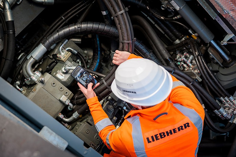
    Liebherr Nenzing has launched an AI-based app to identify parts and schedule maintenance for its deep foundation equipment and crawler cranes up to 400 t capacity. Components can be located via photo recognition, QR code scan, multilingual text search in over 100 languages, or item number, with results cross-checked against the official Liebherr parts catalogue to avoid mis-orders when nameplates are damaged. The app also uses machine operating hours to propose upcoming service intervals, listing required parts, consumables and fluids in optimised quantities for each maintenance kit.

    Technical Brief

    • Nenzing plant coverage means AI support spans deep foundation rigs, duty cycle cranes and crawler cranes.
    • Damaged or corroded nameplates no longer block part identification, reducing unsafe improvisation or component mismatch.
    • Cross-checking against the official Liebherr parts catalogue adds a second barrier against installing incorrect critical components.
    • QR-based identification ties parts to specific machines, helping maintain traceability for lifting, slew and hoist components.
    • Operating-hour driven service kits encourage adherence to OEM maintenance intervals, limiting overrun on wire ropes, hydraulics and brakes.

    Our Take

    Liebherr’s use of AI for parts search at the Nenzing plant aligns with its broader digital push, such as the recent rollout of MyLiebherr Performance and MyLiebherr Maintenance services in the UK and other markets, signalling that support and maintenance workflows are being systematically digitised rather than treated as standalone tools.

    With crawler cranes up to 400 t capacity supported and text search in more than 100 languages, this AI layer is likely aimed at global mixed fleets where incorrect or delayed parts identification can have disproportionate safety and downtime impacts on heavy lifts.

    Geotechnical Software for Modern Teams

    Centralise site data, logs, and lab results with GEODB-io, CMRR-io, and HYDROGEO-io.

    No credit card required.

    • Save and export unlimited calculations
    • Advanced data visualisation
    • Generate professional PDF reports
    • Cloud storage for all your projects

    Prepared by collating external sources, AI-assisted tools, and Geomechanics.io’s proprietary mining database, then reviewed for technical accuracy & edited by our geotechnical team.

    Related Articles

    WT digital project controls: what it means for major infrastructure engineers
    Software
    3 days ago

    WT digital project controls: what it means for major infrastructure engineers

    WT is expanding its digital project controls to give asset owners near real-time visibility of cost, schedule and risk across multi‑billion‑dollar transport and civil infrastructure programmes, building on its quantity surveying and project advisory work. Integrated dashboards consolidate data from planning, procurement and delivery systems, replacing static monthly reports with live variance tracking and forecast out‑turn costs. For geotechnical and civil teams, this means earlier warning of scope creep, ground risk contingencies and interface clashes, tightening change control on complex major works.

    Support Designer in Slide2: target FoS support design explained for engineers
    Software
    4 days ago

    Support Designer in Slide2: target FoS support design explained for engineers

    Rocscience has launched Support Designer in Slide2, allowing engineers to specify a target factor of safety for slope or excavation models and automatically compute required support parameters such as bolt length, spacing, and capacity. The tool works with limit equilibrium analyses, adjusting support patterns to meet user-defined FoS rather than relying on manual trial‑and‑error iterations. This shift to target‑driven design could tighten geotechnical optimisation workflows, particularly for complex reinforced slopes, retaining structures, and underground excavations.

    RadiXplore Xplor platform: legacy exploration data workflows for geologists
    Software
    4 days ago

    RadiXplore Xplor platform: legacy exploration data workflows for geologists

    RadiXplore is using its Xplor platform to mine decades of underused historical exploration data, aiming to improve discovery rates as new greenfield finds become scarcer and drilling costs rise. Co-founders Russel Menezes and Teryne Young are applying machine learning and pattern-recognition workflows to legacy geochemical assays, drill logs and geophysical surveys to re‑rank targets without commissioning new campaigns. For geologists and explorers, the approach could shift budgets from broad regional drilling to data-driven infill and re-interpretation of existing tenements.

    Related Industries & Products

    Mining

    Geotechnical software solutions for mining operations including CMRR analysis, hydrogeological testing, and data management.

    Construction

    Quality control software for construction companies with material testing, batch tracking, and compliance management.

    CMRR-io

    Streamline coal mine roof stability assessments with our cloud-based CMRR software featuring automated calculations, multi-scenario analysis, and collaborative workflows.

    HYDROGEO-io

    Comprehensive hydrogeological testing platform for managing, analysing, and reporting on packer tests, lugeon values, and hydraulic conductivity assessments.

    GEODB-io

    Centralised geotechnical data management solution for storing, accessing, and analysing all your site investigation and material testing data.

    AllGeotechnicalInfrastructureHazardsEnvironmental