HumeLink West BVLOS drone surveys: practical insights for civil and geotechnical teams
Reviewed by Joe Ashwell
First reported on New Civil Engineer
30 Second Briefing
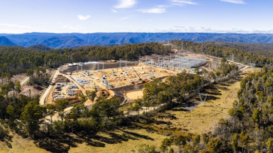
Automated beyond visual line of sight (BVLOS) drone surveys are monitoring construction of the HumeLink West high-voltage transmission project in New South Wales, with flights controlled from an operations centre over 350km away. Remotely piloted aircraft capture corridor imagery and construction progress data without on-site survey crews, reducing access issues along remote tower sites and easements. For civil and geotechnical teams, this enables more frequent terrain, foundation and earthworks checks over long linear sections than conventional ground-based surveys.
Technical Brief
- Remote piloting removes survey personnel from live transmission tower pads and heavy plant working areas.
- Drone flights avoid repeated 4WD access along easements, reducing light-vehicle interaction risk on unsealed tracks.
- Aerial monitoring limits the need for work-at-height inspections on towers and temporary construction structures.
- Regular overflights provide rapid post-storm checks for slope instability or scour without exposing crews to soft ground.
- High-resolution imagery supports early identification of exclusion-zone breaches and unsafe stockpile or laydown encroachments.
- For long linear power schemes, BVLOS survey models can feed into construction safety risk registers and permit-to-work planning.
Our Take
Running drone surveys from an operations centre 350km away has direct implications for safety and resourcing on schemes like HumeLink West, as it allows client and contractor teams to reduce time in remote easements and bushfire-prone corridors while still maintaining high inspection frequency.
New Civil Engineer’s recent webinar on BIM, CDEs and the ‘data handover gap’ suggests that pairing long-range drone work on HumeLink West with structured asset data environments will be critical if survey outputs are to be usable for long-term transmission line maintenance rather than just construction progress checks.
Prepared by collating external sources, AI-assisted tools, and Geomechanics.io’s proprietary mining database, then reviewed for technical accuracy & edited by our geotechnical team.
Related Articles


Related Industries & Products
Construction
Quality control software for construction companies with material testing, batch tracking, and compliance management.
Mining
Geotechnical software solutions for mining operations including CMRR analysis, hydrogeological testing, and data management.
QCDB-io
Comprehensive quality control database for manufacturing, tunnelling, and civil construction with UCS testing, PSD analysis, and grout mix design management.