Cornwall to Devon rail feasibility study: geotechnical and alignment lens for engineers
Reviewed by Joe Ashwell
First reported on New Civil Engineer
30 Second Briefing
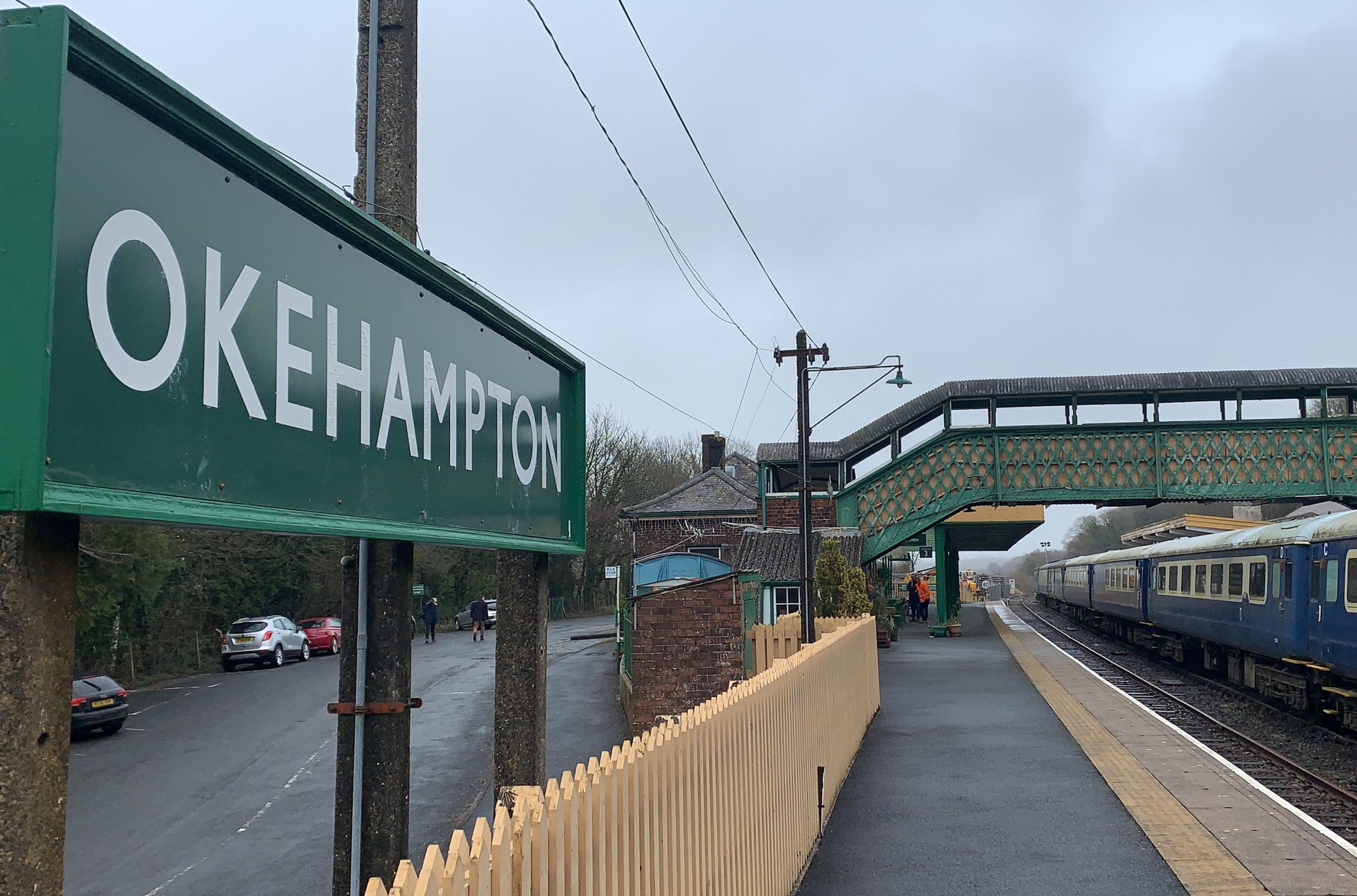
Cornwall Council has approved a feasibility study into reinstating a through rail link between Okehampton and Penzance, potentially creating an additional inland corridor to the existing Dawlish coastal route. Engineers will examine track capacity, alignment constraints on legacy formations, and options for upgrading structures, level crossings and signalling to modern standards. For civil and geotechnical teams, the work will focus on earthwork stability on steep Cornish and Devon cuttings, flood‑prone sections, and interfaces with existing main line operations.
Technical Brief
- Feasibility commission is led by Cornwall Council, so scope will align with local transport and planning policy.
- Study must reconcile legacy Okehampton infrastructure with modern main line performance, axle loads and clearances.
- Any inland corridor will need resilience modelling against coastal outages, including diversion capacity scenarios.
- Brownfield trackbeds between Okehampton and West Cornwall imply extensive title, encroachment and utilities constraint mapping.
- Historic masonry bridges, culverts and retaining walls will require condition grading and load‑rating for upgraded traffic.
- Environmental consents in Cornwall’s designated landscapes will constrain earthwork widening, borrow sources and spoil placement.
Our Take
Cornwall Council’s role in both this rail feasibility work and the Cornish Lithium drilling permissions in Cornwall signals that the authority is increasingly treating transport and mineral projects as linked levers for regional regeneration, which could influence how future rail alignments interface with prospective extraction or processing hubs.
New Civil Engineer’s involvement, alongside its recent coverage of BIM and digital handover challenges on major projects, suggests that any eventual Cornwall–Devon rail scheme will be under pressure to adopt more rigorous digital delivery and asset information standards from the outset to avoid lifecycle data gaps.
Prepared by collating external sources, AI-assisted tools, and Geomechanics.io’s proprietary mining database, then reviewed for technical accuracy & edited by our geotechnical team.
Related Articles


Related Industries & Products
Mining
Geotechnical software solutions for mining operations including CMRR analysis, hydrogeological testing, and data management.
Construction
Quality control software for construction companies with material testing, batch tracking, and compliance management.
CMRR-io
Streamline coal mine roof stability assessments with our cloud-based CMRR software featuring automated calculations, multi-scenario analysis, and collaborative workflows.
HYDROGEO-io
Comprehensive hydrogeological testing platform for managing, analysing, and reporting on packer tests, lugeon values, and hydraulic conductivity assessments.
GEODB-io
Centralised geotechnical data management solution for storing, accessing, and analysing all your site investigation and material testing data.